
FRIDAY 13TH
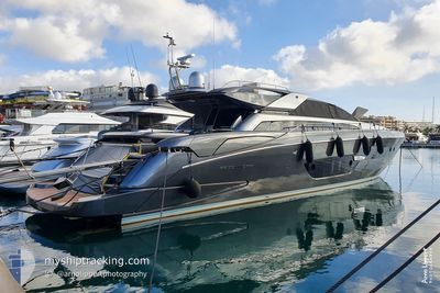
Pleasure Craft
Current Trip
| Trip Time | --- |
|---|---|
| Trip Distance | --- |
| AVG Speed | --- |
| MAX Speed | --- |
| Draught | --- |
| AVG Wind | --- |
| MAX Wind | --- |
| MIN Temp | --- |
| MAX Temp | --- |
| Position Received | 1 d ago |
Current Position
| Longitude | 1.44383° |
|---|---|
| Latitude | 38.91452° |
| Status | Default |
| Speed | |
| Course | --- |
| Area | Mediterranean Sea - Western Basin |
| Station | T-AIS |
| Position Received | 1 d ago |
Info
Information
The current position of FRIDAY 13TH is in Mediterranean Sea - Western Basin with coordinates 38.91452° / 1.44383° as reported on 2024-04-18 07:23 by AIS to our vessel tracker app. The vessel's current speed is 0 Knots and is currently inside the port of IBIZA.
The vessel FRIDAY 13TH (MMSI: 248000933) is a Pleasure Craft It's sailing under the flag of [MT] Malta.
In this page you can find informations about the vessels current position, last detected port calls, and current voyage information. If the vessels is not in coverage by AIS you will find the latest position.
The current position of FRIDAY 13TH is detected by our AIS receivers and we are not responsible for the reliability of the data. The last position was recorded while the vessel was in Coverage by the Ais receivers of our vessel tracking app.
Weather
| Temperature | 15.3°C / 59.54°F |
|---|---|
| Wind Speed | 5 knots |
| Direction | 174° S |
| Pressure | 1016 hPa |
| Humidity | 73 % |
| Cloud Coverage | 13 % |
Featured Company
Events
| Time | Event | Details | Position / Dest | Info |
|---|---|---|---|---|
| 2024-04-18 07:23 | OUT of Coverage |
38.91452 / 1.44383
Mediterranean Sea - Western Basin
[ES] IBIZA
|
Speed: Course: 222.5° |
|
| 2024-04-18 06:44 | IN Coverage |
38.91451 / 1.44376
Mediterranean Sea - Western Basin
[ES] IBIZA
|
Speed: 0.1 kn Course: 229.6° |
|
| 2024-04-16 14:11 | OUT of Coverage |
38.91455 / 1.44384
Mediterranean Sea - Western Basin
[ES] IBIZA
|
Speed: Course: 78° |
|
| 2024-04-16 13:47 | IN Coverage |
38.91455 / 1.44381
Mediterranean Sea - Western Basin
[ES] IBIZA
|
Speed: Course: 42.8° |
|
| 2024-04-16 10:14 | OUT of Coverage |
38.91452 / 1.44375
Mediterranean Sea - Western Basin
[ES] IBIZA
|
Speed: 0.1 kn Course: 119.2° |
|
| 2024-04-16 08:08 | IN Coverage |
38.91454 / 1.44378
Mediterranean Sea - Western Basin
[ES] IBIZA
|
Speed: Course: 213.4° |
|
| 2024-04-16 01:37 | OUT of Coverage |
38.91450 / 1.44391
Mediterranean Sea - Western Basin
[ES] IBIZA
|
Speed: Course: 97.3° |
|
| 2024-04-16 01:10 | IN Coverage |
38.91454 / 1.44379
Mediterranean Sea - Western Basin
[ES] IBIZA
|
Speed: Course: 127.9° |
|
| 2024-04-15 23:07 | OUT of Coverage |
38.91457 / 1.44375
Mediterranean Sea - Western Basin
[ES] IBIZA
|
Speed: Course: 157.2° |
|
| 2024-04-15 21:58 | IN Coverage |
38.91452 / 1.44393
Mediterranean Sea - Western Basin
[ES] IBIZA
|
Speed: Course: 191.4° |