
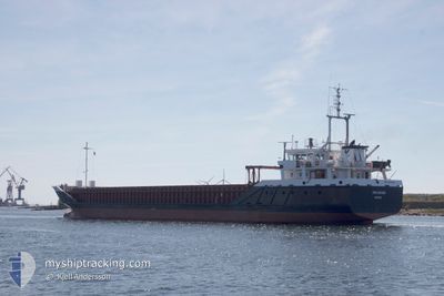
FRI RIVER
General Cargo
Current Trip
| Time Travelled | 4 h, 33 mins |
|---|---|
| Remaining Time | --- |
| Distance Travelled | 43.08 nm |
| Remaining Distance | --- |
| AVG Speed | 10.1 Knots |
| MAX Speed | 10.6 Knots |
| AVG Wind | 11.5 knots |
| MAX Wind | 16.9 knots |
| MIN Temp | 4.3°C / 39.74°F |
| MAX Temp | 7.9°C / 46.22°F |
| Draught | 3.8 m |
| Position Received | Now |
Current Position
| Longitude | 15.11503° |
|---|---|
| Latitude | 54.43520° |
| Status | Under way using engine |
| Speed | 10.1 Knots |
| Course | 51.3° |
| Area | Baltic Sea |
| Station | T-AIS |
| Position Received | Now |
Info
Information
The current position of FRI RIVER is in Baltic Sea with coordinates 54.43520° / 15.11503° as reported on 2024-04-25 18:08 by AIS to our vessel tracker app. The vessel's current speed is 10.1 Knots and is heading at the port of RIGA. The estimated time of arrival as calculated by MyShipTracking vessel tracking app is 2024-04-27 05:00 LT
The vessel FRI RIVER (IMO: 9224104, MMSI: 311000758) is a General Cargo that was built in 2000 ( 24 years old ). It's sailing under the flag of [BS] Bahamas.
In this page you can find informations about the vessels current position, last detected port calls, and current voyage information. If the vessels is not in coverage by AIS you will find the latest position.
The current position of FRI RIVER is detected by our AIS receivers and we are not responsible for the reliability of the data. The last position was recorded while the vessel was in Coverage by the Ais receivers of our vessel tracking app.
The current draught of FRI RIVER as reported by AIS is 3.8 meters
Weather
| Temperature | 4.5°C / 40.1°F |
|---|---|
| Wind Speed | 15 knots |
| Direction | 95° E |
| Pressure | 1005.1 hPa |
| Humidity | 82.8 % |
| Cloud Coverage | 93 % |
Featured Company
Last Port Calls
| Port | Arrival | Departure | Time In Port |
|---|---|---|---|
| 2024-04-25 04:51 | 2024-04-25 13:36 | 8 h | |
| 2024-04-20 10:46 | 2024-04-22 14:44 | 2 d | |
| 2024-04-14 22:31 | 2024-04-17 16:15 | 2 d | |
| 2024-04-05 15:13 | 2024-04-08 16:52 | 3 d | |
| 2024-03-27 18:27 | 2024-04-03 16:34 | 6 d | |
| 2024-03-21 00:52 | 2024-03-22 00:37 | 23 h | |
| 2024-03-16 14:20 | 2024-03-18 19:12 | 2 d | |
| 2024-03-09 19:46 | 2024-03-11 19:48 | 2 d | |
| 2024-02-29 22:29 | 2024-03-06 10:53 | 5 d | |
| 2024-02-27 01:47 | 2024-02-28 14:52 | 1 d |
Most Visited Ports (Last year)
| Port | Arrivals | |
|---|---|---|
| 4 | ||
| 4 | ||
| 3 | ||
| 2 | ||
| 2 | ||
| 2 |
Last Trips
| Origin | Departure | Destination | Arrival | Distance | |
|---|---|---|---|---|---|
| 2024-04-22 16:44 | 2024-04-25 06:51 | 548.61 nm | |||
| 2024-04-17 17:15 | 2024-04-20 12:46 | 686.15 nm | |||
| 2024-04-08 18:52 | 2024-04-14 23:31 | 662.45 nm | |||
| 2024-04-03 18:34 | 2024-04-05 17:13 | 202.32 nm | |||
| 2024-03-22 01:37 | 2024-03-27 19:27 | 1047.38 nm | |||
| 2024-03-18 20:12 | 2024-03-21 01:52 | 374.01 nm | |||
| 2024-03-11 19:48 | 2024-03-16 15:20 | 928.39 nm | |||
| 2024-03-06 11:53 | 2024-03-09 19:46 | 850.74 nm | |||
| 2024-02-28 15:52 | 2024-02-29 23:29 | 341.35 nm | |||
| 2024-02-21 11:49 | 2024-02-27 02:47 | 1009.76 nm |
Events
| Time | Event | Details | Position / Dest | Info |
|---|---|---|---|---|
| 2024-04-25 15:58 | Draught Changed | 3.8 5.5 |
54.19521 / 14.64470
LVRIX
|
Speed: 10.1 kn Course: 48.2° |
| 2024-04-25 15:58 | Destination Changed | LVRIX PLSWI |
54.19521 / 14.64470
LVRIX
|
Speed: 10.1 kn Course: 48.2° |
| 2024-04-25 15:58 | ETA Changed | 2024/04/27 05:00 2024/04/25 06:15 |
54.19521 / 14.64470
LVRIX
|
Speed: 10.1 kn Course: 48.2° |
| 2024-04-25 15:20 | Change Sea Area | Polish part of the Baltic Sea German part of the Baltic Sea |
54.12417 / 14.50691
Baltic Sea
|
Speed: 10.2 kn Course: 48.8° |
| 2024-04-25 15:20 | Status Changed | Under way using engine Default |
54.12417 / 14.50691
PLSWI
|
Speed: 10 kn Course: 48° |
| 2024-04-25 15:20 | IN Coverage |
54.12417 / 14.50691
Baltic Sea
|
Speed: 10.2 kn Course: 48.8° |
|
| 2024-04-25 13:36 | PORT DEPARTURE |
|
53.92758 / 14.27887
PLSWI
|
Speed: 9.7 kn Course: 317° |
| 2024-04-25 05:20 | STOP Moving |
53.89540 / 14.27132
[PL] SWINOUJSCIE
|
Speed: Course: 244° |
|
| 2024-04-25 04:51 | PORT ARRIVAL |
|
53.89333 / 14.26167
[PL] SWINOUJSCIE
|
Speed: 8.3 kn Course: 164° |
| 2024-04-25 02:14 | OUT of Coverage |
54.21458 / 14.06482
Baltic Sea
PLSWI
|
Speed: 8.4 kn Course: 152.6° |