
WAGON C
General Cargo
Current Trip
ITPIO
| Time Travelled | 1 day |
|---|---|
| Remaining Time | --- |
| Distance Travelled | 220.14 nm |
| Remaining Distance | --- |
| AVG Speed | 7.8 Knots |
| MAX Speed | 8.6 Knots |
| AVG Wind | 16.4 knots |
| MAX Wind | 30 knots |
| MIN Temp | 12.5°C / 54.5°F |
| MAX Temp | 17.7°C / 63.86°F |
| Draught | 3.2 m |
| Position Received | 5 d ago |
Current Position
| Longitude | 15.58985° |
|---|---|
| Latitude | 38.59495° |
| Status | Under way using engine |
| Speed | 6 Knots |
| Course | 343.1° |
| Area | Tyrrhenian Sea |
| Station | T-AIS |
| Position Received | 5 d ago |
Info
Information
The current position of WAGON C is in Tyrrhenian Sea with coordinates 38.59495° / 15.58985° as reported on 2024-04-19 21:44 by AIS to our vessel tracker app. The vessel's current speed is 6 Knots
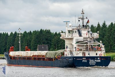
The vessel WAGON C (IMO: 9073880, MMSI: 309938000) is a General Cargo that was built in 1994 ( 30 years old ). It's sailing under the flag of [BS] Bahamas.
In this page you can find informations about the vessels current position, last detected port calls, and current voyage information. If the vessels is not in coverage by AIS you will find the latest position.
The current position of WAGON C is detected by our AIS receivers and we are not responsible for the reliability of the data. The last position was recorded while the vessel was in Coverage by the Ais receivers of our vessel tracking app.
The current draught of WAGON C as reported by AIS is 3.2 meters
Weather
| Temperature | 16.1°C / 60.98°F |
|---|---|
| Wind Speed | 9 knots |
| Direction | 267° W |
| Pressure | 1010.6 hPa |
| Humidity | 55.8 % |
| Cloud Coverage | 88 % |
Featured Company
Last Port Calls
| Port | Arrival | Departure | Time In Port |
|---|---|---|---|
| 2024-04-22 04:00 | 2024-04-24 14:52 | 2 d | |
| 2024-04-03 02:16 | 2024-04-05 12:51 | 2 d | |
| 2024-03-28 18:06 | 2024-03-29 14:51 | 20 h | |
| 2024-03-26 14:59 | 2024-03-27 20:13 | 1 d | |
| 2024-03-10 14:57 | |||
| 2024-02-26 07:04 | 2024-02-29 10:28 | 3 d | |
| 2024-02-20 05:04 | 2024-02-22 22:31 | 2 d | |
| 2024-02-04 06:38 |
Last Trips
| Origin | Departure | Destination | Arrival | Distance | |
|---|---|---|---|---|---|
| 2024-04-05 15:51 | 2024-04-22 06:00 | 1162.06 nm | |||
| 2024-03-29 17:51 | 2024-04-03 05:16 | 412.59 nm | |||
| 2024-03-27 23:13 | 2024-03-28 21:06 | 111.93 nm | |||
| 2024-03-10 16:57 | 2024-03-26 17:59 | 365.65 nm | |||
| 2024-02-23 01:31 | 2024-02-26 10:04 | 159.75 nm | |||
| 2024-01-30 12:38 | 2024-02-04 08:38 | 312.11 nm |
Events
| Time | Event | Details | Position / Dest | Info |
|---|---|---|---|---|
| 2024-04-24 14:52 | PORT DEPARTURE |
|
42.93353 / 10.56486
ITPIO
|
Speed: 6 kn Course: 77° |
| 2024-04-24 14:44 | START Moving |
42.93327 / 10.54866
[IT] PIOMBINO
|
Speed: 4.2 kn Course: 86° |
|
| 2024-04-22 04:28 | STOP Moving |
42.93578 / 10.54473
[IT] PIOMBINO
|
Speed: Course: 124° |
|
| 2024-04-22 04:00 | PORT ARRIVAL |
|
42.93471 / 10.55688
[IT] PIOMBINO
|
Speed: 6.4 kn Course: 302° |
| 2024-04-19 21:52 | Status Changed | Default Under way using engine |
38.60667 / 15.58333
ITPIO
|
Speed: 6 kn Course: 343.1° |
| 2024-04-19 21:44 | OUT of Coverage |
38.59495 / 15.58985
Tyrrhenian Sea
ITPIO
|
Speed: 6 kn Course: 343.1° |
|
| 2024-04-19 21:39 | Status Changed | Under way using engine Default |
38.58721 / 15.59338
ITPIO
|
Speed: 6.4 kn Course: 334° |
| 2024-04-19 21:34 | Status Changed | Default Under way using engine |
38.58004 / 15.59677
ITPIO
|
Speed: 6.2 kn Course: 339.1° |
| 2024-04-19 21:30 | Status Changed | Under way using engine Default |
38.57185 / 15.60096
ITPIO
|
Speed: 6.1 kn Course: 338° |
| 2024-04-19 21:28 | Status Changed | Default Under way using engine |
38.56919 / 15.60234
ITPIO
|
Speed: 6.1 kn Course: 340.2° |