
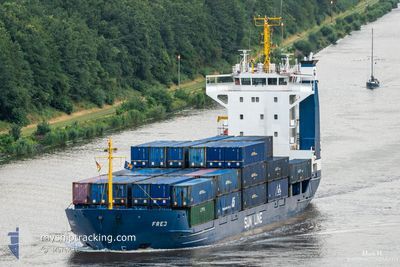
FREJ
General Cargo
Current Trip
| Time Travelled | 2 days |
|---|---|
| Remaining Time | --- |
| Distance Travelled | 695.82 nm |
| Remaining Distance | --- |
| AVG Speed | 9.6 Knots |
| MAX Speed | 13.9 Knots |
| AVG Wind | 12 knots |
| MAX Wind | 24.8 knots |
| MIN Temp | -3.2°C / 26.24°F |
| MAX Temp | 9.3°C / 48.74°F |
| Draught | 6.1 m |
| Position Received | 27 m ago |
Current Position
| Longitude | 16.40582° |
|---|---|
| Latitude | 56.69275° |
| Status | Under way using engine |
| Speed | 12.3 Knots |
| Course | 22.2° |
| Area | Baltic Sea |
| Station | T-AIS |
| Position Received | 27 m ago |
Info
Information
The current position of FREJ is in Baltic Sea with coordinates 56.69275° / 16.40582° as reported on 2024-04-20 01:29 by AIS to our vessel tracker app. The vessel's current speed is 12.3 Knots and is heading at the port of VASTERAS. The estimated time of arrival as calculated by MyShipTracking vessel tracking app is 2024-04-20 19:00 LT
The vessel FREJ (IMO: 9101156, MMSI: 304010515) is a General Cargo that was built in 1994 ( 30 years old ). It's sailing under the flag of [AG] Antigua Barbuda.
In this page you can find informations about the vessels current position, last detected port calls, and current voyage information. If the vessels is not in coverage by AIS you will find the latest position.
The current position of FREJ is detected by our AIS receivers and we are not responsible for the reliability of the data. The last position was recorded while the vessel was in Coverage by the Ais receivers of our vessel tracking app.
The current draught of FREJ as reported by AIS is 6.1 meters
Weather
| Temperature | -1°C / 30.2°F |
|---|---|
| Wind Speed | 9 knots |
| Direction | 344° NNW |
| Pressure | 1009.6 hPa |
| Humidity | 87.3 % |
| Cloud Coverage | 72 % |
Featured Company
Last Port Calls
| Port | Arrival | Departure | Time In Port |
|---|---|---|---|
| 2024-04-16 08:59 | 2024-04-17 09:50 | 1 d | |
| 2024-04-12 17:18 | 2024-04-12 18:02 | 43 m | |
| 2024-04-10 22:02 | 2024-04-12 12:10 | 1 d | |
| 2024-04-10 17:21 | 2024-04-10 17:41 | 20 m | |
| 2024-04-07 19:44 | 2024-04-07 23:19 | 3 h | |
| 2024-04-06 11:20 | 2024-04-07 00:57 | 13 h | |
| 2024-04-05 02:29 | 2024-04-05 14:34 | 12 h | |
| 2024-04-04 08:12 | 2024-04-05 00:22 | 16 h | |
| 2024-03-30 03:09 | 2024-04-01 07:37 | 2 d | |
| 2024-03-29 06:38 | 2024-03-29 16:13 | 9 h |
Last Trips
| Origin | Departure | Destination | Arrival | Distance | |
|---|---|---|---|---|---|
| 2024-04-12 20:02 | 2024-04-16 09:59 | 860.34 nm | |||
| 2024-04-12 14:10 | 2024-04-12 19:18 | 48.92 nm | |||
| 2024-04-10 19:41 | 2024-04-11 00:02 | 48.66 nm | |||
| 2024-04-08 01:19 | 2024-04-10 19:21 | 733.66 nm | |||
| 2024-04-07 01:57 | 2024-04-07 21:44 | 219.91 nm | |||
| 2024-04-05 16:34 | 2024-04-06 12:20 | 213.30 nm | |||
| 2024-04-05 02:22 | 2024-04-05 04:29 | 31.28 nm | |||
| 2024-04-01 09:37 | 2024-04-04 10:12 | 816.17 nm | |||
| 2024-03-29 17:13 | 2024-03-30 04:09 | 103.04 nm | |||
| 2024-03-29 03:26 | 2024-03-29 07:38 | 48.83 nm |
Events
| Time | Event | Details | Position / Dest | Info |
|---|---|---|---|---|
| 2024-04-20 01:35 | Status Changed | Default Under way using engine |
56.70678 / 16.43153
SEVST VIA NOK
|
Speed: 12.3 kn Course: 22.2° |
| 2024-04-20 01:29 | Status Changed | Under way using engine Default |
56.69275 / 16.40582
SEVST VIA NOK
|
Speed: 11.3 kn Course: 21° |
| 2024-04-20 01:24 | Status Changed | Default Under way using engine |
56.67904 / 16.39540
SEVST VIA NOK
|
Speed: 9.7 kn Course: 25.2° |
| 2024-04-20 01:18 | Status Changed | Under way using engine Default |
56.66146 / 16.38188
SEVST VIA NOK
|
Speed: 8.3 kn Course: 24° |
| 2024-04-20 01:08 | Status Changed | Default Under way using engine |
56.63772 / 16.36445
SEVST VIA NOK
|
Speed: 12.4 kn Course: 12.6° |
| 2024-04-19 18:56 | Change Sea Area | Swedish part of the Baltic Sea Danish part of the Kattegat |
55.66247 / 15.19644
Baltic Sea
SEVST VIA NOK
|
Speed: 11.2 kn Course: 53.4° |
| 2024-04-19 14:16 | Change Sea Area | Danish part of the Kattegat Swedish part of the Baltic Sea |
55.01703 / 14.06710
Kattegat
SEVST VIA NOK
|
Speed: 12.6 kn Course: 66° |
| 2024-04-19 13:52 | Change Sea Area | Swedish part of the Baltic Sea German part of the Baltic Sea |
54.98350 / 13.93582
Baltic Sea
SEVST VIA NOK
|
Speed: 12.3 kn Course: 66.1° |
| 2024-04-19 08:07 | Change Sea Area | German part of the Baltic Sea Danish part of the Baltic Sea |
54.41241 / 12.12858
Baltic Sea
SEVST VIA NOK
|
Speed: 12.6 kn Course: 89.7° |
| 2024-04-19 05:58 | Detected in Sea | Danish part of the Baltic Sea |
54.51151 / 11.42237
Baltic Sea
SEVST VIA NOK
|
Speed: 11.9 kn Course: 114.7° |