
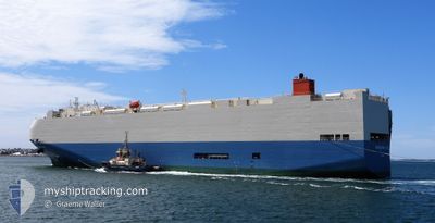
FREEDOM ACE
Vehicles Carrier
Current Trip
| Time Travelled | 1 day |
|---|---|
| Remaining Time | 2 days |
| Distance Travelled | 308.98 nm |
| Remaining Distance | 969.41 nm |
| AVG Speed | 13.4 Knots |
| MAX Speed | 21.1 Knots |
| AVG Wind | 7.8 knots |
| MAX Wind | 15.1 knots |
| MIN Temp | 6.4°C / 43.52°F |
| MAX Temp | 12.9°C / 55.22°F |
| Draught | 8 m |
| Position Received | 1 m ago |
Current Position
| Longitude | -125.41310° |
|---|---|
| Latitude | 46.78985° |
| Status | Under way using engine |
| Speed | 13 Knots |
| Course | 175.8° |
| Area | North Pacific Ocean |
| Station | T-AIS |
| Position Received | 1 m ago |
Info
Information
The current position of FREEDOM ACE is in North Pacific Ocean with coordinates 46.78985° / -125.41310° as reported on 2024-04-19 16:34 by AIS to our vessel tracker app. The vessel's current speed is 13 Knots and is heading at the port of LOS ANGELES. The estimated time of arrival as calculated by MyShipTracking vessel tracking app is 2024-04-22 16:04 LT
The vessel FREEDOM ACE (IMO: 9293662, MMSI: 431868000) is a Vehicles Carrier that was built in 2005 ( 19 years old ). It's sailing under the flag of [JP] Japan.
In this page you can find informations about the vessels current position, last detected port calls, and current voyage information. If the vessels is not in coverage by AIS you will find the latest position.
The current position of FREEDOM ACE is detected by our AIS receivers and we are not responsible for the reliability of the data. The last position was recorded while the vessel was in Coverage by the Ais receivers of our vessel tracking app.
The current draught of FREEDOM ACE as reported by AIS is 8 meters
Weather
| Temperature | 10.7°C / 51.26°F |
|---|---|
| Wind Speed | 14 knots |
| Direction | 80° E |
| Pressure | 1020.5 hPa |
| Humidity | 69.8 % |
| Cloud Coverage | 28 % |
Featured Company
Last Port Calls
| Port | Arrival | Departure | Time In Port |
|---|---|---|---|
| 2024-04-16 13:14 | 2024-04-17 20:10 | 1 d | |
| 2024-04-15 11:29 | 2024-04-16 00:56 | 13 h | |
| 2024-04-04 22:01 | 2024-04-05 08:35 | 10 h | |
| 2024-04-01 22:29 | 2024-04-03 08:45 | 1 d | |
| 2024-03-29 21:33 | 2024-03-30 07:09 | 9 h | |
| 2024-03-27 22:09 | 2024-03-28 08:11 | 10 h | |
| 2024-03-11 16:13 | 2024-03-12 04:59 | 12 h | |
| 2024-03-09 16:22 | 2024-03-11 02:14 | 1 d | |
| 2024-02-21 12:07 | 2024-02-22 13:23 | 1 d | |
| 2024-02-20 22:33 | 2024-02-21 11:29 | 12 h |
Most Visited Ports (Last year)
| Port | Arrivals | |
|---|---|---|
| 5 | ||
| 3 | ||
| 2 | ||
| 2 | ||
| 2 | ||
| 2 |
Last Trips
| Origin | Departure | Destination | Arrival | Distance | |
|---|---|---|---|---|---|
| 2024-04-15 17:56 | 2024-04-16 06:14 | 179.98 nm | |||
| 2024-04-05 17:35 | 2024-04-15 04:29 | 4354.98 nm | |||
| 2024-04-03 17:45 | 2024-04-05 07:01 | 553.04 nm | |||
| 2024-03-30 16:09 | 2024-04-02 07:29 | 446.55 nm | |||
| 2024-03-28 17:11 | 2024-03-30 06:33 | 378.39 nm | |||
| 2024-03-12 07:59 | 2024-03-28 07:09 | 6928.59 nm | |||
| 2024-03-11 05:14 | 2024-03-11 19:13 | 198.22 nm | |||
| 2024-02-22 22:23 | 2024-03-09 19:22 | 6989.17 nm | |||
| 2024-02-21 20:29 | 2024-02-21 21:07 | 7.60 nm | |||
| 2024-02-20 16:29 | 2024-02-21 07:33 | 210.21 nm |
Events
| Time | Event | Details | Position / Dest | Info |
|---|---|---|---|---|
| 2024-04-19 16:28 | Status Changed | Under way using engine Default |
46.81159 / -125.41530
USLAX
|
Speed: 13 kn Course: 175° |
| 2024-04-19 16:14 | IN Coverage |
46.81093 / -125.41523
North Pacific Ocean
USLAX
|
Speed: 13.1 kn Course: 175.5° |
|
| 2024-04-19 11:30 | Status Changed | Default Under way using engine |
47.92166 / -125.49500
USLAX
|
Speed: 13.2 kn Course: 178.8° |
| 2024-04-19 11:03 | OUT of Coverage |
48.02457 / -125.49823
North Pacific Ocean
USLAX
|
Speed: 13.2 kn Course: 178.8° |
|
| 2024-04-19 09:09 | Status Changed | Under way using engine Default |
48.37941 / -125.16797
USLAX
|
Speed: 13.7 kn Course: 221° |
| 2024-04-19 09:02 | Status Changed | Default Under way using engine |
48.40079 / -125.13992
USLAX
|
Speed: 13.7 kn Course: 220.9° |
| 2024-04-19 08:34 | Change Sea Area | United States part of the North Pacific Ocean Canadian part of the North Pacific Ocean |
48.47992 / -125.03884
North Pacific Ocean
USLAX
|
Speed: 13.8 kn Course: 218.8° |
| 2024-04-19 08:10 | Detected in Sea | Canadian part of the North Pacific Ocean |
48.51246 / -124.92367
North Pacific Ocean
USLAX
|
Speed: 13.6 kn Course: 269.9° |
| 2024-04-19 08:10 | Status Changed | Under way using engine Default |
48.51246 / -124.92367
USLAX
|
Speed: 13.2 kn Course: 270° |
| 2024-04-19 08:10 | IN Coverage |
48.51246 / -124.92367
North Pacific Ocean
USLAX
|
Speed: 13.6 kn Course: 269.9° |