
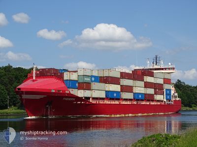
FREDERIK
Container Ship
Current Trip
| Time Travelled | 2 days |
|---|---|
| Remaining Time | 18 h, 7 mins |
| Distance Travelled | 912.63 nm |
| Remaining Distance | 270.38 nm |
| AVG Speed | 14.3 Knots |
| MAX Speed | 16.2 Knots |
| AVG Wind | 13.1 knots |
| MAX Wind | 25.7 knots |
| MIN Temp | 10.4°C / 50.72°F |
| MAX Temp | 20.5°C / 68.9°F |
| Draught | 7.2 m |
| Position Received | Now |
Current Position
| Longitude | 29.98200° |
|---|---|
| Latitude | 34.25988° |
| Status | Under way using engine |
| Speed | 15 Knots |
| Course | 110.9° |
| Area | Mediterranean Sea - Eastern Basin |
| Station | T-AIS |
| Position Received | Now |
Info
Information
The current position of FREDERIK is in Mediterranean Sea - Eastern Basin with coordinates 34.25988° / 29.98200° as reported on 2024-04-23 09:46 by AIS to our vessel tracker app. The vessel's current speed is 15 Knots and is heading at the port of HAIFA. The estimated time of arrival as calculated by MyShipTracking vessel tracking app is 2024-04-24 03:54 LT
The vessel FREDERIK (IMO: 9328637, MMSI: 304374000) is a Container Ship that was built in 2005 ( 19 years old ). It's sailing under the flag of [AG] Antigua Barbuda.
In this page you can find informations about the vessels current position, last detected port calls, and current voyage information. If the vessels is not in coverage by AIS you will find the latest position.
The current position of FREDERIK is detected by our AIS receivers and we are not responsible for the reliability of the data. The last position was recorded while the vessel was in Coverage by the Ais receivers of our vessel tracking app.
The current draught of FREDERIK as reported by AIS is 7.2 meters
Weather
| Temperature | 19.3°C / 66.74°F |
|---|---|
| Wind Speed | 17 knots |
| Direction | 117° ESE |
| Pressure | 1016.5 hPa |
| Humidity | 78.1 % |
| Cloud Coverage | 9 % |
Featured Company
Last Port Calls
| Port | Arrival | Departure | Time In Port |
|---|---|---|---|
| 2024-04-20 11:55 | 2024-04-20 17:51 | 5 h | |
| 2024-04-18 10:43 | 2024-04-19 10:38 | 23 h | |
| 2024-04-17 04:15 | 2024-04-17 16:25 | 12 h | |
| 2024-04-12 11:05 | 2024-04-12 11:12 | 6 m | |
| 2024-04-12 05:56 | 2024-04-12 05:59 | 3 m | |
| 2024-04-11 22:45 | |||
| 2024-04-10 20:53 | 2024-04-11 13:14 | 16 h | |
| 2024-04-06 17:01 | 2024-04-06 23:22 | 6 h | |
| 2024-04-04 02:57 | 2024-04-04 17:15 | 14 h | |
| 2024-03-29 01:27 |
Last Trips
| Origin | Departure | Destination | Arrival | Distance | |
|---|---|---|---|---|---|
| 2024-04-19 12:38 | 2024-04-20 13:55 | 367.09 nm | |||
| 2024-04-17 18:25 | 2024-04-18 12:43 | 225.83 nm | |||
| 2024-04-12 14:12 | 2024-04-17 06:15 | 1799.23 nm | |||
| 2024-04-12 08:59 | 2024-04-12 14:05 | 69.39 nm | |||
| 2024-04-12 08:59 | 2024-04-12 08:56 | 69.39 nm | |||
| 2024-04-11 16:14 | 2024-04-12 01:45 | 80.45 nm | |||
| 2024-04-07 01:22 | 2024-04-10 23:53 | 1521.39 nm | |||
| 2024-04-04 19:15 | 2024-04-06 19:01 | 231.31 nm | |||
| 2024-03-28 19:06 | 2024-03-29 04:27 | 81.21 nm | |||
| 2024-03-23 20:58 | 2024-03-27 23:43 | 1185.67 nm |
Events
| Time | Event | Details | Position / Dest | Info |
|---|---|---|---|---|
| 2024-04-22 21:14 | Detected in Sea | Greek part of the Mediterranean Sea - Eastern Basin |
35.31742 / 26.57838
Mediterranean Sea - Eastern Basin
IL HFA
|
Speed: 13.7 kn Course: 115° |
| 2024-04-22 09:26 | Status Changed | Under way using engine Default |
35.95527 / 23.54152
IL HFA
|
Speed: 13.6 kn Course: 105° |
| 2024-04-22 09:19 | Status Changed | Default Under way using engine |
35.96202 / 23.50987
IL HFA
|
Speed: 13.7 kn Course: 105.1° |
| 2024-04-22 08:26 | Status Changed | Under way using engine Default |
36.01423 / 23.26834
IL HFA
|
Speed: 13.7 kn Course: 102° |
| 2024-04-22 08:18 | Status Changed | Default Under way using engine |
36.02066 / 23.23317
IL HFA
|
Speed: 13.7 kn Course: 102.1° |
| 2024-04-22 08:05 | Change Sea Area | Greek part of the Aegean Sea Greek part of the Mediterranean Sea - Eastern Basin |
36.02889 / 23.16952
Aegean Sea
IL HFA
|
Speed: 13.8 kn Course: 92.8° |
| 2024-04-22 07:49 | Status Changed | Under way using engine Default |
36.03269 / 23.09567
IL HFA
|
Speed: 13.5 kn Course: 95° |
| 2024-04-22 07:41 | Status Changed | Default Under way using engine |
36.03489 / 23.05620
IL HFA
|
Speed: 13.6 kn Course: 95° |
| 2024-04-22 07:22 | Status Changed | Under way using engine Default |
36.04364 / 22.97313
IL HFA
|
Speed: 13.6 kn Course: 101° |
| 2024-04-22 07:00 | Status Changed | Default Under way using engine |
36.06249 / 22.87282
IL HFA
|
Speed: 13.5 kn Course: 104.8° |