
FORTUNA
Standby Safety Vessel
Current Trip
FLAMBOROUGH HEAD
| Time Travelled | 14 days |
|---|---|
| Remaining Time | --- |
| Distance Travelled | 192.22 nm |
| Remaining Distance | --- |
| AVG Speed | 4.3 Knots |
| MAX Speed | 5.6 Knots |
| AVG Wind | 20 knots |
| MAX Wind | 28.9 knots |
| MIN Temp | 4.2°C / 39.56°F |
| MAX Temp | 11.5°C / 52.7°F |
| Draught | 2.8 m |
| Position Received | 23 h, 17 m ago |
Current Position
| Longitude | -1.41909° |
|---|---|
| Latitude | 55.18607° |
| Status | Under way using engine |
| Speed | 1.2 Knots |
| Course | 4° |
| Area | North Sea |
| Station | T-AIS |
| Position Received | 23 h, 17 m ago |
Info
Information
The current position of FORTUNA is in North Sea with coordinates 55.18607° / -1.41909° as reported on 2024-04-17 12:50 by AIS to our vessel tracker app. The vessel's current speed is 1.2 Knots
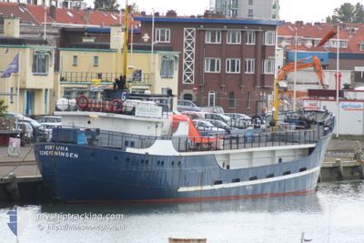
The vessel FORTUNA (IMO: 5127152, MMSI: 245581000) is a Standby Safety Vessel that was built in 1954 ( 70 years old ). It's sailing under the flag of [NL] Netherlands.
In this page you can find informations about the vessels current position, last detected port calls, and current voyage information. If the vessels is not in coverage by AIS you will find the latest position.
The current position of FORTUNA is detected by our AIS receivers and we are not responsible for the reliability of the data. The last position was recorded while the vessel was in Coverage by the Ais receivers of our vessel tracking app.
The current draught of FORTUNA as reported by AIS is 2.8 meters
Weather
| Temperature | 6.8°C / 44.24°F |
|---|---|
| Wind Speed | 24 knots |
| Direction | 349° N |
| Pressure | 1014.4 hPa |
| Humidity | 77.6 % |
| Cloud Coverage | 99 % |
Featured Company
Last Port Calls
| Port | Arrival | Departure | Time In Port |
|---|---|---|---|
| 2024-04-03 06:11 | 2024-04-03 14:08 | 7 h | |
| 2024-03-18 21:23 | 2024-03-28 12:17 | 9 d | |
| 2024-03-16 08:43 | 2024-03-16 14:21 | 5 h | |
| 2024-03-10 08:58 | 2024-03-16 05:17 | 5 d | |
| 2024-03-01 06:25 | 2024-03-02 06:18 | 23 h | |
| 2024-02-13 07:46 | 2024-02-28 14:48 | 15 d |
Most Visited Ports (Last year)
| Port | Arrivals | |
|---|---|---|
| 9 | ||
| 3 | ||
| 2 | ||
| 2 | ||
| 2 | ||
| 1 |
Last Trips
| Origin | Departure | Destination | Arrival | Distance | |
|---|---|---|---|---|---|
| 2024-03-28 13:17 | 2024-04-03 07:11 | 364.37 nm | |||
| 2024-03-16 15:21 | 2024-03-18 22:23 | 24.27 nm | |||
| 2024-03-16 06:17 | 2024-03-16 09:43 | 17.51 nm | |||
| 2024-03-02 06:18 | 2024-03-10 09:58 | 448.99 nm | |||
| 2024-02-28 15:48 | 2024-03-01 06:25 | 281.60 nm | |||
| 2024-01-22 14:33 | 2024-02-13 08:46 | 902.73 nm |
Events
| Time | Event | Details | Position / Dest | Info |
|---|---|---|---|---|
| 2024-04-17 12:50 | OUT of Coverage |
55.18607 / -1.41909
North Sea
|
Speed: 1.2 kn Course: 60.9° |
|
| 2024-04-17 12:50 | IN Coverage |
55.18607 / -1.41909
North Sea
|
Speed: 1.2 kn Course: 60.9° |
|
| 2024-04-17 09:30 | OUT of Coverage |
55.15225 / -1.35653
North Sea
|
Speed: 2 kn Course: 311.8° |
|
| 2024-04-17 09:02 | IN Coverage |
55.16484 / -1.37003
North Sea
|
Speed: 5.5 kn Course: 152.4° |
|
| 2024-04-17 06:51 | OUT of Coverage |
55.13822 / -1.26153
North Sea
|
Speed: 2.6 kn Course: 321.1° |
|
| 2024-04-17 06:51 | IN Coverage |
55.13822 / -1.26153
North Sea
|
Speed: 2.6 kn Course: 321.1° |
|
| 2024-04-17 05:18 | OUT of Coverage |
55.09517 / -1.18744
North Sea
|
Speed: 1.4 kn Course: 149° |
|
| 2024-04-17 04:20 | IN Coverage |
55.11284 / -1.20657
North Sea
|
Speed: 1.2 kn Course: 152.6° |
|
| 2024-04-16 16:18 | OUT of Coverage |
55.22299 / -1.45009
North Sea
|
Speed: 3 kn Course: 348.3° |
|
| 2024-04-16 15:45 | IN Coverage |
55.20002 / -1.44040
North Sea
|
Speed: 4.7 kn Course: 168.7° |