
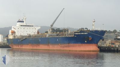
ELANDRA MELODY
Tanker
Current Trip
| Time Travelled | 23 days |
|---|---|
| Remaining Time | --- |
| Distance Travelled | 3490.52 nm |
| Remaining Distance | --- |
| AVG Speed | 9.6 Knots |
| MAX Speed | 13.9 Knots |
| AVG Wind | 15.1 knots |
| MAX Wind | 34.8 knots |
| MIN Temp | -0.4°C / 31.28°F |
| MAX Temp | 22.7°C / 72.86°F |
| Draught | 8 m |
| Position Received | 1 d ago |
Current Position
| Longitude | -54.35360° |
|---|---|
| Latitude | 47.14104° |
| Status | Under way using engine |
| Speed | 10.2 Knots |
| Course | 220.5° |
| Area | North Atlantic Ocean |
| Station | T-AIS |
| Position Received | 1 d ago |
Info
Information
The current position of ELANDRA MELODY is in North Atlantic Ocean with coordinates 47.14104° / -54.35360° as reported on 2024-04-23 20:46 by AIS to our vessel tracker app. The vessel's current speed is 10.2 Knots and is heading at the port of GIBRALTAR. The estimated time of arrival as calculated by MyShipTracking vessel tracking app is 2024-05-02 10:00 LT
The vessel ELANDRA MELODY (IMO: 9676527, MMSI: 636016293) is a Tanker It's sailing under the flag of [LR] Liberia.
In this page you can find informations about the vessels current position, last detected port calls, and current voyage information. If the vessels is not in coverage by AIS you will find the latest position.
The current position of ELANDRA MELODY is detected by our AIS receivers and we are not responsible for the reliability of the data. The last position was recorded while the vessel was in Coverage by the Ais receivers of our vessel tracking app.
The current draught of ELANDRA MELODY as reported by AIS is 8 meters
Weather
| Temperature | 8.2°C / 46.76°F |
|---|---|
| Wind Speed | 18 knots |
| Direction | 191° S |
| Pressure | 1021.7 hPa |
| Humidity | 99.8 % |
| Cloud Coverage | 70 % |
Featured Company
Most Visited Ports (Last year)
| Port | Arrivals | |
|---|---|---|
| 7 | ||
| 3 | ||
| 3 | ||
| 2 | ||
| 2 | ||
| 2 |
Last Trips
| Origin | Departure | Destination | Arrival | Distance | |
|---|---|---|---|---|---|
| 2024-01-08 03:30 | 2024-03-15 08:27 | 2676.45 nm |
Events
| Time | Event | Details | Position / Dest | Info |
|---|---|---|---|---|
| 2024-04-23 20:53 | Status Changed | Default Under way using engine |
47.12500 / -54.37167
GIGIB
|
Speed: 10.2 kn Course: 220.5° |
| 2024-04-23 20:46 | OUT of Coverage |
47.14104 / -54.35360
North Atlantic Ocean
GIGIB
|
Speed: 10.2 kn Course: 220.5° |
|
| 2024-04-23 18:18 | Destination Changed | GIGIB CACBC |
47.47296 / -54.03546
GIGIB
|
Speed: 10.5 kn Course: 201.3° |
| 2024-04-23 18:18 | ETA Changed | 2024/05/02 10:00 2024/04/23 08:30 |
47.47296 / -54.03546
GIGIB
|
Speed: 10.5 kn Course: 201.3° |
| 2024-04-23 17:59 | Status Changed | Under way using engine Default |
47.52325 / -54.00784
CACBC
|
Speed: 10.7 kn Course: 166° |
| 2024-04-23 17:44 | IN Coverage |
47.51835 / -54.01012
North Atlantic Ocean
|
Speed: 10.1 kn Course: 199.2° |
|
| 2024-04-23 16:26 | START Moving | 5.5 nm, West of WHIFFEN HEAD |
47.76327 / -54.15112
CACBC
|
Speed: 4.1 kn Course: 114° |
| 2024-04-23 11:54 | STOP Moving | 5.39 nm, West of WHIFFEN HEAD |
47.76629 / -54.14874
CACBC
|
Speed: 0.2 kn Course: 235° |
| 2024-04-23 09:56 | Status Changed | Default Under way using engine |
47.54167 / -54.01167
CACBC
|
Speed: 9.9 kn Course: 1.8° |
| 2024-04-23 09:50 | OUT of Coverage |
47.52465 / -54.01143
North Atlantic Ocean
CACBC
|
Speed: 9.9 kn Course: 1.8° |