
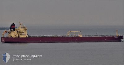
FLAGSHIP IVY
Oil Products Tanker
Current Trip
| Time Travelled | 9 days |
|---|---|
| Remaining Time | --- |
| Distance Travelled | 531.39 nm |
| Remaining Distance | --- |
| AVG Speed | 8.2 Knots |
| MAX Speed | 12.7 Knots |
| AVG Wind | 11.9 knots |
| MAX Wind | 26.9 knots |
| MIN Temp | 11.3°C / 52.34°F |
| MAX Temp | 20.4°C / 68.72°F |
| Draught | 8.5 m |
| Position Received | 5 d ago |
Current Position
| Longitude | 126.76206° |
|---|---|
| Latitude | 32.11194° |
| Status | Under way using engine |
| Speed | 11.1 Knots |
| Course | 160.9° |
| Area | Eastern China Sea |
| Station | T-AIS |
| Position Received | 5 d ago |
Info
Information
The current position of FLAGSHIP IVY is in Eastern China Sea with coordinates 32.11194° / 126.76206° as reported on 2024-04-19 06:15 by AIS to our vessel tracker app. The vessel's current speed is 11.1 Knots
The vessel FLAGSHIP IVY (IMO: 9520869, MMSI: 538004854) is a Oil Products Tanker that was built in 2011 ( 13 years old ). It's sailing under the flag of [MH] Marshall Is.
In this page you can find informations about the vessels current position, last detected port calls, and current voyage information. If the vessels is not in coverage by AIS you will find the latest position.
The current position of FLAGSHIP IVY is detected by our AIS receivers and we are not responsible for the reliability of the data. The last position was recorded while the vessel was in Coverage by the Ais receivers of our vessel tracking app.
The current draught of FLAGSHIP IVY as reported by AIS is 8.5 meters
Weather
| Temperature | 18°C / 64.4°F |
|---|---|
| Wind Speed | 12 knots |
| Direction | 290° WNW |
| Pressure | 1006.9 hPa |
| Humidity | 52.9 % |
| Cloud Coverage | 4 % |
Featured Company
Events
| Time | Event | Details | Position / Dest | Info |
|---|---|---|---|---|
| 2024-04-23 17:32 | STOP Moving | 7.05 nm, East of YEOSU |
34.71041 / 127.80394
KRYOS
|
Speed: 0.2 kn Course: -1° |
| 2024-04-23 14:52 | START Moving |
34.46407 / 128.01448
KRYOS
|
Speed: 5 kn Course: 332° |
|
| 2024-04-23 13:48 | STOP Moving |
34.46667 / 128.00667
KRYOS
|
Speed: Course: -1° |
|
| 2024-04-22 05:23 | START Moving | 21.48 nm, East of SINYANG |
33.32333 / 127.32833
KRYOS
|
Speed: 4 kn Course: -1° |
| 2024-04-22 04:24 | STOP Moving | 20.99 nm, East of SINYANG |
33.33833 / 127.32333
KRYOS
|
Speed: Course: -1° |
| 2024-04-21 23:41 | START Moving | 20 nm, South East of SINYANG |
33.28419 / 127.27795
KRYOS
|
Speed: 3.2 kn Course: -1° |
| 2024-04-21 19:47 | STOP Moving | 21.59 nm, South East of SINYANG |
33.28833 / 127.31500
KRYOS
|
Speed: Course: -1° |
| 2024-04-21 18:35 | START Moving |
33.25500 / 127.30334
KRYOS
|
Speed: 5 kn Course: 56° |
|
| 2024-04-21 17:53 | STOP Moving | 21.47 nm, South East of SINYANG |
33.24667 / 127.28667
KRYOS
|
Speed: Course: -1° |
| 2024-04-21 17:12 | START Moving | 20.32 nm, South East of SINYANG |
33.25834 / 127.26833
KRYOS
|
Speed: 4 kn Course: -1° |