
FIRST BROTHER
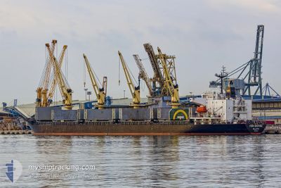
Bulk Carrier
Current Trip
| Time Travelled | 11 days |
|---|---|
| Remaining Time | --- |
| Distance Travelled | 3158.29 nm |
| Remaining Distance | --- |
| AVG Speed | 11.5 Knots |
| MAX Speed | 13.3 Knots |
| AVG Wind | 13.5 knots |
| MAX Wind | 25.8 knots |
| MIN Temp | 0.8°C / 33.44°F |
| MAX Temp | 19.9°C / 67.82°F |
| Draught | 10.4 m |
| Position Received | 5 d ago |
Current Position
| Longitude | -10.86042° |
|---|---|
| Latitude | 54.07334° |
| Status | Under way using engine |
| Speed | 12.1 Knots |
| Course | 200.6° |
| Area | North Atlantic Ocean |
| Station | T-AIS |
| Position Received | 5 d ago |
Info
Information
The current position of FIRST BROTHER is in North Atlantic Ocean with coordinates 54.07334° / -10.86042° as reported on 2024-04-20 06:57 by AIS to our vessel tracker app. The vessel's current speed is 12.1 Knots and is heading at the port of ARATU. The estimated time of arrival as calculated by MyShipTracking vessel tracking app is 2024-05-04 23:00 LT
The vessel FIRST BROTHER (IMO: 9266140, MMSI: 229381000) is a Bulk Carrier that was built in 2003 ( 21 years old ). It's sailing under the flag of [MT] Malta.
In this page you can find informations about the vessels current position, last detected port calls, and current voyage information. If the vessels is not in coverage by AIS you will find the latest position.
The current position of FIRST BROTHER is detected by our AIS receivers and we are not responsible for the reliability of the data. The last position was recorded while the vessel was in Coverage by the Ais receivers of our vessel tracking app.
The current draught of FIRST BROTHER as reported by AIS is 10.4 meters
Weather
| Temperature | 19.9°C / 67.82°F |
|---|---|
| Wind Speed | 17 knots |
| Direction | 51° NE |
| Pressure | 1019.9 hPa |
| Humidity | 70.6 % |
| Cloud Coverage | 100 % |
Featured Company
Last Port Calls
| Port | Arrival | Departure | Time In Port |
|---|---|---|---|
| 2024-04-08 14:05 | 2024-04-14 06:37 | 5 d | |
| 2024-03-28 08:09 | 2024-03-30 18:44 | 2 d | |
| 2024-03-21 15:19 | 2024-03-23 16:32 | 2 d | |
| 2024-02-18 11:28 | 2024-03-02 23:28 | 13 d | |
| 2024-02-07 18:32 | 2024-02-11 05:57 | 3 d | |
| 2024-02-06 21:37 |
Last Trips
| Origin | Departure | Destination | Arrival | Distance | |
|---|---|---|---|---|---|
| 2024-03-30 18:44 | 2024-04-08 17:05 | 1623.77 nm | |||
| 2024-03-23 16:32 | 2024-03-28 08:09 | 457.81 nm | |||
| 2024-03-02 18:28 | 2024-03-21 15:19 | 5189.16 nm | |||
| 2024-02-10 23:57 | 2024-02-18 06:28 | 1126.38 nm | |||
| 2024-02-06 15:37 | 2024-02-07 12:32 | 226.75 nm |
Events
| Time | Event | Details | Position / Dest | Info |
|---|---|---|---|---|
| 2024-04-20 07:04 | Status Changed | Default Under way using engine |
54.05167 / -10.87167
ARATU
|
Speed: 12.1 kn Course: 200.6° |
| 2024-04-20 06:57 | Status Changed | Under way using engine Default |
54.07334 / -10.86042
ARATU
|
Speed: 12 kn Course: 196° |
| 2024-04-20 06:57 | OUT of Coverage |
54.07334 / -10.86042
North Atlantic Ocean
ARATU
|
Speed: 12.1 kn Course: 200.6° |
|
| 2024-04-20 06:07 | Status Changed | Default Under way using engine |
54.23500 / -10.77500
ARATU
|
Speed: 12.3 kn Course: 196.9° |
| 2024-04-20 05:56 | Status Changed | Under way using engine Default |
54.27122 / -10.75491
ARATU
|
Speed: 12.1 kn Course: 201° |
| 2024-04-20 05:38 | Status Changed | Default Under way using engine |
54.32839 / -10.72339
ARATU
|
Speed: 12.4 kn Course: 202.7° |
| 2024-04-20 05:29 | Status Changed | Under way using engine Default |
54.35663 / -10.70529
ARATU
|
Speed: 12.4 kn Course: 200° |
| 2024-04-20 04:37 | Status Changed | Default Under way using engine |
54.52167 / -10.58833
ARATU
|
Speed: 12 kn Course: 205.1° |
| 2024-04-20 04:30 | Change Sea Area | Irish part of the North Atlantic Ocean Norwegian part of the Norwegian Sea |
54.54297 / -10.57522
North Atlantic Ocean
ARATU
|
Speed: 12 kn Course: 205.1° |
| 2024-04-20 04:30 | Status Changed | Under way using engine Default |
54.54297 / -10.57522
ARATU
|
Speed: 12 kn Course: 201° |