
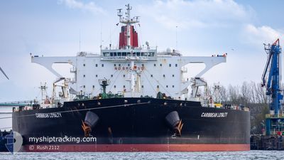
CARIBBEAN LOYALTY
Crude Oil Tanker
Current Trip
| Time Travelled | 9 h, 35 mins |
|---|---|
| Remaining Time | --- |
| Distance Travelled | 129.60 nm |
| Remaining Distance | --- |
| AVG Speed | 10.8 Knots |
| MAX Speed | 16.4 Knots |
| AVG Wind | 12.8 knots |
| MAX Wind | 18.9 knots |
| MIN Temp | 7°C / 44.6°F |
| MAX Temp | 8.9°C / 48.02°F |
| Draught | 10.9 m |
| Position Received | 1 m ago |
Current Position
| Longitude | 1.42639° |
|---|---|
| Latitude | 51.05212° |
| Status | Under way using engine |
| Speed | 15.4 Knots |
| Course | 226.9° |
| Area | North Sea |
| Station | T-AIS |
| Position Received | 1 m ago |
Info
Information
The current position of CARIBBEAN LOYALTY is in North Sea with coordinates 51.05212° / 1.42639° as reported on 2024-04-18 05:37 by AIS to our vessel tracker app. The vessel's current speed is 15.4 Knots and is heading at the port of CORPUS CHRISTI. The estimated time of arrival as calculated by MyShipTracking vessel tracking app is 2024-05-03 16:00 LT
The vessel CARIBBEAN LOYALTY (IMO: 9501150, MMSI: 538004633) is a Crude Oil Tanker that was built in 2011 ( 13 years old ). It's sailing under the flag of [MH] Marshall Is.
In this page you can find informations about the vessels current position, last detected port calls, and current voyage information. If the vessels is not in coverage by AIS you will find the latest position.
The current position of CARIBBEAN LOYALTY is detected by our AIS receivers and we are not responsible for the reliability of the data. The last position was recorded while the vessel was in Coverage by the Ais receivers of our vessel tracking app.
The current draught of CARIBBEAN LOYALTY as reported by AIS is 10.9 meters
Weather
| Temperature | 8.8°C / 47.84°F |
|---|---|
| Wind Speed | 18 knots |
| Direction | 34° NE |
| Pressure | 1019.4 hPa |
| Humidity | 66.3 % |
| Cloud Coverage | 33 % |
Featured Company
Last Port Calls
| Port | Arrival | Departure | Time In Port |
|---|---|---|---|
| 2024-04-08 11:19 | 2024-04-17 20:03 | 9 d | |
| 2024-03-29 14:18 | 2024-04-04 14:28 | 6 d |
Most Visited Ports (Last year)
| Port | Arrivals | |
|---|---|---|
| 1 | ||
| 1 | ||
| 1 | ||
| 1 |
Last Trips
| Origin | Departure | Destination | Arrival | Distance | |
|---|---|---|---|---|---|
| 2024-04-04 16:28 | 2024-04-08 13:19 | 77.67 nm |
Events
| Time | Event | Details | Position / Dest | Info |
|---|---|---|---|---|
| 2024-04-18 05:29 | Change Sea Area | United Kingdom part of the English Channel United Kingdom part of the North Sea |
51.07496 / 1.46768
English Channel
USCRP
|
Speed: 15.7 kn Course: 230.9° |
| 2024-04-18 01:44 | Change Sea Area | United Kingdom part of the North Sea Belgian part of the North Sea |
51.80553 / 2.48058
North Sea
USCRP
|
Speed: 14.9 kn Course: 225.3° |
| 2024-04-18 01:29 | Change Sea Area | Belgian part of the North Sea Dutch part of the North Sea |
51.85132 / 2.54801
North Sea
USCRP
|
Speed: 14.9 kn Course: 221.1° |
| 2024-04-18 00:00 | ETA Changed | 2024/05/03 16:00 2024/05/03 19:19 |
52.05755 / 3.00251
USCRP
|
Speed: 14.6 kn Course: 274.8° |
| 2024-04-17 22:08 | ETA Changed | 2024/05/03 19:19 2024/05/03 19:00 |
52.05815 / 3.73301
USCRP
|
Speed: 13.9 kn Course: 277° |
| 2024-04-17 22:08 | Status Changed | Under way using engine Constrained by her draught |
52.05800 / 3.73498
USCRP
|
Speed: 13.7 kn Course: 276.6° |
| 2024-04-17 21:47 | Destination Changed | USCRP ROTTERDAM |
52.04721 / 3.86337
USCRP
|
Speed: 12.3 kn Course: 282.4° |
| 2024-04-17 21:47 | ETA Changed | 2024/05/03 19:00 2024/04/04 18:18 |
52.04721 / 3.86337
USCRP
|
Speed: 12.3 kn Course: 282.4° |
| 2024-04-17 20:03 | PORT DEPARTURE |
|
51.94468 / 4.07956
ROTTERDAM
|
Speed: 2.9 kn Course: 206° |
| 2024-04-17 19:53 | START Moving |
51.93891 / 4.06868
[NL] MAASVLAKTE - ROTTERDAM
|
Speed: 3.1 kn Course: 244° |