
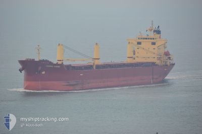
FEDERAL KUSHIRO
Bulk Carrier
Current Trip
| Time Travelled | 6 days |
|---|---|
| Remaining Time | 8 days |
| Distance Travelled | 1436.66 nm |
| Remaining Distance | 1975.60 nm |
| AVG Speed | 11 Knots |
| MAX Speed | 17.6 Knots |
| AVG Wind | 9.2 knots |
| MAX Wind | 20.3 knots |
| MIN Temp | 1.7°C / 35.06°F |
| MAX Temp | 9.8°C / 49.64°F |
| Draught | 8.1 m |
| Position Received | 5 d ago |
Current Position
| Longitude | -68.54470° |
|---|---|
| Latitude | 48.63773° |
| Status | Under way using engine |
| Speed | 7.1 Knots |
| Course | 56.6° |
| Area | Gulf of St-Lawrence |
| Station | T-AIS |
| Position Received | 5 d ago |
Info
Information
The current position of FEDERAL KUSHIRO is in Gulf of St-Lawrence with coordinates 48.63773° / -68.54470° as reported on 2024-04-14 10:29 by AIS to our vessel tracker app. The vessel's current speed is 7.1 Knots and is heading at the port of ANTWERP. The estimated time of arrival as calculated by MyShipTracking vessel tracking app is 2024-04-28 07:38 LT
The vessel FEDERAL KUSHIRO (IMO: 9284702, MMSI: 538004060) is a Bulk Carrier that was built in 2004 ( 20 years old ). It's sailing under the flag of [MH] Marshall Is.
In this page you can find informations about the vessels current position, last detected port calls, and current voyage information. If the vessels is not in coverage by AIS you will find the latest position.
The current position of FEDERAL KUSHIRO is detected by our AIS receivers and we are not responsible for the reliability of the data. The last position was recorded while the vessel was in Coverage by the Ais receivers of our vessel tracking app.
The current draught of FEDERAL KUSHIRO as reported by AIS is 8.1 meters
Weather
| Temperature | 10.1°C / 50.18°F |
|---|---|
| Wind Speed | 9 knots |
| Direction | 267° W |
| Pressure | 1006.9 hPa |
| Humidity | 63.6 % |
| Cloud Coverage | 45 % |
Featured Company
Last Port Calls
| Port | Arrival | Departure | Time In Port |
|---|---|---|---|
| 2024-04-13 00:47 | 2024-04-13 10:34 | 9 h | |
| 2024-04-11 16:25 | 2024-04-11 17:02 | 36 m | |
| 2024-04-09 12:09 | 2024-04-09 13:11 | 1 h | |
| 2024-04-06 15:08 | 2024-04-08 10:49 | 1 d | |
| 2024-04-01 17:06 | 2024-04-01 17:47 | 41 m | |
| 2024-03-30 00:58 | 2024-03-30 01:33 | 35 m | |
| 2024-03-28 13:41 | 2024-03-28 16:32 | 2 h | |
| 2024-03-23 02:08 | 2024-03-24 05:02 | 1 d | |
| 2024-03-21 14:57 | 2024-03-23 00:35 | 1 d | |
| 2024-02-28 08:03 | 2024-03-01 19:46 | 2 d |
Most Visited Ports (Last year)
| Port | Arrivals | |
|---|---|---|
| 4 | ||
| 4 | ||
| 3 | ||
| 2 | ||
| 1 | ||
| 1 |
Last Trips
| Origin | Departure | Destination | Arrival | Distance | |
|---|---|---|---|---|---|
| 2024-04-11 13:02 | 2024-04-12 20:47 | 296.41 nm | |||
| 2024-04-09 09:11 | 2024-04-11 12:25 | 522.16 nm | |||
| 2024-04-08 06:49 | 2024-04-09 08:09 | 240.80 nm | |||
| 2024-04-01 13:47 | 2024-04-06 11:08 | 237.80 nm | |||
| 2024-03-29 21:33 | 2024-04-01 13:06 | 522.58 nm | |||
| 2024-03-28 12:32 | 2024-03-29 20:58 | 298.00 nm | |||
| 2024-03-24 01:02 | 2024-03-28 09:41 | 74.24 nm | |||
| 2024-03-22 20:35 | 2024-03-22 22:08 | 8.02 nm | |||
| 2024-03-01 16:46 | 2024-03-21 10:57 | 5577.55 nm | |||
| 2024-02-19 13:46 | 2024-02-28 05:03 | 467.78 nm |
Events
| Time | Event | Details | Position / Dest | Info |
|---|---|---|---|---|
| 2024-04-14 10:39 | Status Changed | Default Under way using engine |
48.64866 / -68.51971
BE ANR
|
Speed: 7.1 kn Course: 56.6° |
| 2024-04-14 10:29 | OUT of Coverage |
48.63773 / -68.54470
Gulf of St-Lawrence
BE ANR
|
Speed: 7.1 kn Course: 56.6° |
|
| 2024-04-14 10:27 | Status Changed | Under way using engine Default |
48.63575 / -68.54929
BE ANR
|
Speed: 7.1 kn Course: 57° |
| 2024-04-14 10:18 | IN Coverage |
48.63650 / -68.54756
Gulf of St-Lawrence
BE ANR
|
Speed: 7.2 kn Course: 56.8° |
|
| 2024-04-13 22:42 | Status Changed | Default Under way using engine |
47.23239 / -70.56735
BE ANR
|
Speed: 11.4 kn Course: 41.4° |
| 2024-04-13 22:33 | Status Changed | Under way using engine Default |
47.20867 / -70.59278
BE ANR
|
Speed: 11.6 kn Course: 42° |
| 2024-04-13 22:33 | OUT of Coverage |
47.20867 / -70.59278
Gulf of St-Lawrence
BE ANR
|
Speed: 11.4 kn Course: 41.4° |
|
| 2024-04-13 22:21 | Status Changed | Default Under way using engine |
47.18084 / -70.62931
BE ANR
|
Speed: 11.2 kn Course: 41.9° |
| 2024-04-13 22:11 | Status Changed | Under way using engine Default |
47.15714 / -70.65974
BE ANR
|
Speed: 11.6 kn Course: 32° |
| 2024-04-13 22:02 | Status Changed | Default Under way using engine |
47.13420 / -70.68276
BE ANR
|
Speed: 11.9 kn Course: 33.3° |