
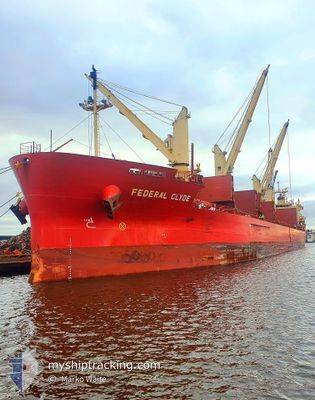
FEDERAL CLYDE
Cargo
Current Trip
| Time Travelled | 3 h, 27 mins |
|---|---|
| Remaining Time | 2 days |
| Distance Travelled | 14.65 nm |
| Remaining Distance | 302.29 nm |
| AVG Speed | 5.8 Knots |
| MAX Speed | 10.3 Knots |
| AVG Wind | 11.9 knots |
| MAX Wind | 12 knots |
| MIN Temp | 4.9°C / 40.82°F |
| MAX Temp | 6.1°C / 42.98°F |
| Draught | 8.1 m |
| Position Received | 39 m ago |
Current Position
| Longitude | -73.68636° |
|---|---|
| Latitude | 45.41699° |
| Status | Under way using engine |
| Speed | 6.4 Knots |
| Course | 265.6° |
| Area | Gulf of St-Lawrence |
| Station | T-AIS |
| Position Received | 39 m ago |
Info
Information
The current position of FEDERAL CLYDE is in Gulf of St-Lawrence with coordinates 45.41699° / -73.68636° as reported on 2024-04-18 08:39 by AIS to our vessel tracker app. The vessel's current speed is 6.4 Knots and is heading at the port of HAMILTON. The estimated time of arrival as calculated by MyShipTracking vessel tracking app is 2024-04-20 09:19 LT
The vessel FEDERAL CLYDE (IMO: 9671072, MMSI: 538006470) is a Cargo It's sailing under the flag of [MH] Marshall Is.
In this page you can find informations about the vessels current position, last detected port calls, and current voyage information. If the vessels is not in coverage by AIS you will find the latest position.
The current position of FEDERAL CLYDE is detected by our AIS receivers and we are not responsible for the reliability of the data. The last position was recorded while the vessel was in Coverage by the Ais receivers of our vessel tracking app.
The current draught of FEDERAL CLYDE as reported by AIS is 8.1 meters
Weather
| Temperature | 5.1°C / 41.18°F |
|---|---|
| Wind Speed | 12 knots |
| Direction | 58° ENE |
| Pressure | 1017.9 hPa |
| Humidity | 57.6 % |
| Cloud Coverage | 100 % |
Featured Company
Most Visited Ports (Last year)
| Port | Arrivals | |
|---|---|---|
| 3 | ||
| 2 | ||
| 2 | ||
| 2 | ||
| 2 | ||
| 1 |
Last Trips
| Origin | Departure | Destination | Arrival | Distance | |
|---|---|---|---|---|---|
| 2024-04-17 19:39 | 2024-04-18 00:52 | 39.62 nm | |||
| 2024-03-20 22:24 | 2024-04-15 07:43 | 5430.52 nm | |||
| 2024-02-28 21:02 | 2024-03-06 18:16 | 902.38 nm | |||
| 2024-02-08 17:51 | 2024-02-24 23:21 | 3522.58 nm |
Events
| Time | Event | Details | Position / Dest | Info |
|---|---|---|---|---|
| 2024-04-18 09:06 | Status Changed | Default Under way using engine |
45.40378 / -73.77142
CAHAM
|
Speed: 6.4 kn Course: 265.6° |
| 2024-04-18 07:47 | START Moving | 0.99 nm, East of SAINTE-CATHERINE |
45.40794 / -73.56990
CAHAM
|
Speed: 3.1 kn Course: 264° |
| 2024-04-18 07:05 | STOP Moving | 1.23 nm, East of SAINTE-CATHERINE |
45.40802 / -73.56424
CAHAM
|
Speed: 0.3 kn Course: 270° |
| 2024-04-18 05:51 | PORT DEPARTURE |
|
45.46677 / -73.50332
CAHAM
|
Speed: 6.6 kn Course: 168° |
| 2024-04-18 05:36 | START Moving |
45.49082 / -73.51623
[CA] MONTREAL
|
Speed: 3.2 kn Course: 166° |
|
| 2024-04-18 04:54 | STOP Moving |
45.49449 / -73.51737
[CA] MONTREAL
|
Speed: 0.3 kn Course: 168° |
|
| 2024-04-18 04:52 | PORT ARRIVAL |
|
45.49481 / -73.51747
[CA] MONTREAL
|
Speed: 0.6 kn Course: 168° |
| 2024-04-18 00:30 | Status Changed | Under way using engine Moored |
45.96546 / -73.19982
CAHAM
|
Speed: 10.1 kn Course: 209.5° |
| 2024-04-17 23:43 | START Moving | 0.21 nm, North West of SOREL |
46.05298 / -73.11901
CAHAM
|
Speed: 3.1 kn Course: 275° |
| 2024-04-17 23:39 | PORT DEPARTURE |
|
46.05173 / -73.11694
CAHAM
|
Speed: 0.3 kn Course: 263° |