
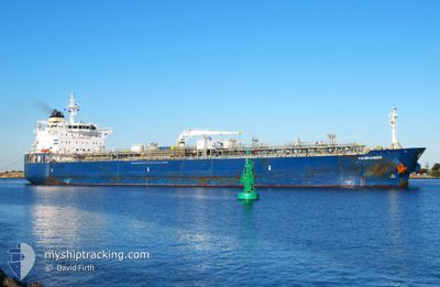
FAUSKANGER
Oil/Chemical Tanker
Current Trip
PN BLB
| Time Travelled | 8 days |
|---|---|
| Remaining Time | --- |
| Distance Travelled | 2357.30 nm |
| Remaining Distance | --- |
| AVG Speed | 11.4 Knots |
| MAX Speed | 16.5 Knots |
| AVG Wind | 14.5 knots |
| MAX Wind | 29.2 knots |
| MIN Temp | 2.8°C / 37.04°F |
| MAX Temp | 17.2°C / 62.96°F |
| Draught | 11.7 m |
| Position Received | 5 d ago |
Current Position
| Longitude | 141.65911° |
|---|---|
| Latitude | 41.63507° |
| Status | Under way using engine |
| Speed | 13.6 Knots |
| Course | 98.2° |
| Area | North Pacific Ocean |
| Station | T-AIS |
| Position Received | 5 d ago |
Info
Information
The current position of FAUSKANGER is in North Pacific Ocean with coordinates 41.63507° / 141.65911° as reported on 2024-04-18 14:53 by AIS to our vessel tracker app. The vessel's current speed is 13.6 Knots
The vessel FAUSKANGER (IMO: 9387700, MMSI: 257376000) is a Oil/Chemical Tanker that was built in 2009 ( 15 years old ). It's sailing under the flag of [NO] Norway.
In this page you can find informations about the vessels current position, last detected port calls, and current voyage information. If the vessels is not in coverage by AIS you will find the latest position.
The current position of FAUSKANGER is detected by our AIS receivers and we are not responsible for the reliability of the data. The last position was recorded while the vessel was in Coverage by the Ais receivers of our vessel tracking app.
The current draught of FAUSKANGER as reported by AIS is 11.7 meters
Weather
| Temperature | 5.7°C / 42.26°F |
|---|---|
| Wind Speed | 16 knots |
| Direction | 291° WNW |
| Pressure | 1012.9 hPa |
| Humidity | 66.8 % |
| Cloud Coverage | 83 % |
Featured Company
Last Port Calls
| Port | Arrival | Departure | Time In Port |
|---|---|---|---|
| 2024-04-14 09:24 | 2024-04-15 21:15 | 1 d | |
| 2024-04-09 07:34 | 2024-04-10 23:45 | 1 d | |
| 2024-04-09 07:10 | 2024-04-09 07:21 | 10 m | |
| 2024-04-05 22:33 | 2024-04-06 23:20 | 1 d | |
| 2024-04-03 01:48 | 2024-04-03 19:42 | 17 h | |
| 2024-03-28 22:41 | 2024-03-29 22:44 | 1 d | |
| 2024-03-19 18:26 | 2024-03-22 22:25 | 3 d | |
| 2024-03-14 04:02 | 2024-03-14 21:55 | 17 h | |
| 2024-03-13 02:59 | 2024-03-14 03:19 | 1 d | |
| 2024-02-23 23:34 | 2024-02-25 23:22 | 1 d |
Last Trips
| Origin | Departure | Destination | Arrival | Distance | |
|---|---|---|---|---|---|
| 2024-04-11 08:45 | 2024-04-14 18:24 | 442.82 nm | |||
| 2024-04-09 16:21 | 2024-04-09 16:34 | 0.31 nm | |||
| 2024-04-07 08:20 | 2024-04-09 16:10 | 65.92 nm | |||
| 2024-04-04 04:42 | 2024-04-06 07:33 | 496.10 nm | |||
| 2024-03-30 07:44 | 2024-04-03 10:48 | 821.46 nm | |||
| 2024-03-23 07:25 | 2024-03-29 07:41 | 982.62 nm | |||
| 2024-03-15 06:55 | 2024-03-20 03:26 | 146.75 nm | |||
| 2024-03-14 12:19 | 2024-03-14 13:02 | 4.62 nm | |||
| 2024-02-26 12:22 | 2024-03-13 11:59 | 5224.23 nm | |||
| 2024-02-10 21:39 | 2024-02-24 12:34 | 1926.60 nm |
Events
| Time | Event | Details | Position / Dest | Info |
|---|---|---|---|---|
| 2024-04-18 14:53 | OUT of Coverage |
41.63507 / 141.65911
North Pacific Ocean
PN BLB
|
Speed: 13.6 kn Course: 98.2° |
|
| 2024-04-18 13:41 | Change Sea Area | Japanese part of the North Pacific Ocean Japanese part of the Japan Sea |
41.62331 / 141.29700
North Pacific Ocean
PN BLB
|
Speed: 12.7 kn Course: 91° |
| 2024-04-18 09:11 | IN Coverage |
41.17665 / 140.01655
Japan Sea
PN BLB
|
Speed: 12.8 kn Course: 55.1° |
|
| 2024-04-16 08:18 | Status Changed | Default Under way using engine |
35.01456 / 129.89410
PN BLB
|
Speed: 12.7 kn Course: 63.6° |
| 2024-04-16 08:17 | OUT of Coverage |
35.01221 / 129.88834
Japan Sea
PN BLB
|
Speed: 12.7 kn Course: 63.6° |
|
| 2024-04-16 05:21 | Draught Changed | 11.7 10.5 |
34.67889 / 129.21327
PN BLB
|
Speed: 14.1 kn Course: 21.9° |
| 2024-04-16 05:21 | Destination Changed | PN BLB KR YOS |
34.67889 / 129.21327
PN BLB
|
Speed: 14.1 kn Course: 21.9° |
| 2024-04-16 05:21 | ETA Changed | 2024/05/14 12:00 2024/04/12 08:00 |
34.67889 / 129.21327
PN BLB
|
Speed: 14.1 kn Course: 21.9° |
| 2024-04-16 05:14 | Status Changed | Under way using engine Default |
34.65338 / 129.20060
KR YOS
|
Speed: 14 kn Course: 22° |
| 2024-04-16 05:11 | Status Changed | Default Under way using engine |
34.64034 / 129.19412
KR YOS
|
Speed: 13.9 kn Course: 22.8° |