
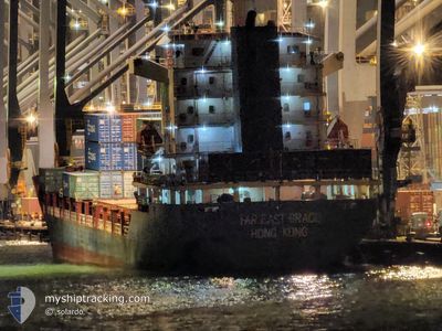
FAR EAST GRACE
Cargo
Current Trip
| Time Travelled | 2 days |
|---|---|
| Remaining Time | 14 h, 28 mins |
| Distance Travelled | 299.43 nm |
| Remaining Distance | 278.06 nm |
| AVG Speed | 8.8 Knots |
| MAX Speed | 9.9 Knots |
| AVG Wind | 17.5 knots |
| MAX Wind | 23 knots |
| MIN Temp | 16.7°C / 62.06°F |
| MAX Temp | 19.8°C / 67.64°F |
| Draught | 7.1 m |
| Position Received | 19 h, 27 m ago |
Current Position
| Longitude | 27.99756° |
|---|---|
| Latitude | 35.37673° |
| Status | Under way using engine |
| Speed | 8.1 Knots |
| Course | 143.6° |
| Area | Mediterranean Sea - Eastern Basin |
| Station | T-AIS |
| Position Received | 19 h, 27 m ago |
Info
Information
The current position of FAR EAST GRACE is in Mediterranean Sea - Eastern Basin with coordinates 35.37673° / 27.99756° as reported on 2024-04-17 10:27 by AIS to our vessel tracker app. The vessel's current speed is 8.1 Knots and is heading at the port of ALEXANDRIA. The estimated time of arrival as calculated by MyShipTracking vessel tracking app is 2024-04-18 20:23 LT
The vessel FAR EAST GRACE (IMO: 9422574, MMSI: 477656100) is a Cargo It's sailing under the flag of [HK] Hong Kong.
In this page you can find informations about the vessels current position, last detected port calls, and current voyage information. If the vessels is not in coverage by AIS you will find the latest position.
The current position of FAR EAST GRACE is detected by our AIS receivers and we are not responsible for the reliability of the data. The last position was recorded while the vessel was in Coverage by the Ais receivers of our vessel tracking app.
The current draught of FAR EAST GRACE as reported by AIS is 7.1 meters
Weather
| Temperature | 19.7°C / 67.46°F |
|---|---|
| Wind Speed | 23 knots |
| Direction | 112° ESE |
| Pressure | 1006 hPa |
| Humidity | 78.2 % |
| Cloud Coverage | 60 % |
Featured Company
Last Port Calls
| Port | Arrival | Departure | Time In Port |
|---|---|---|---|
| 2024-04-15 15:02 | 2024-04-16 00:39 | 9 h | |
| 2024-04-11 17:46 | 2024-04-12 05:52 | 12 h | |
| 2024-04-06 14:00 | 2024-04-08 09:25 | 1 d | |
| 2024-03-30 14:20 | 2024-03-31 00:45 | 10 h | |
| 2024-03-27 14:11 | 2024-03-28 08:20 | 18 h | |
| 2024-03-18 15:56 | 2024-03-19 01:37 | 9 h | |
| 2024-03-15 10:22 | 2024-03-16 10:42 | 1 d | |
| 2024-03-13 04:11 | 2024-03-13 19:55 | 15 h | |
| 2024-03-03 11:14 | |||
| 2024-02-24 03:48 | 2024-02-24 19:47 | 15 h |
Last Trips
| Origin | Departure | Destination | Arrival | Distance | |
|---|---|---|---|---|---|
| 2024-04-12 08:52 | 2024-04-15 18:02 | 358.30 nm | |||
| 2024-04-08 11:25 | 2024-04-11 20:46 | 733.23 nm | |||
| 2024-03-31 03:45 | 2024-04-06 16:00 | 582.61 nm | |||
| 2024-03-28 11:20 | 2024-03-30 17:20 | 376.77 nm | |||
| 2024-03-16 13:42 | 2024-03-18 18:56 | 352.93 nm | |||
| 2024-03-13 22:55 | 2024-03-15 13:22 | 92.87 nm | |||
| 2024-02-24 22:47 | 2024-03-03 14:14 | 645.27 nm | |||
| 2024-02-20 15:02 | 2024-02-24 06:48 | 512.02 nm | |||
| 2024-02-14 03:55 | 2024-02-18 20:59 | 584.38 nm | |||
| 2024-02-08 19:26 | 2024-02-13 00:41 | 616.37 nm |
Events
| Time | Event | Details | Position / Dest | Info |
|---|---|---|---|---|
| 2024-04-17 10:27 | OUT of Coverage |
35.37673 / 27.99756
Mediterranean Sea - Eastern Basin
EGALY
|
Speed: 8.1 kn Course: 143.6° |
|
| 2024-04-17 09:53 | ETA Changed | 2024/04/18 18:00 2024/04/18 14:00 |
35.43908 / 27.93921
EGALY
|
Speed: 8.1 kn Course: 141.4° |
| 2024-04-17 06:31 | Detected in Sea | Greek part of the Mediterranean Sea - Eastern Basin |
35.78739 / 27.57240
Mediterranean Sea - Eastern Basin
EGALY
|
Speed: 8.8 kn Course: 135.6° |
| 2024-04-17 04:42 | Status Changed | Under way using engine Default |
35.98877 / 27.36011
EGALY
|
Speed: 8.5 kn Course: 132° |
| 2024-04-17 04:14 | Status Changed | Default Under way using engine |
36.03749 / 27.30068
EGALY
|
Speed: 8.2 kn Course: 134.3° |
| 2024-04-17 02:42 | Status Changed | Under way using engine Default |
36.18494 / 27.12705
EGALY
|
Speed: 8 kn Course: 137° |
| 2024-04-17 02:17 | Status Changed | Default Under way using engine |
36.22500 / 27.08167
EGALY
|
Speed: 8.1 kn Course: 129.5° |
| 2024-04-17 00:40 | Status Changed | Under way using engine Default |
36.38296 / 26.89005
EGALY
|
Speed: 8.6 kn Course: 139° |
| 2024-04-17 00:40 | IN Coverage |
36.38296 / 26.89005
Aegean Sea
EGALY
|
Speed: 8.2 kn Course: 137.2° |
|
| 2024-04-16 23:11 | OUT of Coverage |
36.54040 / 26.71195
Aegean Sea
EGALY
|
Speed: 9.1 kn Course: 140° |