
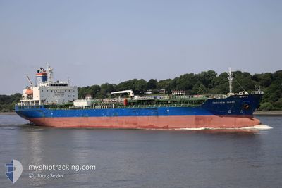
FAIRCHEM SABRE
Oil/Chemical Tanker
Current Trip
| Time Travelled | 3 days |
|---|---|
| Remaining Time | 2 days |
| Distance Travelled | 1091.88 nm |
| Remaining Distance | 649.72 nm |
| AVG Speed | 11.8 Knots |
| MAX Speed | 14.6 Knots |
| AVG Wind | 17 knots |
| MAX Wind | 29.9 knots |
| MIN Temp | 5.6°C / 42.08°F |
| MAX Temp | 13.1°C / 55.58°F |
| Draught | 9.9 m |
| Position Received | 11 m ago |
Current Position
| Longitude | -9.84586° |
|---|---|
| Latitude | 43.75845° |
| Status | Under way using engine |
| Speed | 12.5 Knots |
| Course | 216° |
| Area | North Atlantic Ocean |
| Station | T-AIS |
| Position Received | 11 m ago |
Info
Information
The current position of FAIRCHEM SABRE is in North Atlantic Ocean with coordinates 43.75845° / -9.84586° as reported on 2024-04-19 04:57 by AIS to our vessel tracker app. The vessel's current speed is 12.5 Knots and is heading at the port of JORF LASFAR. The estimated time of arrival as calculated by MyShipTracking vessel tracking app is 2024-04-21 06:18 LT
The vessel FAIRCHEM SABRE (IMO: 9657478, MMSI: 538007299) is a Oil/Chemical Tanker that was built in 2013 ( 11 years old ). It's sailing under the flag of [MH] Marshall Is.
In this page you can find informations about the vessels current position, last detected port calls, and current voyage information. If the vessels is not in coverage by AIS you will find the latest position.
The current position of FAIRCHEM SABRE is detected by our AIS receivers and we are not responsible for the reliability of the data. The last position was recorded while the vessel was in Coverage by the Ais receivers of our vessel tracking app.
The current draught of FAIRCHEM SABRE as reported by AIS is 9.9 meters
Weather
| Temperature | 13°C / 55.4°F |
|---|---|
| Wind Speed | 29 knots |
| Direction | 74° ENE |
| Pressure | 1017.4 hPa |
| Humidity | 83.5 % |
| Cloud Coverage | --- |
Featured Company
Last Trips
Events
| Time | Event | Details | Position / Dest | Info |
|---|---|---|---|---|
| 2024-04-19 04:55 | Detected in Sea | Spanish part of the North Atlantic Ocean |
43.76403 / -9.84045
North Atlantic Ocean
MAJFL
|
Speed: 12.4 kn Course: 216.4° |
| 2024-04-19 04:55 | Status Changed | Under way using engine Default |
43.76403 / -9.84045
MAJFL
|
Speed: 12.4 kn Course: 219° |
| 2024-04-19 04:55 | IN Coverage |
43.76403 / -9.84045
North Atlantic Ocean
MAJFL
|
Speed: 12.4 kn Course: 216.4° |
|
| 2024-04-17 20:07 | Status Changed | Default Under way using engine |
49.55976 / -4.07381
MAJFL
|
Speed: 13.4 kn Course: 239.3° |
| 2024-04-17 20:02 | OUT of Coverage |
49.56885 / -4.05009
English Channel
MAJFL
|
Speed: 13.4 kn Course: 239.3° |
|
| 2024-04-17 17:48 | Change Sea Area | United Kingdom part of the English Channel Guernsey part of the English Channel |
49.81618 / -3.39425
English Channel
MAJFL
|
Speed: 13.1 kn Course: 248.6° |
| 2024-04-17 17:47 | Status Changed | Under way using engine Default |
49.81779 / -3.38830
MAJFL
|
Speed: 13.1 kn Course: 239° |
| 2024-04-17 17:31 | IN Coverage |
49.81618 / -3.39425
English Channel
MAJFL
|
Speed: 13.1 kn Course: 248.6° |
|
| 2024-04-17 16:03 | Status Changed | Default Under way using engine |
49.97382 / -2.87260
MAJFL
|
Speed: 12.2 kn Course: 257.6° |
| 2024-04-17 15:56 | OUT of Coverage |
49.97886 / -2.83632
English Channel
MAJFL
|
Speed: 12.2 kn Course: 257.6° |