
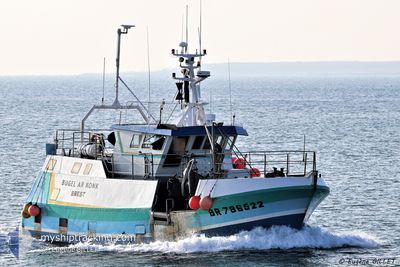
F/V BUGEL AR KONK
Fishing
Current Trip
EN PECHE
| Time Travelled | --- |
|---|---|
| Remaining Time | --- |
| Distance Travelled | 1209.24 nm |
| Remaining Distance | --- |
| AVG Speed | 8.8 Knots |
| MAX Speed | 11.6 Knots |
| AVG Wind | 13.6 knots |
| MAX Wind | 37.3 knots |
| MIN Temp | 2.1°C / 35.78°F |
| MAX Temp | 13.3°C / 55.94°F |
| Draught | 0 m |
| Position Received | 3 d ago |
Current Position
| Longitude | -4.78012° |
|---|---|
| Latitude | 48.36010° |
| Status | Default |
| Speed | 0.8 Knots |
| Course | 83° |
| Area | Celtic Sea |
| Station | T-AIS |
| Position Received | 3 d ago |
Info
Information
The current position of F/V BUGEL AR KONK is in Celtic Sea with coordinates 48.36010° / -4.78012° as reported on 2024-04-21 20:43 by AIS to our vessel tracker app. The vessel's current speed is 0.8 Knots
The vessel F/V BUGEL AR KONK (MMSI: 228336000) is a Fishing It's sailing under the flag of [FR] France.
In this page you can find informations about the vessels current position, last detected port calls, and current voyage information. If the vessels is not in coverage by AIS you will find the latest position.
The current position of F/V BUGEL AR KONK is detected by our AIS receivers and we are not responsible for the reliability of the data. The last position was recorded while the vessel was in Coverage by the Ais receivers of our vessel tracking app.
Weather
| Temperature | 9.3°C / 48.74°F |
|---|---|
| Wind Speed | 17 knots |
| Direction | 56° NE |
| Pressure | 1029.8 hPa |
| Humidity | 66.6 % |
| Cloud Coverage | 12 % |
Featured Company
Last Port Calls
Last Trips
| Origin | Departure | Destination | Arrival | Distance |
|---|
Events
| Time | Event | Details | Position / Dest | Info |
|---|---|---|---|---|
| 2024-04-21 20:43 | OUT of Coverage |
48.36010 / -4.78012
Celtic Sea
|
Speed: 0.8 kn Course: 31.4° |
|
| 2024-04-21 18:01 | IN Coverage |
48.11241 / -5.09095
Celtic Sea
|
Speed: 8.2 kn Course: 43.9° |
|
| 2024-04-21 02:15 | OUT of Coverage |
48.18248 / -5.06363
Celtic Sea
|
Speed: 8.2 kn Course: 232.2° |
|
| 2024-04-21 00:25 | IN Coverage |
48.35728 / -4.78533
Celtic Sea
|
Speed: 7.5 kn Course: 213.3° |
|
| 2024-04-20 13:50 | OUT of Coverage |
48.35871 / -4.78435
Celtic Sea
|
Speed: 9.3 kn Course: 38.9° |
|
| 2024-04-20 12:13 | IN Coverage |
48.18487 / -5.08230
Celtic Sea
|
Speed: 10.3 kn Course: 53.2° |
|
| 2024-04-20 02:09 | OUT of Coverage |
48.18128 / -5.06362
Celtic Sea
|
Speed: 9.2 kn Course: 231.3° |
|
| 2024-04-20 00:26 | IN Coverage |
48.35618 / -4.78648
Celtic Sea
|
Speed: 8.5 kn Course: 198.6° |
|
| 2024-04-19 12:42 | OUT of Coverage |
48.35738 / -4.78504
Celtic Sea
|
Speed: 9.6 kn Course: 19.6° |
|
| 2024-04-19 08:20 | IN Coverage |
47.95784 / -5.31965
Celtic Sea
|
Speed: 2.7 kn Course: 348.9° |