
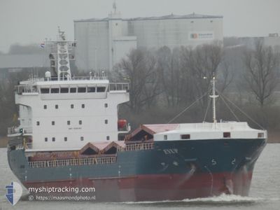
EYUP
Cargo
Current Trip
| Time Travelled | 8 days |
|---|---|
| Remaining Time | 2 days |
| Distance Travelled | 1585.33 nm |
| Remaining Distance | 979.80 nm |
| AVG Speed | 9.2 Knots |
| MAX Speed | 10.8 Knots |
| AVG Wind | 13.3 knots |
| MAX Wind | 35 knots |
| MIN Temp | 15°C / 59°F |
| MAX Temp | 23.2°C / 73.76°F |
| Draught | 7 m |
| Position Received | 5 d ago |
Current Position
| Longitude | 1.17133° |
|---|---|
| Latitude | 36.74367° |
| Status | Under way using engine |
| Speed | 10.4 Knots |
| Course | 80° |
| Area | Mediterranean Sea - Western Basin |
| Station | T-AIS |
| Position Received | 5 d ago |
Info
Information
The current position of EYUP is in Mediterranean Sea - Western Basin with coordinates 36.74367° / 1.17133° as reported on 2024-04-13 17:49 by AIS to our vessel tracker app. The vessel's current speed is 10.4 Knots and is heading at the port of MERSIN. The estimated time of arrival as calculated by MyShipTracking vessel tracking app is 2024-04-21 05:06 LT
The vessel EYUP (MMSI: 356224000) is a Cargo It's sailing under the flag of [PA] Panama.
In this page you can find informations about the vessels current position, last detected port calls, and current voyage information. If the vessels is not in coverage by AIS you will find the latest position.
The current position of EYUP is detected by our AIS receivers and we are not responsible for the reliability of the data. The last position was recorded while the vessel was in Coverage by the Ais receivers of our vessel tracking app.
The current draught of EYUP as reported by AIS is 7 meters
Weather
| Temperature | 17°C / 62.6°F |
|---|---|
| Wind Speed | 17 knots |
| Direction | 315° NW |
| Pressure | 1008 hPa |
| Humidity | 69 % |
| Cloud Coverage | --- |
Featured Company
Last Port Calls
| Port | Arrival | Departure | Time In Port |
|---|---|---|---|
| 2024-04-05 15:08 | 2024-04-10 14:56 | 4 d | |
| 2024-04-01 06:14 | 2024-04-04 01:29 | 2 d | |
| 2024-03-04 08:04 | 2024-03-11 17:08 | 7 d | |
| 2024-02-27 19:57 | 2024-02-29 19:43 | 1 d | |
| 2024-02-21 18:26 | 2024-02-21 18:34 | 7 m | |
| 2024-02-21 12:15 | 2024-02-21 18:22 | 6 h | |
| 2024-02-07 16:11 | 2024-02-12 14:02 | 4 d |
Last Trips
| Origin | Departure | Destination | Arrival | Distance | |
|---|---|---|---|---|---|
| 2024-04-04 01:29 | 2024-04-05 16:08 | 339.68 nm | |||
| 2024-03-11 18:08 | 2024-04-01 06:14 | 1050.11 nm | |||
| 2024-02-29 20:43 | 2024-03-04 09:04 | 386.21 nm | |||
| 2024-02-21 19:34 | 2024-02-27 20:57 | 714.75 nm | |||
| 2024-02-21 19:22 | 2024-02-21 19:26 | 0.30 nm | |||
| 2024-02-12 16:02 | 2024-02-21 13:15 | 1831.48 nm | |||
| 2024-01-26 16:35 | 2024-02-07 18:11 | 1277.71 nm |
Events
| Time | Event | Details | Position / Dest | Info |
|---|---|---|---|---|
| 2024-04-13 17:54 | Status Changed | Default Under way using engine |
36.74650 / 1.19033
TRMER
|
Speed: 10.4 kn Course: 80° |
| 2024-04-13 17:49 | OUT of Coverage |
36.74367 / 1.17133
Mediterranean Sea - Western Basin
|
Speed: 10.4 kn Course: 80° |
|
| 2024-04-13 17:34 | Status Changed | Under way using engine Default |
36.73650 / 1.12033
TRMER
|
Speed: 10.1 kn Course: 81° |
| 2024-04-13 17:26 | IN Coverage |
36.73650 / 1.12033
Mediterranean Sea - Western Basin
|
Speed: 10.3 kn Course: 80° |
|
| 2024-04-13 15:42 | Status Changed | Default Under way using engine |
36.69250 / .75233
TRMER
|
Speed: 7.9 kn Course: 81° |
| 2024-04-13 15:36 | OUT of Coverage |
36.69017 / .73383
Mediterranean Sea - Western Basin
|
Speed: 7.9 kn Course: 81° |
|
| 2024-04-13 15:18 | Draught Changed | 7 7.2 |
36.68300 / .68267
TRMER
|
Speed: 7.9 kn Course: 80° |
| 2024-04-13 14:56 | Status Changed | Under way using engine Default |
36.67433 / .62000
TRMER
|
Speed: 8.5 kn Course: 80° |
| 2024-04-13 14:46 | IN Coverage |
36.67516 / .62567
Mediterranean Sea - Western Basin
TRMER
|
Speed: 7.9 kn Course: 79° |
|
| 2024-04-13 13:11 | OUT of Coverage |
36.61867 / .29667
Mediterranean Sea - Western Basin
TRMER
|
Speed: 8.7 kn Course: 80° |