
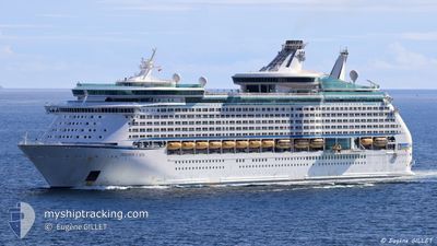
EXPLORER OF THE SEAS
Passengers Ship
Current Trip
| Trip Time | 1 day |
|---|---|
| Trip Distance | 753.61 nm |
| AVG Speed | 19.2 Knots |
| MAX Speed | 24.3 Knots |
| Draught | 9.1 m |
| AVG Wind | 11.5 knots |
| MAX Wind | 23 knots |
| MIN Temp | 24°C / 75.2°F |
| MAX Temp | 27.3°C / 81.14°F |
| Position Received | 3 m ago |
Current Position
| Longitude | -80.17751° |
|---|---|
| Latitude | 25.78039° |
| Status | Moored |
| Speed | |
| Course | 116° |
| Area | North Atlantic Ocean |
| Station | T-AIS |
| Position Received | 3 m ago |
Info
Information
The current position of EXPLORER OF THE SEAS is in North Atlantic Ocean with coordinates 25.78039° / -80.17751° as reported on 2024-04-19 16:45 by AIS to our vessel tracker app. The vessel's current speed is 0 Knots and is currently inside the port of MIAMI.
The vessel EXPLORER OF THE SEAS (IMO: 9161728, MMSI: 311316000) is a Passengers Ship that was built in 2000 ( 24 years old ). It's sailing under the flag of [BS] Bahamas.
In this page you can find informations about the vessels current position, last detected port calls, and current voyage information. If the vessels is not in coverage by AIS you will find the latest position.
The current position of EXPLORER OF THE SEAS is detected by our AIS receivers and we are not responsible for the reliability of the data. The last position was recorded while the vessel was in Coverage by the Ais receivers of our vessel tracking app.
The current draught of EXPLORER OF THE SEAS as reported by AIS is 9.1 meters
Weather
| Temperature | 26.2°C / 79.16°F |
|---|---|
| Wind Speed | 8 knots |
| Direction | 125° SE |
| Pressure | 1018.7 hPa |
| Humidity | 61.2 % |
| Cloud Coverage | 11 % |
Featured Company
Last Port Calls
| Port | Arrival | Departure | Time In Port |
|---|---|---|---|
| 2024-04-19 09:07 | |||
| 2024-04-17 12:40 | 2024-04-17 21:07 | 8 h | |
| 2024-04-14 09:33 | 2024-04-14 20:46 | 11 h | |
| 2024-04-11 14:44 | 2024-04-11 22:51 | 8 h | |
| 2024-04-10 13:03 | 2024-04-10 20:58 | 7 h | |
| 2024-04-09 10:19 | 2024-04-09 20:21 | 10 h | |
| 2024-04-07 13:20 | 2024-04-07 19:08 | 5 h | |
| 2024-04-05 08:58 | 2024-04-05 21:13 | 12 h | |
| 2024-04-02 12:44 | 2024-04-02 23:07 | 10 h | |
| 2024-03-31 09:57 | 2024-03-31 20:42 | 10 h |
Last Trips
| Origin | Departure | Destination | Arrival | Distance | |
|---|---|---|---|---|---|
| 2024-04-17 16:07 | 2024-04-19 05:07 | 753.61 nm | |||
| 2024-04-14 16:46 | 2024-04-17 07:40 | 824.14 nm | |||
| 2024-04-11 18:51 | 2024-04-14 05:33 | 1136.73 nm | |||
| 2024-04-10 16:58 | 2024-04-11 10:44 | 318.78 nm | |||
| 2024-04-09 16:21 | 2024-04-10 09:03 | 317.66 nm | |||
| 2024-04-07 15:08 | 2024-04-09 06:19 | 539.87 nm | |||
| 2024-04-05 17:13 | 2024-04-07 09:20 | 690.07 nm | |||
| 2024-04-02 18:07 | 2024-04-05 04:58 | 893.63 nm | |||
| 2024-03-31 16:42 | 2024-04-02 07:44 | 743.08 nm | |||
| 2024-03-28 18:58 | 2024-03-31 05:57 | 1136.26 nm |
Events
| Time | Event | Details | Position / Dest | Info |
|---|---|---|---|---|
| 2024-04-19 10:07 | Status Changed | Moored Under way using engine |
25.78036 / -80.17753
[US] MIAMI
|
Speed: Course: 116° |
| 2024-04-19 09:50 | STOP Moving |
25.78057 / -80.17773
[US] MIAMI
|
Speed: 0.3 kn Course: 129° |
|
| 2024-04-19 09:07 | PORT ARRIVAL |
|
25.76421 / -80.13430
[US] MIAMI
|
Speed: 10.7 kn Course: 293.4° |
| 2024-04-19 07:36 | Destination Changed | MIA,US LAST UPDATE TIME |
25.49467 / -79.79006
MIA,US
|
Speed: 23.6 kn Course: 344.3° |
| 2024-04-19 07:36 | ETA Changed | 2024/04/19 08:30 2024/04/16 21:01 |
25.49467 / -79.79006
MIA,US
|
Speed: 23.6 kn Course: 344.3° |
| 2024-04-19 07:25 | Change Sea Area | United States part of the North Atlantic Ocean Cuban part of the North Atlantic Ocean |
25.42667 / -79.76919
North Atlantic Ocean
|
Speed: 23.3 kn Course: 344.3° |
| 2024-04-19 07:23 | IN Coverage |
25.42667 / -79.76919
North Atlantic Ocean
|
Speed: 23.3 kn Course: 344.3° |
|
| 2024-04-17 21:08 | START Moving | 0.98 nm, North East of FALMOUTH |
18.50500 / -77.63666
LAST UPDATE TIME
|
Speed: 11 kn Course: -1° |
| 2024-04-17 21:07 | PORT DEPARTURE |
|
18.50500 / -77.63666
LAST UPDATE TIME
|
Speed: 4 kn Course: -1° |
| 2024-04-17 12:49 | STOP Moving |
18.49500 / -77.64667
[JM] FALMOUTH
|
Speed: Course: -1° |