
EVER GREET
Cargo
Current Trip
| Time Travelled | 13 h, 54 mins |
|---|---|
| Remaining Time | 11 h, 31 mins |
| Distance Travelled | 214.16 nm |
| Remaining Distance | 209.48 nm |
| AVG Speed | 13.7 Knots |
| MAX Speed | 18.8 Knots |
| AVG Wind | 8.2 knots |
| MAX Wind | 15.4 knots |
| MIN Temp | 6.2°C / 43.16°F |
| MAX Temp | 9.8°C / 49.64°F |
| Draught | 11.9 m |
| Position Received | Now |
Current Position
| Longitude | -0.49482° |
|---|---|
| Latitude | 50.42146° |
| Status | Under way using engine |
| Speed | 16.1 Knots |
| Course | 254.3° |
| Area | English Channel |
| Station | T-AIS |
| Position Received | Now |
Info
Information
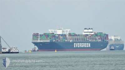
The current position of EVER GREET is in English Channel with coordinates 50.42146° / -0.49482° as reported on 2024-04-23 18:54 by AIS to our vessel tracker app. The vessel's current speed is 16.1 Knots and is heading at the port of ROTTERDAM. The estimated time of arrival as calculated by MyShipTracking vessel tracking app is 2024-04-24 06:26 LT
The vessel EVER GREET (IMO: 9832729, MMSI: 371829000) is a Cargo It's sailing under the flag of [PA] Panama.
In this page you can find informations about the vessels current position, last detected port calls, and current voyage information. If the vessels is not in coverage by AIS you will find the latest position.
The current position of EVER GREET is detected by our AIS receivers and we are not responsible for the reliability of the data. The last position was recorded while the vessel was in Coverage by the Ais receivers of our vessel tracking app.
The current draught of EVER GREET as reported by AIS is 11.9 meters
Weather
| Temperature | 9.9°C / 49.82°F |
|---|---|
| Wind Speed | 16 knots |
| Direction | 9° N |
| Pressure | 1021 hPa |
| Humidity | 73.2 % |
| Cloud Coverage | 100 % |
Featured Company
Last Port Calls
| Port | Arrival | Departure | Time In Port |
|---|---|---|---|
| 2024-04-20 11:14 | 2024-04-23 05:01 | 2 d | |
| 2024-04-16 20:40 | 2024-04-19 05:02 | 2 d | |
| 2024-04-12 03:36 | 2024-04-14 08:43 | 2 d | |
| 2024-03-09 18:49 | 2024-03-10 21:20 | 1 d | |
| 2024-03-03 14:36 | 2024-03-04 10:49 | 20 h | |
| 2024-02-27 19:10 | 2024-02-28 22:39 | 1 d | |
| 2024-02-22 00:19 | 2024-02-23 13:55 | 1 d | |
| 2024-02-13 03:22 | 2024-02-13 23:27 | 20 h |
Last Trips
| Origin | Departure | Destination | Arrival | Distance | |
|---|---|---|---|---|---|
| 2024-04-19 07:02 | 2024-04-20 13:14 | 332.33 nm | |||
| 2024-04-14 10:43 | 2024-04-16 22:40 | 505.92 nm | |||
| 2024-03-11 05:20 | 2024-04-12 05:36 | 12065.60 nm | |||
| 2024-03-04 18:49 | 2024-03-10 02:49 | 1463.55 nm | |||
| 2024-02-29 06:39 | 2024-03-03 22:36 | 878.42 nm | |||
| 2024-02-23 21:55 | 2024-02-28 03:10 | 935.59 nm | |||
| 2024-02-14 07:27 | 2024-02-22 08:19 | 3004.17 nm | |||
| 2024-01-16 21:33 | 2024-02-13 11:22 | 11919.51 nm |
Events
| Time | Event | Details | Position / Dest | Info |
|---|---|---|---|---|
| 2024-04-23 15:35 | START Moving | 14.68 nm, South East of RYE |
50.74472 / .95126
ROTTERDAM>MYTPP
|
Speed: 18.2 kn Course: 236.1° |
| 2024-04-23 15:34 | STOP Moving | 14.68 nm, South East of RYE |
50.74761 / .95799
ROTTERDAM>MYTPP
|
Speed: Course: 0° |
| 2024-04-23 14:43 | Change Sea Area | United Kingdom part of the English Channel French part of the English Channel |
50.89061 / 1.27717
English Channel
ROTTERDAM>MYTPP
|
Speed: 17 kn Course: 224.1° |
| 2024-04-23 14:37 | Change Sea Area | French part of the English Channel United Kingdom part of the English Channel |
50.91215 / 1.30584
English Channel
ROTTERDAM>MYTPP
|
Speed: 16.9 kn Course: 217.6° |
| 2024-04-23 13:55 | Change Sea Area | United Kingdom part of the English Channel United Kingdom part of the North Sea |
51.06171 / 1.48313
English Channel
ROTTERDAM>MYTPP
|
Speed: 14.8 kn Course: 236.4° |
| 2024-04-23 11:17 | ETA Changed | 2024/05/18 11:00 2024/05/18 09:00 |
51.58997 / 2.10525
ROTTERDAM>MYTPP
|
Speed: 16.5 kn Course: 224.7° |
| 2024-04-23 10:11 | Change Sea Area | United Kingdom part of the North Sea Belgian part of the North Sea |
51.80621 / 2.47856
North Sea
ROTTERDAM>MYTPP
|
Speed: 17.9 kn Course: 223° |
| 2024-04-23 09:59 | Change Sea Area | Belgian part of the North Sea Dutch part of the North Sea |
51.84945 / 2.54471
North Sea
ROTTERDAM>MYTPP
|
Speed: 17.6 kn Course: 224.2° |
| 2024-04-23 05:12 | START Moving | 0.57 nm, East of MAASVLAKTE - ROTTERDAM |
51.96017 / 4.08423
ROTTERDAM>MYTPP
|
Speed: 3.1 kn Course: 18° |
| 2024-04-23 05:06 | STOP Moving | 0.57 nm, South East of MAASVLAKTE - ROTTERDAM |
51.95821 / 4.08335
ROTTERDAM>MYTPP
|
Speed: 0.3 kn Course: 16° |