
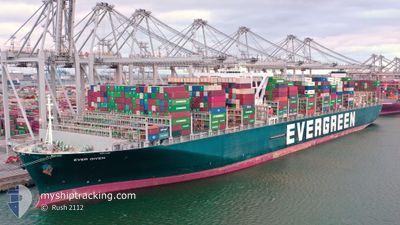
EVER GIVEN
Cargo A
Current Trip
NLRTM>>LKCMB
| Time Travelled | 4 days |
|---|---|
| Remaining Time | --- |
| Distance Travelled | 2215.07 nm |
| Remaining Distance | --- |
| AVG Speed | 17.7 Knots |
| MAX Speed | 21.6 Knots |
| AVG Wind | 20.1 knots |
| MAX Wind | 36.4 knots |
| MIN Temp | 8.2°C / 46.76°F |
| MAX Temp | 20.3°C / 68.54°F |
| Draught | 14.6 m |
| Position Received | 2 m ago |
Current Position
| Longitude | -17.56152° |
|---|---|
| Latitude | 21.08299° |
| Status | Under way using engine |
| Speed | 20.5 Knots |
| Course | 179.6° |
| Area | North Atlantic Ocean |
| Station | T-AIS |
| Position Received | 2 m ago |
Info
Information
The current position of EVER GIVEN is in North Atlantic Ocean with coordinates 21.08299° / -17.56152° as reported on 2024-04-20 04:07 by AIS to our vessel tracker app. The vessel's current speed is 20.5 Knots
The vessel EVER GIVEN (IMO: 9811000, MMSI: 353136000) is a Cargo A It's sailing under the flag of [PA] Panama.
In this page you can find informations about the vessels current position, last detected port calls, and current voyage information. If the vessels is not in coverage by AIS you will find the latest position.
The current position of EVER GIVEN is detected by our AIS receivers and we are not responsible for the reliability of the data. The last position was recorded while the vessel was in Coverage by the Ais receivers of our vessel tracking app.
The current draught of EVER GIVEN as reported by AIS is 14.6 meters
Weather
| Temperature | 19°C / 66.2°F |
|---|---|
| Wind Speed | 20 knots |
| Direction | 10° N |
| Pressure | 1012.1 hPa |
| Humidity | 87.8 % |
| Cloud Coverage | 100 % |
Featured Company
Last Port Calls
| Port | Arrival | Departure | Time In Port |
|---|---|---|---|
| 2024-04-12 22:20 | 2024-04-15 09:16 | 2 d | |
| 2024-04-06 00:34 | 2024-04-09 06:24 | 3 d | |
| 2024-03-28 15:45 | 2024-03-31 08:24 | 2 d | |
| 2024-02-26 07:10 | 2024-02-27 16:23 | 1 d | |
| 2024-02-20 06:35 | 2024-02-21 01:15 | 18 h | |
| 2024-02-18 07:15 | 2024-02-18 23:13 | 15 h | |
| 2024-02-14 21:11 | 2024-02-16 01:13 | 1 d | |
| 2024-02-08 12:10 | 2024-02-10 12:26 | 2 d | |
| 2024-02-03 23:44 | 2024-02-04 20:08 | 20 h |
Most Visited Ports (Last year)
| Port | Arrivals | |
|---|---|---|
| 8 | ||
| 4 | ||
| 4 | ||
| 4 | ||
| 3 | ||
| 3 |
Last Trips
| Origin | Departure | Destination | Arrival | Distance | |
|---|---|---|---|---|---|
| 2024-04-09 08:24 | 2024-04-13 00:20 | 355.01 nm | |||
| 2024-03-31 10:24 | 2024-04-06 02:34 | 533.17 nm | |||
| 2024-02-28 00:23 | 2024-03-28 16:45 | 11892.58 nm | |||
| 2024-02-21 09:15 | 2024-02-26 15:10 | 1485.16 nm | |||
| 2024-02-19 07:13 | 2024-02-20 14:35 | 455.61 nm | |||
| 2024-02-16 09:13 | 2024-02-18 15:15 | 473.36 nm | |||
| 2024-02-10 20:26 | 2024-02-15 05:11 | 689.07 nm | |||
| 2024-02-05 04:08 | 2024-02-08 20:10 | 949.74 nm | |||
| 2024-01-31 16:37 | 2024-02-04 07:44 | 1651.01 nm |
Events
| Time | Event | Details | Position / Dest | Info |
|---|---|---|---|---|
| 2024-04-19 23:57 | Status Changed | Under way using engine Default |
22.48510 / -17.20394
NLRTM>>LKCMB
|
Speed: 21.4 kn Course: 205° |
| 2024-04-19 23:54 | Status Changed | Default Under way using engine |
22.50326 / -17.19472
NLRTM>>LKCMB
|
Speed: 21.2 kn Course: 199.7° |
| 2024-04-19 22:48 | Status Changed | Under way using engine Default |
22.86486 / -17.06250
NLRTM>>LKCMB
|
Speed: 20.9 kn Course: 198° |
| 2024-04-19 22:17 | Status Changed | Default Under way using engine |
23.03817 / -17.00196
NLRTM>>LKCMB
|
Speed: 20.6 kn Course: 197.6° |
| 2024-04-19 21:07 | Change Sea Area | Western Saharan part of the North Atlantic Ocean Spanish (Canary Islands) part of the North Atlantic Ocean |
23.41620 / -16.87325
North Atlantic Ocean
|
Speed: 20.4 kn Course: 198° |
| 2024-04-19 21:05 | Status Changed | Under way using engine Default |
23.42749 / -16.86933
NLRTM>>LKCMB
|
Speed: 20.6 kn Course: 197° |
| 2024-04-19 21:00 | IN Coverage |
23.41620 / -16.87325
North Atlantic Ocean
|
Speed: 20.4 kn Course: 198° |
|
| 2024-04-19 09:03 | Status Changed | Default Under way using engine |
27.33456 / -15.35057
NLRTM>>LKCMB
|
Speed: 21.5 kn Course: 205° |
| 2024-04-19 08:14 | OUT of Coverage |
27.60768 / -15.23800
North Atlantic Ocean
|
Speed: 21.5 kn Course: 205° |
|
| 2024-04-19 03:54 | Status Changed | Under way using engine Default |
29.06180 / -14.70876
NLRTM>>LKCMB
|
Speed: 21.4 kn Course: 192° |