
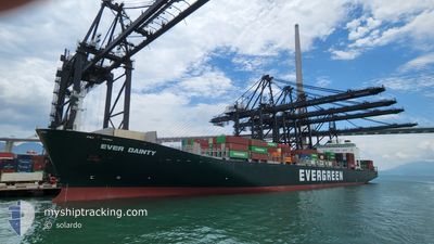
EVER DAINTY
Container Ship
Current Trip
| Time Travelled | 29 days |
|---|---|
| Remaining Time | 13 h, 13 mins |
| Distance Travelled | 5960.62 nm |
| Remaining Distance | 214.34 nm |
| AVG Speed | 14.6 Knots |
| MAX Speed | 19.4 Knots |
| AVG Wind | 7.6 knots |
| MAX Wind | 32.3 knots |
| MIN Temp | 13.9°C / 57.02°F |
| MAX Temp | 30.6°C / 87.08°F |
| Draught | 8.7 m |
| Position Received | 1 d ago |
Current Position
| Longitude | 118.92395° |
|---|---|
| Latitude | 24.10655° |
| Status | Under way using engine |
| Speed | 16 Knots |
| Course | 48° |
| Area | South China Sea |
| Station | T-AIS |
| Position Received | 1 d ago |
Info
Information
The current position of EVER DAINTY is in South China Sea with coordinates 24.10655° / 118.92395° as reported on 2024-04-23 20:22 by AIS to our vessel tracker app. The vessel's current speed is 16 Knots and is heading at the port of QINGDAO. The estimated time of arrival as calculated by MyShipTracking vessel tracking app is 2024-04-26 06:45 LT
The vessel EVER DAINTY (IMO: 9134232, MMSI: 565106000) is a Container Ship that was built in 1997 ( 27 years old ). It's sailing under the flag of [SG] Singapore.
In this page you can find informations about the vessels current position, last detected port calls, and current voyage information. If the vessels is not in coverage by AIS you will find the latest position.
The current position of EVER DAINTY is detected by our AIS receivers and we are not responsible for the reliability of the data. The last position was recorded while the vessel was in Coverage by the Ais receivers of our vessel tracking app.
The current draught of EVER DAINTY as reported by AIS is 8.7 meters
Weather
| Temperature | 14.3°C / 57.74°F |
|---|---|
| Wind Speed | 7 knots |
| Direction | 159° SSE |
| Pressure | 1009.5 hPa |
| Humidity | 80.3 % |
| Cloud Coverage | 100 % |
Featured Company
Last Port Calls
| Port | Arrival | Departure | Time In Port |
|---|---|---|---|
| 2024-03-26 06:13 | 2024-03-26 20:41 | 14 h | |
| 2024-03-23 14:02 | 2024-03-24 07:29 | 17 h | |
| 2024-03-14 19:48 | 2024-03-15 07:06 | 11 h | |
| 2024-03-10 16:30 | 2024-03-11 05:08 | 12 h | |
| 2024-03-08 08:44 | 2024-03-08 21:04 | 12 h | |
| 2024-03-01 08:38 | 2024-03-02 01:21 | 16 h | |
| 2024-02-12 20:38 | 2024-02-16 12:17 | 3 d |
Last Trips
| Origin | Departure | Destination | Arrival | Distance | |
|---|---|---|---|---|---|
| 2024-03-24 15:29 | 2024-03-26 14:13 | 200.38 nm | |||
| 2024-03-15 15:06 | 2024-03-23 22:02 | 1444.53 nm | |||
| 2024-03-11 13:08 | 2024-03-15 03:48 | 1039.66 nm | |||
| 2024-03-09 05:04 | 2024-03-11 00:30 | 395.82 nm | |||
| 2024-03-02 09:21 | 2024-03-08 16:44 | 2510.31 nm | |||
| 2024-02-16 15:17 | 2024-03-01 16:38 | 4059.81 nm | |||
| 2024-01-28 05:23 | 2024-02-12 23:38 | 3952.39 nm |
Events
| Time | Event | Details | Position / Dest | Info |
|---|---|---|---|---|
| 2024-04-23 20:28 | Status Changed | Default Under way using engine |
24.12595 / 118.94785
SG SIN>CN TAO
|
Speed: 16 kn Course: 48° |
| 2024-04-23 20:22 | Status Changed | Under way using engine Default |
24.10655 / 118.92395
SG SIN>CN TAO
|
Speed: 16 kn Course: 45° |
| 2024-04-23 20:22 | OUT of Coverage |
24.10655 / 118.92395
South China Sea
SG SIN>CN TAO
|
Speed: 16 kn Course: 48° |
|
| 2024-04-23 20:08 | IN Coverage |
24.10655 / 118.92395
South China Sea
SG SIN>CN TAO
|
Speed: 16 kn Course: 48° |
|
| 2024-04-23 18:28 | Status Changed | Default Under way using engine |
23.78255 / 118.51365
SG SIN>CN TAO
|
Speed: 15.1 kn Course: 47° |
| 2024-04-23 18:23 | OUT of Coverage |
23.77075 / 118.49985
South China Sea
SG SIN>CN TAO
|
Speed: 15.1 kn Course: 47° |
|
| 2024-04-23 17:57 | Status Changed | Under way using engine Default |
23.69523 / 118.41030
SG SIN>CN TAO
|
Speed: 15.2 kn Course: 49° |
| 2024-04-23 17:54 | Status Changed | Default Under way using engine |
23.68775 / 118.40098
SG SIN>CN TAO
|
Speed: 15.3 kn Course: 51° |
| 2024-04-23 15:33 | Change Sea Area | Chinese part of the South China Sea Malaysian part of the South China Sea |
23.33550 / 117.86625
South China Sea
SG SIN>CN TAO
|
Speed: 16.7 kn Course: 64° |
| 2024-04-23 15:32 | Status Changed | Under way using engine Default |
23.33355 / 117.86178
SG SIN>CN TAO
|
Speed: 16.7 kn Course: 62° |