
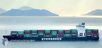
EVER BUILD
Cargo D
Current Trip
| Time Travelled | 23 h, 7 mins |
|---|---|
| Remaining Time | 6 h, 2 mins |
| Distance Travelled | 329.34 nm |
| Remaining Distance | 305.20 nm |
| AVG Speed | 17.8 Knots |
| MAX Speed | 19.7 Knots |
| AVG Wind | 4.9 knots |
| MAX Wind | 7.9 knots |
| MIN Temp | 26.9°C / 80.42°F |
| MAX Temp | 29.9°C / 85.82°F |
| Draught | 11.2 m |
| Position Received | 18 h, 38 m ago |
Current Position
| Longitude | 120.07037° |
|---|---|
| Latitude | 21.21653° |
| Status | Under way using engine |
| Speed | 18.7 Knots |
| Course | 186.8° |
| Area | South China Sea |
| Station | T-AIS |
| Position Received | 18 h, 38 m ago |
Info
Information
The current position of EVER BUILD is in South China Sea with coordinates 21.21653° / 120.07037° as reported on 2024-04-22 22:10 by AIS to our vessel tracker app. The vessel's current speed is 18.7 Knots and is heading at the port of MANILA. The estimated time of arrival as calculated by MyShipTracking vessel tracking app is 2024-04-23 22:50 LT
The vessel EVER BUILD (IMO: 9790062, MMSI: 370616000) is a Cargo D It's sailing under the flag of [PA] Panama.
In this page you can find informations about the vessels current position, last detected port calls, and current voyage information. If the vessels is not in coverage by AIS you will find the latest position.
The current position of EVER BUILD is detected by our AIS receivers and we are not responsible for the reliability of the data. The last position was recorded while the vessel was in Coverage by the Ais receivers of our vessel tracking app.
The current draught of EVER BUILD as reported by AIS is 11.2 meters
Weather
| Temperature | 29.5°C / 85.1°F |
|---|---|
| Wind Speed | 4 knots |
| Direction | 44° NE |
| Pressure | 1009.8 hPa |
| Humidity | 74.4 % |
| Cloud Coverage | 15 % |
Featured Company
Last Port Calls
| Port | Arrival | Departure | Time In Port |
|---|---|---|---|
| 2024-04-21 22:56 | 2024-04-22 17:41 | 18 h | |
| 2024-04-20 13:36 | 2024-04-20 23:53 | 10 h | |
| 2024-04-17 07:12 | 2024-04-17 19:17 | 12 h | |
| 2024-04-15 07:32 | 2024-04-15 23:59 | 16 h | |
| 2024-04-08 21:51 | 2024-04-09 13:56 | 16 h | |
| 2024-04-07 08:02 | 2024-04-07 22:31 | 14 h | |
| 2024-04-01 09:55 | 2024-04-03 14:36 | 2 d | |
| 2024-03-27 22:25 | 2024-03-28 12:27 | 14 h | |
| 2024-03-27 01:07 | 2024-03-27 17:55 | 16 h | |
| 2024-03-25 14:40 | 2024-03-26 03:05 | 12 h |
Last Trips
| Origin | Departure | Destination | Arrival | Distance | |
|---|---|---|---|---|---|
| 2024-04-21 07:53 | 2024-04-22 06:56 | 361.35 nm | |||
| 2024-04-18 03:17 | 2024-04-20 21:36 | 1157.21 nm | |||
| 2024-04-16 07:59 | 2024-04-17 15:12 | 448.91 nm | |||
| 2024-04-09 21:56 | 2024-04-15 15:32 | 1301.44 nm | |||
| 2024-04-08 06:31 | 2024-04-09 05:51 | 362.88 nm | |||
| 2024-04-03 21:36 | 2024-04-07 16:02 | 1548.42 nm | |||
| 2024-03-28 20:27 | 2024-04-01 16:55 | 1709.46 nm | |||
| 2024-03-28 01:55 | 2024-03-28 06:25 | 15.64 nm | |||
| 2024-03-26 11:05 | 2024-03-27 09:07 | 376.83 nm | |||
| 2024-03-25 20:40 | 2024-03-25 22:40 | 4.29 nm |
Events
| Time | Event | Details | Position / Dest | Info |
|---|---|---|---|---|
| 2024-04-22 22:21 | Status Changed | Default Under way using engine |
21.15995 / 120.06419
TW KHH >> PH MNL
|
Speed: 18.7 kn Course: 186.8° |
| 2024-04-22 22:10 | OUT of Coverage |
21.21653 / 120.07037
South China Sea
TW KHH >> PH MNL
|
Speed: 18.7 kn Course: 186.8° |
|
| 2024-04-22 22:06 | Status Changed | Under way using engine Default |
21.23670 / 120.07269
TW KHH >> PH MNL
|
Speed: 18.8 kn Course: 186° |
| 2024-04-22 22:03 | Status Changed | Default Under way using engine |
21.25363 / 120.07481
TW KHH >> PH MNL
|
Speed: 19.1 kn Course: 184.7° |
| 2024-04-22 21:44 | Status Changed | Under way using engine Default |
21.35523 / 120.08383
TW KHH >> PH MNL
|
Speed: 18.6 kn Course: 184° |
| 2024-04-22 21:35 | Status Changed | Default Under way using engine |
21.40116 / 120.08740
TW KHH >> PH MNL
|
Speed: 18.8 kn Course: 186.6° |
| 2024-04-22 21:28 | Status Changed | Under way using engine Default |
21.43641 / 120.09060
TW KHH >> PH MNL
|
Speed: 19.2 kn Course: 187° |
| 2024-04-22 21:28 | IN Coverage |
21.43173 / 120.09002
South China Sea
TW KHH >> PH MNL
|
Speed: 18.8 kn Course: 186.6° |
|
| 2024-04-22 19:15 | Status Changed | Default Under way using engine |
22.13403 / 120.16438
TW KHH >> PH MNL
|
Speed: 19.2 kn Course: 187.1° |
| 2024-04-22 19:10 | OUT of Coverage |
22.15798 / 120.16799
South China Sea
TW KHH >> PH MNL
|
Speed: 19.2 kn Course: 187.1° |