
EUROPE
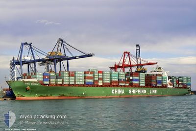
Container Ship
Current Trip
PAPCN
| Time Travelled | 9 h, 38 mins |
|---|---|
| Remaining Time | --- |
| Distance Travelled | 162.27 nm |
| Remaining Distance | --- |
| AVG Speed | 17 Knots |
| MAX Speed | 18.1 Knots |
| AVG Wind | 16.4 knots |
| MAX Wind | 19 knots |
| MIN Temp | 26.2°C / 79.16°F |
| MAX Temp | 28.2°C / 82.76°F |
| Draught | 13 m |
| Position Received | 1 d ago |
Current Position
| Longitude | -79.95153° |
|---|---|
| Latitude | 9.49523° |
| Status | At anchor |
| Speed | |
| Course | 44° |
| Area | Caribbean Sea |
| Station | T-AIS |
| Position Received | 1 d ago |
Info
Information
The current position of EUROPE is in Caribbean Sea with coordinates 9.49523° / -79.95153° as reported on 2024-04-24 04:26 by AIS to our vessel tracker app. The vessel's current speed is 0 Knots
The vessel EUROPE (IMO: 9285988, MMSI: 212175000) is a Container Ship that was built in 2004 ( 20 years old ). It's sailing under the flag of [CY] Cyprus.
In this page you can find informations about the vessels current position, last detected port calls, and current voyage information. If the vessels is not in coverage by AIS you will find the latest position.
The current position of EUROPE is detected by our AIS receivers and we are not responsible for the reliability of the data. The last position was recorded while the vessel was in Coverage by the Ais receivers of our vessel tracking app.
The current draught of EUROPE as reported by AIS is 13 meters
Weather
| Temperature | 27.5°C / 81.5°F |
|---|---|
| Wind Speed | 18 knots |
| Direction | 42° NE |
| Pressure | 1010.6 hPa |
| Humidity | 86.2 % |
| Cloud Coverage | 64 % |
Featured Company
Last Port Calls
| Port | Arrival | Departure | Time In Port |
|---|---|---|---|
| 2024-04-24 08:26 | 2024-04-25 02:06 | 17 h | |
| 2024-03-30 00:48 | 2024-03-31 06:32 | 1 d | |
| 2024-03-27 01:07 | 2024-03-27 18:57 | 17 h | |
| 2024-03-23 01:47 | 2024-03-23 21:03 | 19 h | |
| 2024-03-15 21:42 | 2024-03-16 04:07 | 6 h | |
| 2024-02-29 11:43 | 2024-03-04 01:07 | 3 d | |
| 2024-02-14 20:31 | 2024-02-16 17:39 | 1 d | |
| 2024-02-10 13:26 | 2024-02-12 09:25 | 1 d | |
| 2024-02-10 12:51 | 2024-02-10 13:07 | 16 m |
Most Visited Ports (Last year)
| Port | Arrivals | |
|---|---|---|
| 12 | ||
| 11 | ||
| 9 | ||
| 7 | ||
| 6 | ||
| 6 |
Last Trips
| Origin | Departure | Destination | Arrival | Distance | |
|---|---|---|---|---|---|
| 2024-03-31 15:32 | 2024-04-24 03:26 | 8697.85 nm | |||
| 2024-03-28 02:57 | 2024-03-30 09:48 | 518.49 nm | |||
| 2024-03-24 05:03 | 2024-03-27 09:07 | 817.03 nm | |||
| 2024-03-16 13:07 | 2024-03-23 09:47 | 1658.52 nm | |||
| 2024-03-03 17:07 | 2024-03-16 06:42 | 5203.59 nm | |||
| 2024-02-16 09:39 | 2024-02-29 03:43 | 24.93 nm | |||
| 2024-02-12 01:25 | 2024-02-14 12:31 | 637.35 nm | |||
| 2024-02-10 05:07 | 2024-02-10 05:26 | 0.60 nm | |||
| 2024-01-30 17:12 | 2024-02-10 04:51 | 4007.08 nm |
Events
| Time | Event | Details | Position / Dest | Info |
|---|---|---|---|---|
| 2024-04-25 02:06 | PORT DEPARTURE |
|
9.35382 / -79.91901
PAPCN
|
Speed: 3.5 kn Course: 307° |
| 2024-04-25 02:02 | START Moving |
9.35017 / -79.91466
[PA] CRISTOBAL
|
Speed: 3.5 kn Course: 307° |
|
| 2024-04-24 08:49 | STOP Moving |
9.35103 / -79.90728
[PA] CRISTOBAL
|
Speed: Course: 99° |
|
| 2024-04-24 08:26 | PORT ARRIVAL |
|
9.35092 / -79.91196
[PA] CRISTOBAL
|
Speed: 5.8 kn Course: 180° |
| 2024-04-24 06:58 | START Moving | 8.22 nm, North West of COLON |
9.49765 / -79.94650
PAPCN
|
Speed: 3.9 kn Course: 99° |
| 2024-04-24 04:32 | Status Changed | Default At anchor |
9.49490 / -79.95132
PAPCN
|
Speed: Course: 44° |
| 2024-04-24 04:26 | Status Changed | At anchor Default |
9.49523 / -79.95153
PAPCN
|
Speed: 0.4 kn Course: 13° |
| 2024-04-24 04:26 | OUT of Coverage |
9.49523 / -79.95153
Caribbean Sea
|
Speed: Course: 282° |
|
| 2024-04-24 03:53 | Status Changed | Default At anchor |
9.49457 / -79.95102
PAPCN
|
Speed: Course: 22° |
| 2024-04-24 03:44 | Status Changed | At anchor Default |
9.49456 / -79.95034
PAPCN
|
Speed: 0.1 kn Course: 29° |