
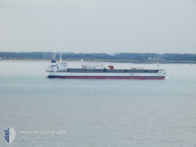
ESSAYRA
Cargo
Current Trip
| Time Travelled | 14 days |
|---|---|
| Remaining Time | --- |
| Distance Travelled | 4598.31 nm |
| Remaining Distance | --- |
| AVG Speed | 13.6 Knots |
| MAX Speed | 15.4 Knots |
| AVG Wind | 9.4 knots |
| MAX Wind | 24.6 knots |
| MIN Temp | 12.3°C / 54.14°F |
| MAX Temp | 29.1°C / 84.38°F |
| Draught | 8.7 m |
| Position Received | 11 h, 36 m ago |
Current Position
| Longitude | -11.53535° |
|---|---|
| Latitude | 42.45014° |
| Status | Under way using engine |
| Speed | 12.8 Knots |
| Course | 26.3° |
| Area | North Atlantic Ocean |
| Station | T-AIS |
| Position Received | 11 h, 36 m ago |
Info
Information
The current position of ESSAYRA is in North Atlantic Ocean with coordinates 42.45014° / -11.53535° as reported on 2024-04-16 09:13 by AIS to our vessel tracker app. The vessel's current speed is 12.8 Knots and is heading at the port of GENT. The estimated time of arrival as calculated by MyShipTracking vessel tracking app is 2024-04-18 23:00 LT
The vessel ESSAYRA (IMO: 9735452, MMSI: 636017418) is a Cargo It's sailing under the flag of [LR] Liberia.
In this page you can find informations about the vessels current position, last detected port calls, and current voyage information. If the vessels is not in coverage by AIS you will find the latest position.
The current position of ESSAYRA is detected by our AIS receivers and we are not responsible for the reliability of the data. The last position was recorded while the vessel was in Coverage by the Ais receivers of our vessel tracking app.
The current draught of ESSAYRA as reported by AIS is 8.7 meters
Weather
| Temperature | 12.4°C / 54.32°F |
|---|---|
| Wind Speed | 20 knots |
| Direction | 28° NNE |
| Pressure | 1026.4 hPa |
| Humidity | 73.8 % |
| Cloud Coverage | 78 % |
Featured Company
Most Visited Ports (Last year)
| Port | Arrivals | |
|---|---|---|
| 13 | ||
| 7 | ||
| 3 | ||
| 1 | ||
| 1 |
Last Trips
| Origin | Departure | Destination | Arrival | Distance | |
|---|---|---|---|---|---|
| 2024-03-30 00:02 | 2024-03-30 10:23 | 3.56 nm | |||
| 2024-03-13 12:55 | 2024-03-29 23:10 | 5478.38 nm | |||
| 2024-03-13 09:58 | 2024-03-13 11:32 | 8.59 nm | |||
| 2024-02-21 14:48 | 2024-03-10 05:49 | 5445.80 nm | |||
| 2024-01-31 17:24 | 2024-02-17 05:38 | 5493.45 nm |
Events
| Time | Event | Details | Position / Dest | Info |
|---|---|---|---|---|
| 2024-04-16 09:21 | Status Changed | Default Under way using engine |
42.47623 / -11.51833
BE GNE
|
Speed: 12.8 kn Course: 26.3° |
| 2024-04-16 09:13 | OUT of Coverage |
42.45014 / -11.53535
North Atlantic Ocean
BE GNE
|
Speed: 12.8 kn Course: 26.3° |
|
| 2024-04-16 09:12 | Status Changed | Under way using engine Default |
42.44587 / -11.53821
BE GNE
|
Speed: 12.4 kn Course: 26° |
| 2024-04-16 08:57 | Status Changed | Default Under way using engine |
42.39921 / -11.56864
BE GNE
|
Speed: 12.5 kn Course: 24.9° |
| 2024-04-16 08:36 | Status Changed | Under way using engine Default |
42.33449 / -11.61059
BE GNE
|
Speed: 12.5 kn Course: 27° |
| 2024-04-16 08:10 | Status Changed | Default Under way using engine |
42.25369 / -11.66300
BE GNE
|
Speed: 12.3 kn Course: 26.2° |
| 2024-04-16 08:01 | Status Changed | Under way using engine Default |
42.22528 / -11.68135
BE GNE
|
Speed: 12.3 kn Course: 25° |
| 2024-04-16 07:31 | Status Changed | Default Under way using engine |
42.12935 / -11.74354
BE GNE
|
Speed: 12.9 kn Course: 23.9° |
| 2024-04-16 07:16 | Detected in Sea | Spanish part of the North Atlantic Ocean |
42.08072 / -11.77495
North Atlantic Ocean
BE GNE
|
Speed: 12.9 kn Course: 23.9° |
| 2024-04-16 07:15 | Status Changed | Under way using engine Default |
42.07915 / -11.77591
BE GNE
|
Speed: 13.1 kn Course: 27° |