
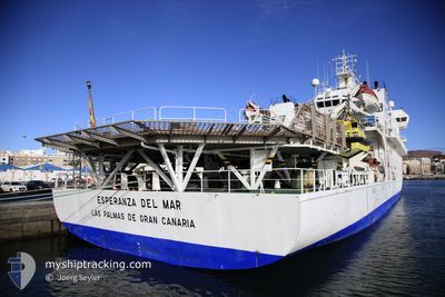
ESPERANZA DEL MAR
Hospital Ship
Current Trip
| Time Travelled | 13 days |
|---|---|
| Remaining Time | 3 days |
| Distance Travelled | 1861.40 nm |
| Remaining Distance | 606.81 nm |
| AVG Speed | 7 Knots |
| MAX Speed | 13.3 Knots |
| AVG Wind | 21.1 knots |
| MAX Wind | 35 knots |
| MIN Temp | 7.5°C / 45.5°F |
| MAX Temp | 20.9°C / 69.62°F |
| Draught | 4.5 m |
| Position Received | 3 h, 23 m ago |
Current Position
| Longitude | -10.83319° |
|---|---|
| Latitude | 51.65778° |
| Status | Under way using engine |
| Speed | 1.3 Knots |
| Course | 258° |
| Area | North Atlantic Ocean |
| Station | T-AIS |
| Position Received | 3 h, 23 m ago |
Info
Information
The current position of ESPERANZA DEL MAR is in North Atlantic Ocean with coordinates 51.65778° / -10.83319° as reported on 2024-04-18 17:01 by AIS to our vessel tracker app. The vessel's current speed is 1.3 Knots and is heading at the port of VIGO. The estimated time of arrival as calculated by MyShipTracking vessel tracking app is 2024-04-22 19:03 LT
The vessel ESPERANZA DEL MAR (IMO: 9220536, MMSI: 224731000) is a Hospital Ship that was built in 2001 ( 23 years old ). It's sailing under the flag of [ES] Spain.
In this page you can find informations about the vessels current position, last detected port calls, and current voyage information. If the vessels is not in coverage by AIS you will find the latest position.
The current position of ESPERANZA DEL MAR is detected by our AIS receivers and we are not responsible for the reliability of the data. The last position was recorded while the vessel was in Coverage by the Ais receivers of our vessel tracking app.
The current draught of ESPERANZA DEL MAR as reported by AIS is 4.5 meters
Weather
| Temperature | 10.9°C / 51.62°F |
|---|---|
| Wind Speed | 14 knots |
| Direction | 289° WNW |
| Pressure | 1026.3 hPa |
| Humidity | 88.4 % |
| Cloud Coverage | 58 % |
Featured Company
Most Visited Ports (Last year)
| Port | Arrivals | |
|---|---|---|
| 13 | ||
| 2 | ||
| 1 |
Events
| Time | Event | Details | Position / Dest | Info |
|---|---|---|---|---|
| 2024-04-18 17:01 | OUT of Coverage |
51.65778 / -10.83319
North Atlantic Ocean
VIGO
|
Speed: 1.3 kn Course: 217.6° |
|
| 2024-04-18 15:09 | IN Coverage |
51.76355 / -11.08252
North Atlantic Ocean
VIGO
|
Speed: 6.2 kn Course: 124.5° |
|
| 2024-04-17 23:14 | Status Changed | Default Under way using engine |
51.96633 / -11.06601
VIGO
|
Speed: 6.3 kn Course: 312° |
| 2024-04-17 22:56 | Status Changed | Under way using engine Default |
51.94521 / -11.03548
VIGO
|
Speed: 6.2 kn Course: 319° |
| 2024-04-17 22:56 | OUT of Coverage |
51.94521 / -11.03548
North Atlantic Ocean
VIGO
|
Speed: 6.3 kn Course: 312° |
|
| 2024-04-17 22:36 | Status Changed | Default Under way using engine |
51.91967 / -10.99861
VIGO
|
Speed: 6.2 kn Course: 320.1° |
| 2024-04-17 13:38 | Status Changed | Under way using engine Default |
51.59043 / -9.84104
VIGO
|
Speed: 9.9 kn Course: 235° |
| 2024-04-17 13:30 | Status Changed | Default Under way using engine |
51.60289 / -9.81327
VIGO
|
Speed: 9.9 kn Course: 234.1° |
| 2024-04-17 13:18 | Status Changed | Under way using engine Towing Astern |
51.62281 / -9.76937
VIGO
|
Speed: 9.6 kn Course: 232° |
| 2024-04-17 13:17 | Destination Changed | VIGO CASTELTOWN |
51.62389 / -9.76698
VIGO
|
Speed: 9.6 kn Course: 232° |