
ERLE
General Cargo
Current Trip
| Trip Time | 1 day |
|---|---|
| Trip Distance | 245.91 nm |
| AVG Speed | 10.1 Knots |
| MAX Speed | 12.5 Knots |
| Draught | 4 m |
| AVG Wind | 7.8 knots |
| MAX Wind | 17.9 knots |
| MIN Temp | 14.8°C / 58.64°F |
| MAX Temp | 24.4°C / 75.92°F |
| Position Received | 3 m ago |
Current Position
| Longitude | 29.60124° |
|---|---|
| Latitude | 40.77737° |
| Status | Moored |
| Speed | |
| Course | --- |
| Area | Sea of Marmara |
| Station | T-AIS |
| Position Received | 3 m ago |
Info
Information
The current position of ERLE is in Sea of Marmara with coordinates 40.77737° / 29.60124° as reported on 2024-04-19 04:26 by AIS to our vessel tracker app. The vessel's current speed is 0 Knots and is currently inside the port of HEREKE.
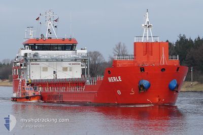
The vessel ERLE (IMO: 9506576, MMSI: 351750000) is a General Cargo that was built in 2011 ( 13 years old ). It's sailing under the flag of [PA] Panama.
In this page you can find informations about the vessels current position, last detected port calls, and current voyage information. If the vessels is not in coverage by AIS you will find the latest position.
The current position of ERLE is detected by our AIS receivers and we are not responsible for the reliability of the data. The last position was recorded while the vessel was in Coverage by the Ais receivers of our vessel tracking app.
The current draught of ERLE as reported by AIS is 4 meters
Weather
| Temperature | 12.5°C / 54.5°F |
|---|---|
| Wind Speed | 2 knots |
| Direction | 77° ENE |
| Pressure | 1011.7 hPa |
| Humidity | 90.7 % |
| Cloud Coverage | 99 % |
Featured Company
Last Port Calls
| Port | Arrival | Departure | Time In Port |
|---|---|---|---|
| 2024-04-17 20:51 | |||
| 2024-04-16 07:57 | 2024-04-16 13:54 | 5 h | |
| 2024-04-15 02:58 | |||
| 2024-04-02 05:18 | 2024-04-09 15:17 | 7 d | |
| 2024-03-28 09:16 | 2024-03-31 06:44 | 2 d | |
| 2024-03-18 13:12 | 2024-03-20 11:06 | 1 d | |
| 2024-03-10 11:06 | 2024-03-11 11:28 | 1 d | |
| 2024-02-29 15:43 | |||
| 2024-02-20 12:42 | 2024-02-22 16:39 | 2 d | |
| 2024-02-09 07:57 | 2024-02-10 12:21 | 1 d |
Last Trips
| Origin | Departure | Destination | Arrival | Distance | |
|---|---|---|---|---|---|
| 2024-04-16 16:54 | 2024-04-17 23:51 | 245.91 nm | |||
| 2024-04-09 17:17 | 2024-04-15 05:58 | 1486.88 nm | |||
| 2024-03-31 07:44 | 2024-04-02 07:18 | 391.95 nm | |||
| 2024-03-20 12:06 | 2024-03-28 10:16 | 1366.86 nm | |||
| 2024-03-11 14:28 | 2024-03-18 14:12 | 1248.24 nm | |||
| 2024-02-22 17:39 | 2024-02-29 17:43 | 1347.22 nm | |||
| 2024-02-10 13:21 | 2024-02-20 13:42 | 1834.44 nm | |||
| 2024-02-05 17:38 | 2024-02-09 08:57 | 896.50 nm | |||
| 2024-01-22 06:15 | 2024-02-03 11:45 | 2020.60 nm |
Events
| Time | Event | Details | Position / Dest | Info |
|---|---|---|---|---|
| 2024-04-17 21:07 | Status Changed | Moored Under way using engine |
40.77746 / 29.60127
[TR] HEREKE
|
Speed: Course: 511° |
| 2024-04-17 21:04 | STOP Moving |
40.77731 / 29.60134
[TR] HEREKE
|
Speed: 0.3 kn Course: 511° |
|
| 2024-04-17 20:51 | PORT ARRIVAL |
|
40.77247 / 29.59463
[TR] HEREKE
|
Speed: 3.7 kn Course: 49.4° |
| 2024-04-17 15:07 | Change Sea Area | Turkish part of the Sea of Marmara Turkish part of the Black Sea |
41.23122 / 29.12824
Sea of Marmara
GR SKG
|
Speed: 10.7 kn Course: 177.8° |
| 2024-04-17 14:35 | Status Changed | Under way using engine At anchor |
41.27661 / 29.03943
GR SKG
|
Speed: 5.9 kn Course: 87.5° |
| 2024-04-17 14:33 | Status Changed | At anchor Default |
41.27647 / 29.03491
GR SKG
|
Speed: 1.1 kn Course: -1° |
| 2024-04-17 14:33 | START Moving | 4.46 nm, North West of RUMELI FENERI |
41.27647 / 29.03491
GR SKG
|
Speed: 3.5 kn Course: 74.1° |
| 2024-04-17 14:23 | Status Changed | Default At anchor |
41.27575 / 29.03668
GR SKG
|
Speed: 0.1 kn Course: 511° |
| 2024-04-17 14:14 | Status Changed | At anchor Default |
41.27663 / 29.03796
GR SKG
|
Speed: Course: -1° |
| 2024-04-17 14:14 | IN Coverage |
41.27663 / 29.03796
Black Sea
GR SKG
|
Speed: 0.1 kn Course: 309.1° |