
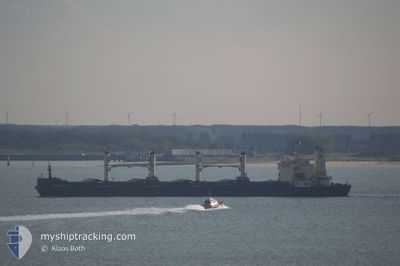
ENISEY
Bulk Carrier
Current Trip
| Time Travelled | --- |
|---|---|
| Remaining Time | --- |
| Distance Travelled | 908.97 nm |
| Remaining Distance | 25.21 nm |
| AVG Speed | 8.4 Knots |
| MAX Speed | 8.4 Knots |
| AVG Wind | 6.1 knots |
| MAX Wind | 25.8 knots |
| MIN Temp | 5.6°C / 42.08°F |
| MAX Temp | 16.5°C / 61.7°F |
| Draught | 6.8 m |
| Position Received | 2024-03-24 22:58 |
Current Position
| Longitude | 29.39691° |
|---|---|
| Latitude | 41.33502° |
| Status | Under way using engine |
| Speed | 12.8 Knots |
| Course | 63.5° |
| Area | Black Sea |
| Station | T-AIS |
| Position Received | 2024-03-24 22:58 |
Info
Information
The current position of ENISEY is in Black Sea with coordinates 41.33502° / 29.39691° as reported on 2024-03-24 22:58 by AIS to our vessel tracker app. The vessel's current speed is 12.8 Knots and is heading at the port of KAVKAZ.
The vessel ENISEY (IMO: 9079169, MMSI: 273212240) is a Bulk Carrier that was built in 1995 ( 29 years old ). It's sailing under the flag of [RU] Russia.
In this page you can find informations about the vessels current position, last detected port calls, and current voyage information. If the vessels is not in coverage by AIS you will find the latest position.
The current position of ENISEY is detected by our AIS receivers and we are not responsible for the reliability of the data. The last position was recorded while the vessel was in Coverage by the Ais receivers of our vessel tracking app.
The current draught of ENISEY as reported by AIS is 6.8 meters
Weather
| Temperature | 15.3°C / 59.54°F |
|---|---|
| Wind Speed | 5 knots |
| Direction | 138° SE |
| Pressure | 1007 hPa |
| Humidity | 81 % |
| Cloud Coverage | 100 % |
Featured Company
Last Port Calls
Last Trips
| Origin | Departure | Destination | Arrival | Distance |
|---|
Events
| Time | Event | Details | Position / Dest | Info |
|---|---|---|---|---|
| 2024-04-24 21:00 | STOP Moving | 8.63 nm, South West of TAMAN |
45.00103 / 36.55526
RUKZP
|
Speed: 0.2 kn Course: 145° |
| 2024-04-23 21:54 | STOP Moving | 8.71 nm, South West of TAMAN |
44.99903 / 36.55596
RUKZP
|
Speed: 0.3 kn Course: 65° |
| 2024-04-23 21:52 | START Moving | 8.75 nm, South West of TAMAN |
44.99902 / 36.55449
RUKZP
|
Speed: 6 kn Course: 280° |
| 2024-04-22 22:41 | STOP Moving | 8.55 nm, South West of TAMAN |
45.00016 / 36.56064
RUKZP
|
Speed: 0.3 kn Course: 258° |
| 2024-04-22 15:22 | STOP Moving | 8.53 nm, South West of TAMAN |
45.00149 / 36.55877
RUKZP
|
Speed: 0.2 kn Course: 196° |
| 2024-04-22 15:08 | START Moving | 10.09 nm, South West of TAMAN |
44.97583 / 36.54787
RUKZP
|
Speed: 42.2 kn Course: 189° |
| 2024-04-22 01:52 | STOP Moving | 8.53 nm, South West of TAMAN |
45.00109 / 36.55951
RUKZP
|
Speed: 0.1 kn Course: 220° |
| 2024-04-22 01:35 | START Moving | 8.49 nm, South West of TAMAN |
45.00186 / 36.55965
RUKZP
|
Speed: 4.7 kn Course: 219° |
| 2024-04-21 18:01 | STOP Moving | 8.58 nm, South West of TAMAN |
44.99996 / 36.55998
RUKZP
|
Speed: 0.3 kn Course: 235° |
| 2024-04-21 17:44 | START Moving | 8.67 nm, South West of TAMAN |
44.99818 / 36.56025
RUKZP
|
Speed: 8.8 kn Course: 187° |