
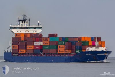
EMPIRE
Container Ship
Current Trip
| Time Travelled | 1 day |
|---|---|
| Remaining Time | --- |
| Distance Travelled | 311.44 nm |
| Remaining Distance | --- |
| AVG Speed | 12.9 Knots |
| MAX Speed | 17.1 Knots |
| AVG Wind | 9.4 knots |
| MAX Wind | 19.5 knots |
| MIN Temp | 0.1°C / 32.18°F |
| MAX Temp | 2.5°C / 36.5°F |
| Draught | 8.6 m |
| Position Received | Now |
Current Position
| Longitude | 21.07756° |
|---|---|
| Latitude | 61.17860° |
| Status | At anchor |
| Speed | 0.1 Knots |
| Course | 44° |
| Area | Gulf of Bothnia |
| Station | T-AIS |
| Position Received | Now |
Info
Information
The current position of EMPIRE is in Gulf of Bothnia with coordinates 61.17860° / 21.07756° as reported on 2024-04-18 23:05 by AIS to our vessel tracker app. The vessel's current speed is 0.1 Knots
The vessel EMPIRE (IMO: 9387425, MMSI: 245258000) is a Container Ship that was built in 2009 ( 15 years old ). It's sailing under the flag of [NL] Netherlands.
In this page you can find informations about the vessels current position, last detected port calls, and current voyage information. If the vessels is not in coverage by AIS you will find the latest position.
The current position of EMPIRE is detected by our AIS receivers and we are not responsible for the reliability of the data. The last position was recorded while the vessel was in Coverage by the Ais receivers of our vessel tracking app.
The current draught of EMPIRE as reported by AIS is 8.6 meters
Weather
| Temperature | 0.9°C / 33.62°F |
|---|---|
| Wind Speed | 5 knots |
| Direction | 13° NNE |
| Pressure | 1013.8 hPa |
| Humidity | 72.5 % |
| Cloud Coverage | 62 % |
Featured Company
Last Port Calls
| Port | Arrival | Departure | Time In Port |
|---|---|---|---|
| 2024-04-16 18:29 | 2024-04-17 10:19 | 15 h | |
| 2024-04-15 11:49 | 2024-04-16 15:16 | 1 d | |
| 2024-04-12 08:51 | 2024-04-13 00:14 | 15 h | |
| 2024-04-09 06:17 | 2024-04-10 14:22 | 1 d | |
| 2024-04-04 16:50 | 2024-04-05 19:36 | 1 d | |
| 2024-04-01 05:31 | 2024-04-02 01:19 | 19 h | |
| 2024-03-29 07:24 | 2024-03-29 18:11 | 10 h | |
| 2024-03-28 01:34 | 2024-03-28 01:38 | 3 m | |
| 2024-03-25 17:34 | 2024-03-27 12:16 | 1 d | |
| 2024-03-25 03:25 | 2024-03-25 04:28 | 1 h |
Last Trips
| Origin | Departure | Destination | Arrival | Distance | |
|---|---|---|---|---|---|
| 2024-04-16 18:16 | 2024-04-16 21:29 | 45.07 nm | |||
| 2024-04-13 02:14 | 2024-04-15 14:49 | 421.17 nm | |||
| 2024-04-10 16:22 | 2024-04-12 10:51 | 441.17 nm | |||
| 2024-04-05 21:36 | 2024-04-09 08:17 | 444.64 nm | |||
| 2024-04-02 04:19 | 2024-04-04 18:50 | 424.61 nm | |||
| 2024-03-29 19:11 | 2024-04-01 08:31 | 417.39 nm | |||
| 2024-03-28 02:38 | 2024-03-29 08:24 | 349.70 nm | |||
| 2024-03-27 13:16 | 2024-03-28 02:34 | 88.53 nm | |||
| 2024-03-25 05:28 | 2024-03-25 18:34 | 88.55 nm | |||
| 2024-03-20 19:22 | 2024-03-25 04:25 | 634.24 nm |
Events
| Time | Event | Details | Position / Dest | Info |
|---|---|---|---|---|
| 2024-04-18 09:59 | Destination Changed | FIRAU PEC343578 FIRAU |
61.18021 / 21.07586
FIRAU PEC343578
|
Speed: 0.4 kn Course: 103° |
| 2024-04-18 09:57 | Status Changed | At anchor Under way using engine |
61.18026 / 21.07595
FIRAU
|
Speed: 0.4 kn Course: 107° |
| 2024-04-18 09:43 | STOP Moving | 10.93 nm, West of OLKILUOTO |
61.18071 / 21.07992
FIRAU
|
Speed: 0.3 kn Course: 83° |
| 2024-04-18 09:02 | IN Coverage |
61.11993 / 20.91653
Gulf of Bothnia
FIRAU
|
Speed: 15.8 kn Course: 45.9° |
|
| 2024-04-18 05:32 | OUT of Coverage |
60.66812 / 19.58664
Gulf of Bothnia
FIRAU
|
Speed: 13.1 kn Course: 55.2° |
|
| 2024-04-18 04:29 | Change Sea Area | Finnish part of the Gulf of Bothnia Swedish part of the Gulf of Bothnia |
60.54268 / 19.20857
Gulf of Bothnia
FIRAU
|
Speed: 12.3 kn Course: 56.8° |
| 2024-04-18 02:35 | Change Sea Area | Swedish part of the Gulf of Bothnia Finnish part of the Gulf of Bothnia |
60.20230 / 19.08073
Gulf of Bothnia
FIRAU
|
Speed: 12.1 kn Course: 336.5° |
| 2024-04-18 02:26 | Change Sea Area | Finnish part of the Gulf of Bothnia Swedish part of the Gulf of Bothnia |
60.17560 / 19.10855
Gulf of Bothnia
FIRAU
|
Speed: 12 kn Course: 330.8° |
| 2024-04-18 02:08 | Change Sea Area | Swedish part of the Gulf of Bothnia Finnish part of the Gulf of Bothnia |
60.12501 / 19.17771
Gulf of Bothnia
FIRAU
|
Speed: 12.4 kn Course: 320.6° |
| 2024-04-18 00:02 | Change Sea Area | Finnish part of the Gulf of Bothnia Finnish part of the Baltic Sea |
59.79173 / 19.74641
Gulf of Bothnia
FIRAU
|
Speed: 12.7 kn Course: 312.5° |