
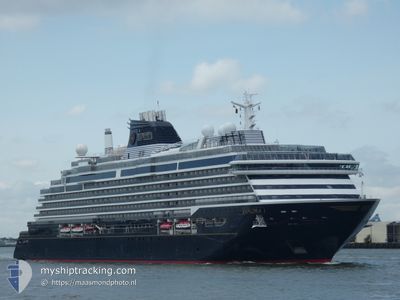
EXPLORA I
Passenger
Current Trip
| Trip Time | 5 days |
|---|---|
| Trip Distance | 2417.74 nm |
| AVG Speed | 16.5 Knots |
| MAX Speed | 20 Knots |
| Draught | 7 m |
| AVG Wind | 11.4 knots |
| MAX Wind | 23.5 knots |
| MIN Temp | 5.2°C / 41.36°F |
| MAX Temp | 23.4°C / 74.12°F |
| Position Received | 5 d ago |
Current Position
| Longitude | -126.36616° |
|---|---|
| Latitude | 47.40259° |
| Status | Under way using engine |
| Speed | 18.9 Knots |
| Course | 222.3° |
| Area | North Pacific Ocean |
| Station | T-AIS |
| Position Received | 5 d ago |
Info
Information
The current position of EXPLORA I is in North Pacific Ocean with coordinates 47.40259° / -126.36616° as reported on 2024-04-19 14:07 by AIS to our vessel tracker app. The vessel's current speed is 18.9 Knots and is currently inside the port of HILO.
The vessel EXPLORA I (IMO: 9869875, MMSI: 256389000) is a Passenger It's sailing under the flag of [MT] Malta.
In this page you can find informations about the vessels current position, last detected port calls, and current voyage information. If the vessels is not in coverage by AIS you will find the latest position.
The current position of EXPLORA I is detected by our AIS receivers and we are not responsible for the reliability of the data. The last position was recorded while the vessel was in Coverage by the Ais receivers of our vessel tracking app.
The current draught of EXPLORA I as reported by AIS is 7 meters
Weather
| Temperature | 23.3°C / 73.94°F |
|---|---|
| Wind Speed | 5 knots |
| Direction | 86° E |
| Pressure | 1019.2 hPa |
| Humidity | 72.4 % |
| Cloud Coverage | 6 % |
Featured Company
Last Port Calls
| Port | Arrival | Departure | Time In Port |
|---|---|---|---|
| 2024-04-24 23:14 | |||
| 2024-04-18 13:08 | 2024-04-19 00:27 | 11 h | |
| 2024-04-17 15:12 | 2024-04-18 02:52 | 11 h | |
| 2024-04-16 14:56 | 2024-04-17 01:10 | 10 h | |
| 2024-04-14 00:13 | 2024-04-15 00:59 | 1 d | |
| 2024-04-11 13:40 | 2024-04-13 00:38 | 1 d | |
| 2024-04-10 00:20 | 2024-04-11 00:52 | 1 d | |
| 2024-04-06 12:08 | 2024-04-06 21:45 | 9 h | |
| 2024-04-03 13:38 | 2024-04-03 23:48 | 10 h | |
| 2024-04-01 13:33 | 2024-04-02 01:52 | 12 h |
Most Visited Ports (Last year)
| Port | Arrivals | |
|---|---|---|
| 8 | ||
| 7 | ||
| 7 | ||
| 7 | ||
| 4 | ||
| 4 |
Last Trips
| Origin | Departure | Destination | Arrival | Distance | |
|---|---|---|---|---|---|
| 2024-04-18 17:27 | 2024-04-24 13:14 | 2417.74 nm | |||
| 2024-04-17 19:52 | 2024-04-18 06:08 | 81.86 nm | |||
| 2024-04-16 18:10 | 2024-04-17 08:12 | 238.12 nm | |||
| 2024-04-14 17:59 | 2024-04-16 07:56 | 572.31 nm | |||
| 2024-04-12 17:38 | 2024-04-13 17:13 | 383.32 nm | |||
| 2024-04-10 17:52 | 2024-04-11 06:40 | 114.14 nm | |||
| 2024-04-06 15:45 | 2024-04-09 17:20 | 1073.43 nm | |||
| 2024-04-03 17:48 | 2024-04-06 06:08 | 1031.46 nm | |||
| 2024-04-01 19:52 | 2024-04-03 07:38 | 477.35 nm | |||
| 2024-03-27 17:33 | 2024-04-01 07:33 | 840.74 nm |
Events
| Time | Event | Details | Position / Dest | Info |
|---|---|---|---|---|
| 2024-04-24 23:47 | STOP Moving |
19.73088 / -155.05464
[US] HILO
|
Speed: 0.3 kn Course: 174° |
|
| 2024-04-24 23:14 | PORT ARRIVAL |
|
19.74162 / -155.08223
[US] HILO
|
Speed: 7.5 kn Course: 199° |
| 2024-04-19 14:20 | Status Changed | Default Under way using engine |
47.35166 / -126.43333
USITO
|
Speed: 18.9 kn Course: 222.3° |
| 2024-04-19 14:07 | OUT of Coverage |
47.40259 / -126.36616
North Pacific Ocean
USITO
|
Speed: 18.9 kn Course: 222.3° |
|
| 2024-04-19 09:47 | Change Sea Area | United States part of the North Pacific Ocean Canadian part of the North Pacific Ocean |
48.47499 / -125.05710
North Pacific Ocean
USITO
|
Speed: 19.7 kn Course: 214° |
| 2024-04-19 09:04 | Change Sea Area | Canadian part of the North Pacific Ocean Canadian part of the The Coastal Waters of Southeast Alaska and British Columbia |
48.51148 / -124.73141
North Pacific Ocean
USITO
|
Speed: 18.8 kn Course: 291.8° |
| 2024-04-19 04:37 | Change Sea Area | Canadian part of the The Coastal Waters of Southeast Alaska and British Columbia United States part of the The Coastal Waters of Southeast Alaska and British Columbia |
48.52397 / -123.21120
The Coastal Waters of Southeast Alaska and British Columbia
USITO
|
Speed: 17 kn Course: 174.4° |
| 2024-04-19 04:01 | Change Sea Area | United States part of the The Coastal Waters of Southeast Alaska and British Columbia Canadian part of the The Coastal Waters of Southeast Alaska and British Columbia |
48.68835 / -123.25481
The Coastal Waters of Southeast Alaska and British Columbia
USITO
|
Speed: 15.5 kn Course: 186.9° |
| 2024-04-19 03:19 | Change Sea Area | Canadian part of the The Coastal Waters of Southeast Alaska and British Columbia United States part of the The Coastal Waters of Southeast Alaska and British Columbia |
48.78261 / -123.01834
The Coastal Waters of Southeast Alaska and British Columbia
USITO
|
Speed: 15.1 kn Course: 225.9° |
| 2024-04-19 03:10 | Change Sea Area | United States part of the The Coastal Waters of Southeast Alaska and British Columbia Canadian part of the The Coastal Waters of Southeast Alaska and British Columbia |
48.81701 / -123.00695
The Coastal Waters of Southeast Alaska and British Columbia
USITO
|
Speed: 16.7 kn Course: 144.1° |