
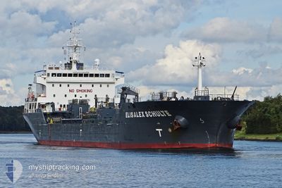
ELISALEX SCHULTE
Oil/Chemical Tanker
Current Trip
| Time Travelled | 3 days |
|---|---|
| Remaining Time | 1 day |
| Distance Travelled | 947.34 nm |
| Remaining Distance | 440.09 nm |
| AVG Speed | 11.1 Knots |
| MAX Speed | 13.6 Knots |
| AVG Wind | 16.8 knots |
| MAX Wind | 34.3 knots |
| MIN Temp | 14.5°C / 58.1°F |
| MAX Temp | 19.9°C / 67.82°F |
| Draught | 7.6 m |
| Position Received | 2 d ago |
Current Position
| Longitude | 14.34309° |
|---|---|
| Latitude | 36.43959° |
| Status | Under way using engine |
| Speed | 8.4 Knots |
| Course | 293.2° |
| Area | Mediterranean Sea - Eastern Basin |
| Station | T-AIS |
| Position Received | 2 d ago |
Info
Information
The current position of ELISALEX SCHULTE is in Mediterranean Sea - Eastern Basin with coordinates 36.43959° / 14.34309° as reported on 2024-04-17 22:30 by AIS to our vessel tracker app. The vessel's current speed is 8.4 Knots and is heading at the port of GIBRALTAR. The estimated time of arrival as calculated by MyShipTracking vessel tracking app is 2024-04-21 11:08 LT
The vessel ELISALEX SCHULTE (IMO: 9439876, MMSI: 563052000) is a Oil/Chemical Tanker that was built in 2011 ( 13 years old ). It's sailing under the flag of [SG] Singapore.
In this page you can find informations about the vessels current position, last detected port calls, and current voyage information. If the vessels is not in coverage by AIS you will find the latest position.
The current position of ELISALEX SCHULTE is detected by our AIS receivers and we are not responsible for the reliability of the data. The last position was recorded while the vessel was in Coverage by the Ais receivers of our vessel tracking app.
The current draught of ELISALEX SCHULTE as reported by AIS is 7.6 meters
Weather
| Temperature | 14.9°C / 58.82°F |
|---|---|
| Wind Speed | 13 knots |
| Direction | 90° E |
| Pressure | 1018.6 hPa |
| Humidity | 62.9 % |
| Cloud Coverage | 26 % |
Featured Company
Last Port Calls
| Port | Arrival | Departure | Time In Port |
|---|---|---|---|
| 2024-04-14 06:39 | 2024-04-16 10:09 | 2 d | |
| 2024-04-11 06:42 | 2024-04-12 23:21 | 1 d | |
| 2024-04-04 14:35 | 2024-04-05 03:41 | 13 h | |
| 2024-03-26 20:01 | 2024-03-28 10:24 | 1 d | |
| 2024-03-23 07:19 | 2024-03-25 04:56 | 1 d | |
| 2024-03-19 04:47 | 2024-03-19 06:03 | 1 h | |
| 2024-03-17 06:07 | 2024-03-19 04:09 | 1 d | |
| 2024-03-17 04:33 | 2024-03-17 05:31 | 57 m | |
| 2024-03-16 22:20 | 2024-03-17 00:32 | 2 h | |
| 2024-03-14 14:55 | 2024-03-15 15:07 | 1 d |
Most Visited Ports (Last year)
| Port | Arrivals | |
|---|---|---|
| 12 | ||
| 10 | ||
| 10 | ||
| 9 | ||
| 5 | ||
| 4 |
Last Trips
| Origin | Departure | Destination | Arrival | Distance | |
|---|---|---|---|---|---|
| 2024-04-13 01:21 | 2024-04-14 08:39 | 380.50 nm | |||
| 2024-04-05 05:41 | 2024-04-11 08:42 | 1721.84 nm | |||
| 2024-03-28 11:24 | 2024-04-04 16:35 | 1538.29 nm | |||
| 2024-03-25 05:56 | 2024-03-26 21:01 | 48.81 nm | |||
| 2024-03-19 06:03 | 2024-03-23 08:19 | 740.61 nm | |||
| 2024-03-19 04:09 | 2024-03-19 04:47 | 1.95 nm | |||
| 2024-03-17 05:31 | 2024-03-17 06:07 | 1.95 nm | |||
| 2024-03-15 15:07 | 2024-03-17 04:33 | 440.21 nm | |||
| 2024-03-15 15:07 | 2024-03-16 22:20 | 411.68 nm | |||
| 2024-03-11 09:40 | 2024-03-14 14:55 | 753.79 nm |
Events
| Time | Event | Details | Position / Dest | Info |
|---|---|---|---|---|
| 2024-04-17 22:41 | Status Changed | Default Under way using engine |
36.44833 / 14.31167
GIGIB
|
Speed: 8.4 kn Course: 293.2° |
| 2024-04-17 22:30 | OUT of Coverage |
36.43959 / 14.34309
Mediterranean Sea - Eastern Basin
GIGIB
|
Speed: 8.4 kn Course: 293.2° |
|
| 2024-04-17 22:26 | Change Sea Area | Maltese part of the Mediterranean Sea - Eastern Basin Italian part of the Mediterranean Sea - Eastern Basin |
36.43575 / 14.35446
Mediterranean Sea - Eastern Basin
GIGIB
|
Speed: 8.8 kn Course: 291.8° |
| 2024-04-17 22:25 | Status Changed | Under way using engine Default |
36.43482 / 14.35728
GIGIB
|
Speed: 8 kn Course: 291° |
| 2024-04-17 21:32 | Status Changed | Default Under way using engine |
36.39333 / 14.49833
GIGIB
|
Speed: 7.9 kn Course: 289.3° |
| 2024-04-17 21:16 | Detected in Sea | Italian part of the Mediterranean Sea - Eastern Basin |
36.38238 / 14.54090
Mediterranean Sea - Eastern Basin
GIGIB
|
Speed: 9.1 kn Course: 288° |
| 2024-04-17 21:16 | Status Changed | Under way using engine Default |
36.38238 / 14.54090
GIGIB
|
Speed: 8 kn Course: 289° |
| 2024-04-17 21:16 | IN Coverage |
36.38238 / 14.54090
Mediterranean Sea - Eastern Basin
GIGIB
|
Speed: 9.1 kn Course: 288° |
|
| 2024-04-16 17:35 | Status Changed | Default Under way using engine |
40.21799 / 18.83370
GIGIB
|
Speed: 11.6 kn Course: 193.8° |
| 2024-04-16 17:28 | OUT of Coverage |
40.24001 / 18.84079
Adriatic Sea
GIGIB
|
Speed: 11.6 kn Course: 193.8° |