
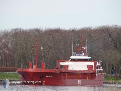
EKNOE
General Cargo
Current Trip
| Time Travelled | 17 h, 10 mins |
|---|---|
| Remaining Time | 17 h, 41 mins |
| Distance Travelled | 193.88 nm |
| Remaining Distance | 213.67 nm |
| AVG Speed | 10.8 Knots |
| MAX Speed | 13.2 Knots |
| AVG Wind | 12.8 knots |
| MAX Wind | 22.8 knots |
| MIN Temp | 3.7°C / 38.66°F |
| MAX Temp | 5.9°C / 42.62°F |
| Draught | 3.4 m |
| Position Received | 1 m ago |
Current Position
| Longitude | 14.94393° |
|---|---|
| Latitude | 55.39801° |
| Status | Under way using engine |
| Speed | 11.7 Knots |
| Course | 84.9° |
| Area | Kattegat |
| Station | T-AIS |
| Position Received | 1 m ago |
Info
Information
The current position of EKNOE is in Kattegat with coordinates 55.39801° / 14.94393° as reported on 2024-04-16 20:25 by AIS to our vessel tracker app. The vessel's current speed is 11.7 Knots and is heading at the port of KLAIPEDA. The estimated time of arrival as calculated by MyShipTracking vessel tracking app is 2024-04-17 14:08 LT
The vessel EKNOE (IMO: 9353395, MMSI: 304936000) is a General Cargo that was built in 2006 ( 18 years old ). It's sailing under the flag of [AG] Antigua Barbuda.
In this page you can find informations about the vessels current position, last detected port calls, and current voyage information. If the vessels is not in coverage by AIS you will find the latest position.
The current position of EKNOE is detected by our AIS receivers and we are not responsible for the reliability of the data. The last position was recorded while the vessel was in Coverage by the Ais receivers of our vessel tracking app.
The current draught of EKNOE as reported by AIS is 3.4 meters
Weather
| Temperature | 4.5°C / 40.1°F |
|---|---|
| Wind Speed | 7 knots |
| Direction | 38° NE |
| Pressure | 1002.9 hPa |
| Humidity | 82.4 % |
| Cloud Coverage | 100 % |
Featured Company
Last Port Calls
| Port | Arrival | Departure | Time In Port |
|---|---|---|---|
| 2024-04-16 03:14 | 2024-04-16 03:17 | 3 m | |
| 2024-04-14 02:03 | 2024-04-15 03:02 | 1 d | |
| 2024-04-09 15:53 | 2024-04-10 14:39 | 22 h | |
| 2024-04-06 08:31 | 2024-04-06 08:33 | 1 m | |
| 2024-04-03 17:00 | 2024-04-05 09:13 | 1 d | |
| 2024-03-29 16:33 | 2024-03-30 18:05 | 1 d | |
| 2024-03-27 11:50 | 2024-03-28 13:09 | 1 d | |
| 2024-03-24 03:23 | 2024-03-24 03:26 | 3 m | |
| 2024-03-23 15:56 | 2024-03-23 18:56 | 2 h | |
| 2024-03-20 19:12 | 2024-03-23 00:19 | 2 d |
Last Trips
| Origin | Departure | Destination | Arrival | Distance | |
|---|---|---|---|---|---|
| 2024-04-15 05:02 | 2024-04-16 05:14 | 211.81 nm | |||
| 2024-04-10 17:39 | 2024-04-14 04:03 | 801.78 nm | |||
| 2024-04-06 10:33 | 2024-04-09 18:53 | 706.37 nm | |||
| 2024-04-05 11:13 | 2024-04-06 10:31 | 216.60 nm | |||
| 2024-03-30 20:05 | 2024-04-03 19:00 | 904.61 nm | |||
| 2024-03-28 14:09 | 2024-03-29 18:33 | 287.21 nm | |||
| 2024-03-24 04:26 | 2024-03-27 12:50 | 468.87 nm | |||
| 2024-03-23 19:56 | 2024-03-24 04:23 | 47.76 nm | |||
| 2024-03-23 01:19 | 2024-03-23 16:56 | 159.28 nm | |||
| 2024-03-19 09:42 | 2024-03-20 20:12 | 209.85 nm |
Events
| Time | Event | Details | Position / Dest | Info |
|---|---|---|---|---|
| 2024-04-16 16:35 | Detected in Sea | Danish part of the Kattegat |
54.97825 / 14.02007
Kattegat
LTKLJ
|
Speed: 10.3 kn Course: 73.2° |
| 2024-04-16 16:25 | Detected in Sea | Swedish part of the Baltic Sea |
54.97034 / 13.97339
Baltic Sea
LTKLJ
|
Speed: 10 kn Course: 74.5° |
| 2024-04-16 15:05 | Status Changed | Under way using engine Default |
54.90305 / 13.58431
LTKLJ
|
Speed: 11 kn Course: 72° |
| 2024-04-16 14:47 | Status Changed | Default Under way using engine |
54.88735 / 13.49647
LTKLJ
|
Speed: 11.2 kn Course: 71.4° |
| 2024-04-16 09:35 | Change Sea Area | German part of the Baltic Sea Danish part of the Baltic Sea |
54.40838 / 12.11744
Baltic Sea
LTKLJ
|
Speed: 12 kn Course: 89.6° |
| 2024-04-16 07:25 | Change Sea Area | Danish part of the Baltic Sea German part of the Baltic Sea |
54.50546 / 11.43574
Baltic Sea
LTKLJ
|
Speed: 12 kn Course: 113.5° |
| 2024-04-16 05:29 | Change Sea Area | German part of the Baltic Sea Danish part of the Baltic Sea |
54.55887 / 10.76408
Baltic Sea
LTKLJ
|
Speed: 12.7 kn Course: 84.1° |
| 2024-04-16 05:05 | Change Sea Area | Danish part of the Baltic Sea German part of the Baltic Sea |
54.55089 / 10.61947
Baltic Sea
LTKLJ
|
Speed: 12.5 kn Course: 85.6° |
| 2024-04-16 03:56 | Change Sea Area | German part of the Baltic Sea German part of the North Sea |
54.45970 / 10.26856
Baltic Sea
LTKLJ
|
Speed: 10.4 kn Course: 39.3° |
| 2024-04-16 03:17 | PORT DEPARTURE |
|
54.36414 / 10.17140
LTKLJ
|
Speed: 9.9 kn Course: 46° |