
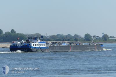
EILTANK 6
Tanker C
Current Trip
| Time Travelled | 55 mins |
|---|---|
| Remaining Time | --- |
| Distance Travelled | --- |
| Remaining Distance | --- |
| AVG Speed | --- |
| MAX Speed | --- |
| AVG Wind | --- |
| MAX Wind | --- |
| MIN Temp | --- |
| MAX Temp | --- |
| Draught | 0.6 m |
| Position Received | 54 m ago |
Current Position
| Longitude | 6.61713° |
|---|---|
| Latitude | 51.62834° |
| Status | Under way using engine |
| Speed | 0.3 Knots |
| Course | --- |
| Area | North Sea |
| Station | T-AIS |
| Position Received | 54 m ago |
Info
Information
The current position of EILTANK 6 is in North Sea with coordinates 51.62834° / 6.61713° as reported on 2024-04-23 07:34 by AIS to our vessel tracker app. The vessel's current speed is 0.3 Knots
The vessel EILTANK 6 (MMSI: 211386900) is a Tanker C It's sailing under the flag of [DE] Germany.
In this page you can find informations about the vessels current position, last detected port calls, and current voyage information. If the vessels is not in coverage by AIS you will find the latest position.
The current position of EILTANK 6 is detected by our AIS receivers and we are not responsible for the reliability of the data. The last position was recorded while the vessel was in Coverage by the Ais receivers of our vessel tracking app.
The current draught of EILTANK 6 as reported by AIS is 0.6 meters
Weather
| Temperature | 4.7°C / 40.46°F |
|---|---|
| Wind Speed | 3 knots |
| Direction | 33° NNE |
| Pressure | 1022 hPa |
| Humidity | 67.1 % |
| Cloud Coverage | 20 % |
Featured Company
Last Port Calls
| Port | Arrival | Departure | Time In Port |
|---|---|---|---|
| 2024-04-22 08:56 | 2024-04-23 07:34 | 22 h | |
| 2024-04-20 11:24 | 2024-04-21 09:44 | 22 h | |
| 2024-04-19 04:55 | 2024-04-19 05:59 | 1 h | |
| 2024-04-17 07:20 | 2024-04-17 07:48 | 28 m | |
| 2024-04-14 15:22 | 2024-04-17 05:26 | 2 d | |
| 2024-04-14 14:18 | 2024-04-14 14:52 | 34 m | |
| 2024-04-12 18:07 | |||
| 2024-04-10 09:43 | 2024-04-10 10:37 | 54 m | |
| 2024-04-08 17:01 | 2024-04-08 17:44 | 42 m | |
| 2024-04-07 09:53 | 2024-04-08 04:35 | 18 h |
Last Trips
| Origin | Departure | Destination | Arrival | Distance | |
|---|---|---|---|---|---|
| 2024-04-21 11:44 | 2024-04-22 10:56 | 40.53 nm | |||
| 2024-04-19 07:59 | 2024-04-20 13:24 | 66.77 nm | |||
| 2024-04-17 09:48 | 2024-04-19 06:55 | 104.09 nm | |||
| 2024-04-17 07:26 | 2024-04-17 09:20 | 16.79 nm | |||
| 2024-04-14 16:52 | 2024-04-14 17:22 | 4.40 nm | |||
| 2024-04-14 16:52 | 2024-04-14 16:18 | 4.40 nm | |||
| 2024-04-10 12:37 | 2024-04-12 20:07 | 11.77 nm | |||
| 2024-04-08 19:44 | 2024-04-10 11:43 | 61.87 nm | |||
| 2024-04-08 06:35 | 2024-04-08 19:01 | 80.18 nm | |||
| 2024-04-07 07:33 | 2024-04-07 11:53 | 43.40 nm |
Events
| Time | Event | Details | Position / Dest | Info |
|---|---|---|---|---|
| 2024-04-23 07:34 | IN Coverage |
51.62834 / 6.61713
North Sea
DEBOT03910CITYX00150
|
Speed: 0.3 kn Course: 511° |
|
| 2024-04-23 07:34 | PORT DEPARTURE |
|
51.62834 / 6.61713
DEBOT03910CITYX00150
|
Speed: 4.1 kn Course: 173.7° |
| 2024-04-22 09:51 | OUT of Coverage |
51.93628 / 7.63802
North Sea
[DE] MUNSTER
|
Speed: 4.1 kn Course: 173.7° |
|
| 2024-04-22 09:17 | START Moving |
51.97667 / 7.66194
[DE] MUNSTER
|
Speed: 3.6 kn Course: 168.1° |
|
| 2024-04-22 09:15 | Status Changed | Under way using engine Moored |
51.97803 / 7.66160
[DE] MUNSTER
|
Speed: 0.4 kn Course: 511° |
| 2024-04-22 08:58 | Status Changed | Moored Under way using engine |
51.97840 / 7.66145
[DE] MUNSTER
|
Speed: 0.2 kn Course: 511° |
| 2024-04-22 08:56 | STOP Moving |
51.97850 / 7.66153
[DE] MUNSTER
|
Speed: 0.3 kn Course: 511° |
|
| 2024-04-22 08:56 | PORT ARRIVAL |
|
51.97850 / 7.66153
[DE] MUNSTER
|
Speed: 0.6 kn Course: 511° |
| 2024-04-22 08:32 | IN Coverage |
52.00816 / 7.66027
North Sea
DEBOT03910CITYX00150
|
Speed: 6.1 kn Course: 192° |
|
| 2024-04-21 17:05 | OUT of Coverage |
52.36157 / 7.77335
North Sea
DEBOT03910CITYX00150
|
Speed: 5.4 kn Course: 274.8° |