
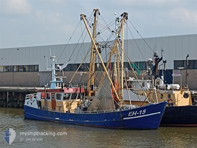
EH15 GERRIT SENIOR
Fishing
Current Trip
| Trip Time | 2 days |
|---|---|
| Trip Distance | 224.32 nm |
| AVG Speed | 4.2 Knots |
| MAX Speed | 10 Knots |
| Draught | 0 m |
| AVG Wind | 17 knots |
| MAX Wind | 27.7 knots |
| MIN Temp | 5.9°C / 42.62°F |
| MAX Temp | 9.4°C / 48.92°F |
| Position Received | 1 m ago |
Current Position
| Longitude | 5.41607° |
|---|---|
| Latitude | 53.17993° |
| Status | Moored |
| Speed | |
| Course | 69° |
| Area | North Sea |
| Station | T-AIS |
| Position Received | 1 m ago |
Info
Information
The current position of EH15 GERRIT SENIOR is in North Sea with coordinates 53.17993° / 5.41607° as reported on 2024-04-20 03:14 by AIS to our vessel tracker app. The vessel's current speed is 0 Knots and is currently inside the port of HARLINGEN.
The vessel EH15 GERRIT SENIOR (IMO: 8431815, MMSI: 245700000) is a Fishing It's sailing under the flag of [NL] Netherlands.
In this page you can find informations about the vessels current position, last detected port calls, and current voyage information. If the vessels is not in coverage by AIS you will find the latest position.
The current position of EH15 GERRIT SENIOR is detected by our AIS receivers and we are not responsible for the reliability of the data. The last position was recorded while the vessel was in Coverage by the Ais receivers of our vessel tracking app.
Weather
| Temperature | 7.1°C / 44.78°F |
|---|---|
| Wind Speed | 23 knots |
| Direction | 342° NNW |
| Pressure | 1016.8 hPa |
| Humidity | 72.7 % |
| Cloud Coverage | 86 % |
Featured Company
Last Port Calls
| Port | Arrival | Departure | Time In Port |
|---|---|---|---|
| 2024-04-19 05:17 | |||
| 2024-04-11 23:58 | 2024-04-16 06:27 | 4 d | |
| 2024-04-10 21:57 | 2024-04-11 07:54 | 9 h | |
| 2024-04-09 07:05 | 2024-04-10 02:42 | 19 h | |
| 2024-03-29 13:54 | 2024-04-07 23:22 | 9 d | |
| 2024-03-01 16:03 | 2024-03-29 09:10 | 27 d | |
| 2024-03-01 14:25 |
Most Visited Ports (Last year)
| Port | Arrivals | |
|---|---|---|
| 20 | ||
| 7 | ||
| 6 | ||
| 4 | ||
| 3 | ||
| 2 |
Last Trips
| Origin | Departure | Destination | Arrival | Distance | |
|---|---|---|---|---|---|
| 2024-04-16 08:27 | 2024-04-19 07:17 | 224.32 nm | |||
| 2024-04-11 09:54 | 2024-04-12 01:58 | 62.27 nm | |||
| 2024-04-10 04:42 | 2024-04-10 23:57 | 78.39 nm | |||
| 2024-04-08 01:22 | 2024-04-09 09:05 | 122.58 nm | |||
| 2024-03-29 10:10 | 2024-03-29 14:54 | 37.83 nm | |||
| 2024-03-01 15:25 | 2024-03-01 17:03 | 11.82 nm |
Events
| Time | Event | Details | Position / Dest | Info |
|---|---|---|---|---|
| 2024-04-19 05:18 | STOP Moving |
53.18076 / 5.41855
[NL] HARLINGEN
|
Speed: 0.2 kn Course: 15° |
|
| 2024-04-19 05:17 | PORT ARRIVAL |
|
53.18076 / 5.41855
[NL] HARLINGEN
|
Speed: 0.8 kn Course: 19° |
| 2024-04-19 05:06 | START Moving | 0.93 nm, West of HARLINGEN |
53.18167 / 5.39999
URK
|
Speed: 8.3 kn Course: 172.1° |
| 2024-04-19 05:00 | STOP Moving | 1.03 nm, West of HARLINGEN |
53.18378 / 5.39809
URK
|
Speed: 0.3 kn Course: 303° |
| 2024-04-18 03:30 | IN Coverage |
53.04454 / 5.17487
North Sea
|
Speed: 7.9 kn Course: 75° |
|
| 2024-04-17 21:02 | OUT of Coverage |
53.04354 / 5.06258
North Sea
|
Speed: 6.6 kn Course: 106.7° |
|
| 2024-04-17 09:58 | IN Coverage |
53.03950 / 5.05936
North Sea
|
Speed: 2.7 kn Course: 106° |
|
| 2024-04-17 08:47 | OUT of Coverage |
53.05888 / 4.98897
North Sea
|
Speed: 2.4 kn Course: 278.5° |
|
| 2024-04-16 06:27 | PORT DEPARTURE |
|
53.17448 / 5.39930
URK
|
Speed: 9.3 kn Course: 207° |
| 2024-04-16 06:21 | START Moving |
53.17963 / 5.41372
[NL] HARLINGEN
|
Speed: 7.4 kn Course: 196° |