
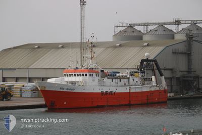
EGS VENTUS
Research/Survey Vessel
Current Trip
| Trip Time | 12 h, 14 mins |
|---|---|
| Trip Distance | 24.21 nm |
| AVG Speed | 6.9 Knots |
| MAX Speed | 10.4 Knots |
| Draught | 6.1 m |
| AVG Wind | 11.6 knots |
| MAX Wind | 12.9 knots |
| MIN Temp | 10.9°C / 51.62°F |
| MAX Temp | 11.6°C / 52.88°F |
| Position Received | 1 m ago |
Current Position
| Longitude | -0.21267° |
|---|---|
| Latitude | 50.82894° |
| Status | Moored |
| Speed | |
| Course | 103° |
| Area | English Channel |
| Station | T-AIS |
| Position Received | 1 m ago |
Info
Information
The current position of EGS VENTUS is in English Channel with coordinates 50.82894° / -0.21267° as reported on 2024-04-20 03:10 by AIS to our vessel tracker app. The vessel's current speed is 0 Knots and is currently inside the port of SHOREHAM.
The vessel EGS VENTUS (IMO: 7504237, MMSI: 538007957) is a Research/Survey Vessel that was built in 1977 ( 47 years old ). It's sailing under the flag of [MH] Marshall Is.
In this page you can find informations about the vessels current position, last detected port calls, and current voyage information. If the vessels is not in coverage by AIS you will find the latest position.
The current position of EGS VENTUS is detected by our AIS receivers and we are not responsible for the reliability of the data. The last position was recorded while the vessel was in Coverage by the Ais receivers of our vessel tracking app.
The current draught of EGS VENTUS as reported by AIS is 6.1 meters
Weather
| Temperature | 6.5°C / 43.7°F |
|---|---|
| Wind Speed | 14 knots |
| Direction | 354° N |
| Pressure | 1025.6 hPa |
| Humidity | 65.8 % |
| Cloud Coverage | 36 % |
Featured Company
Events
| Time | Event | Details | Position / Dest | Info |
|---|---|---|---|---|
| 2024-04-15 15:46 | Status Changed | Moored Default |
50.82856 / -.20993
[GB] SHOREHAM
|
Speed: Course: 103° |
| 2024-04-15 15:43 | Status Changed | Default Moored |
50.82858 / -.20991
[GB] SHOREHAM
|
Speed: Course: 103° |
| 2024-04-12 02:04 | Status Changed | Moored Under way using engine |
50.82854 / -.20994
[GB] SHOREHAM
|
Speed: Course: 104° |
| 2024-04-12 01:45 | STOP Moving |
50.82864 / -.20993
[GB] SHOREHAM
|
Speed: 0.3 kn Course: 105° |
|
| 2024-04-12 01:32 | START Moving |
50.83069 / -.22690
[GB] SHOREHAM
|
Speed: 3.1 kn Course: 90° |
|
| 2024-04-12 01:10 | STOP Moving |
50.82998 / -.23768
[GB] SHOREHAM
|
Speed: 0.3 kn Course: 89° |
|
| 2024-04-12 00:57 | PORT ARRIVAL |
|
50.82505 / -.24719
[GB] SHOREHAM
|
Speed: 6.7 kn Course: 356.9° |
| 2024-04-12 00:32 | START Moving | 3.15 nm, South of SHOREHAM |
50.77622 / -.26482
GB SHO
|
Speed: 3.1 kn Course: 40° |
| 2024-04-12 00:19 | Status Changed | Under way using engine At anchor |
50.77211 / -.26867
GB SHO
|
Speed: 0.6 kn Course: 151° |
| 2024-04-11 17:10 | Status Changed | At anchor Under way using engine |
50.77083 / -.27020
GB SHO
|
Speed: 0.2 kn Course: 97° |