
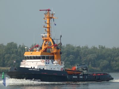
EEMS WRESTLER
Tug
Current Trip
| Time Travelled | 8 days |
|---|---|
| Remaining Time | 1 day |
| Distance Travelled | 1089.71 nm |
| Remaining Distance | 65.86 nm |
| AVG Speed | 5.8 Knots |
| MAX Speed | 13 Knots |
| AVG Wind | 9 knots |
| MAX Wind | 29 knots |
| MIN Temp | 11.1°C / 51.98°F |
| MAX Temp | 23.7°C / 74.66°F |
| Draught | 3.6 m |
| Position Received | Now |
Current Position
| Longitude | 15.22053° |
|---|---|
| Latitude | 36.83199° |
| Status | Under way using engine |
| Speed | 2.4 Knots |
| Course | 198° |
| Area | Ionian Sea |
| Station | T-AIS |
| Position Received | Now |
Info
Information
The current position of EEMS WRESTLER is in Ionian Sea with coordinates 36.83199° / 15.22053° as reported on 2024-04-24 18:05 by AIS to our vessel tracker app. The vessel's current speed is 2.4 Knots and is heading at the port of VALLETTA. The estimated time of arrival as calculated by MyShipTracking vessel tracking app is 2024-04-25 21:24 LT
The vessel EEMS WRESTLER (IMO: 8843549, MMSI: 245199000) is a Tug that was built in 1990 ( 34 years old ). It's sailing under the flag of [NL] Netherlands.
In this page you can find informations about the vessels current position, last detected port calls, and current voyage information. If the vessels is not in coverage by AIS you will find the latest position.
The current position of EEMS WRESTLER is detected by our AIS receivers and we are not responsible for the reliability of the data. The last position was recorded while the vessel was in Coverage by the Ais receivers of our vessel tracking app.
The current draught of EEMS WRESTLER as reported by AIS is 3.6 meters
Weather
| Temperature | 11.8°C / 53.24°F |
|---|---|
| Wind Speed | 17 knots |
| Direction | 318° NW |
| Pressure | 1009.2 hPa |
| Humidity | 81.7 % |
| Cloud Coverage | 100 % |
Featured Company
Last Port Calls
| Port | Arrival | Departure | Time In Port |
|---|---|---|---|
| 2024-04-12 03:55 | 2024-04-16 06:16 | 4 d | |
| 2024-03-21 17:52 | 2024-03-25 08:07 | 3 d | |
| 2024-03-21 10:23 | 2024-03-21 16:44 | 6 h | |
| 2024-03-15 20:37 | 2024-03-18 17:59 | 2 d | |
| 2024-02-28 18:36 | 2024-03-12 08:39 | 12 d | |
| 2024-02-22 16:52 | 2024-02-28 08:13 | 5 d | |
| 2024-02-19 13:31 |
Last Trips
| Origin | Departure | Destination | Arrival | Distance | |
|---|---|---|---|---|---|
| 2024-03-25 09:07 | 2024-04-12 06:55 | 2225.37 nm | |||
| 2024-03-21 17:44 | 2024-03-21 18:52 | 4.34 nm | |||
| 2024-03-18 18:59 | 2024-03-21 11:23 | 590.78 nm | |||
| 2024-03-12 08:39 | 2024-03-15 21:37 | 642.40 nm | |||
| 2024-02-28 08:13 | 2024-02-28 18:36 | 88.06 nm | |||
| 2024-02-19 13:31 | 2024-02-22 16:52 | 709.70 nm |
Events
| Time | Event | Details | Position / Dest | Info |
|---|---|---|---|---|
| 2024-04-24 01:50 | ETA Changed | 2024/04/27 08:00 2024/04/21 22:00 |
36.81509 / 15.19512
MT MLA
|
Speed: 2.2 kn Course: 25° |
| 2024-04-23 20:48 | START Moving | 11.61 nm, North East of PORTOPALO |
36.84830 / 15.21848
MT MLA
|
Speed: 4.5 kn Course: 59° |
| 2024-04-23 19:30 | STOP Moving | 10.46 nm, North of PORTOPALO |
36.83716 / 15.18660
MT MLA
|
Speed: 0.3 kn Course: 54° |
| 2024-04-23 08:15 | START Moving | 13.22 nm, South of SIRACUSA |
36.85251 / 15.37271
MT MLA
|
Speed: 3.9 kn Course: 49° |
| 2024-04-23 08:07 | STOP Moving | 13.21 nm, South of SIRACUSA |
36.85166 / 15.36868
MT MLA
|
Speed: 0.1 kn Course: 52° |
| 2024-04-23 01:38 | Status Changed | Under way using engine Default |
36.72810 / 15.19561
MT MLA
|
Speed: 3.3 kn Course: 267° |
| 2024-04-23 01:07 | Status Changed | Default Under way using engine |
36.73294 / 15.22788
MT MLA
|
Speed: 3 kn Course: 272° |
| 2024-04-22 22:14 | Change Sea Area | Italian part of the Ionian Sea Greek part of the Aegean Sea |
36.72501 / 15.46451
Ionian Sea
|
Speed: 5.4 kn Course: 258.4° |
| 2024-04-22 22:13 | Status Changed | Under way using engine Default |
36.72536 / 15.46567
MT MLA
|
Speed: 6.8 kn Course: 261° |
| 2024-04-22 22:13 | IN Coverage |
36.72501 / 15.46451
Ionian Sea
|
Speed: 5.4 kn Course: 258.4° |