
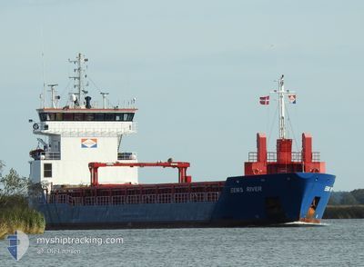
EEMS RIVER
General Cargo
Current Trip
AKKUYU
| Time Travelled | 16 h, 22 mins |
|---|---|
| Remaining Time | --- |
| Distance Travelled | 109.67 nm |
| Remaining Distance | --- |
| AVG Speed | 8.8 Knots |
| MAX Speed | 10.5 Knots |
| AVG Wind | 3.7 knots |
| MAX Wind | 6 knots |
| MIN Temp | 15.3°C / 59.54°F |
| MAX Temp | 22.2°C / 71.96°F |
| Draught | 4.8 m |
| Position Received | 1 h, 9 m ago |
Current Position
| Longitude | 27.09283° |
|---|---|
| Latitude | 40.56219° |
| Status | Under way using engine |
| Speed | 9.2 Knots |
| Course | 245.1° |
| Area | Sea of Marmara |
| Station | T-AIS |
| Position Received | 1 h, 9 m ago |
Info
Information
The current position of EEMS RIVER is in Sea of Marmara with coordinates 40.56219° / 27.09283° as reported on 2024-04-25 04:09 by AIS to our vessel tracker app. The vessel's current speed is 9.2 Knots
The vessel EEMS RIVER (IMO: 9528524, MMSI: 246802000) is a General Cargo that was built in 2012 ( 12 years old ). It's sailing under the flag of [NL] Netherlands.
In this page you can find informations about the vessels current position, last detected port calls, and current voyage information. If the vessels is not in coverage by AIS you will find the latest position.
The current position of EEMS RIVER is detected by our AIS receivers and we are not responsible for the reliability of the data. The last position was recorded while the vessel was in Coverage by the Ais receivers of our vessel tracking app.
The current draught of EEMS RIVER as reported by AIS is 4.8 meters
Weather
| Temperature | 16.4°C / 61.52°F |
|---|---|
| Wind Speed | 2 knots |
| Direction | 275° W |
| Pressure | 1004.2 hPa |
| Humidity | 84.1 % |
| Cloud Coverage | 100 % |
Featured Company
Last Port Calls
| Port | Arrival | Departure | Time In Port |
|---|---|---|---|
| 2024-04-23 14:40 | 2024-04-24 12:57 | 22 h | |
| 2024-04-17 04:52 | 2024-04-17 10:33 | 5 h | |
| 2024-04-06 10:44 | 2024-04-08 12:23 | 2 d | |
| 2024-04-02 07:04 | 2024-04-05 17:12 | 3 d | |
| 2024-03-29 16:57 | 2024-03-30 16:39 | 23 h | |
| 2024-03-24 12:16 | 2024-03-27 12:11 | 2 d | |
| 2024-03-19 17:20 | 2024-03-20 16:47 | 23 h | |
| 2024-03-19 16:22 | 2024-03-19 16:33 | 11 m | |
| 2024-03-15 13:03 | 2024-03-15 14:50 | 1 h | |
| 2024-03-12 01:02 | 2024-03-15 11:08 | 3 d |
Last Trips
| Origin | Departure | Destination | Arrival | Distance | |
|---|---|---|---|---|---|
| 2024-04-17 12:33 | 2024-04-23 17:40 | 1460.93 nm | |||
| 2024-04-08 14:23 | 2024-04-17 06:52 | 1880.21 nm | |||
| 2024-04-05 19:12 | 2024-04-06 12:44 | 117.95 nm | |||
| 2024-03-30 16:39 | 2024-04-02 09:04 | 595.93 nm | |||
| 2024-03-27 13:11 | 2024-03-29 16:57 | 451.77 nm | |||
| 2024-03-20 16:47 | 2024-03-24 13:16 | 462.35 nm | |||
| 2024-03-19 16:33 | 2024-03-19 17:20 | 3.50 nm | |||
| 2024-03-15 15:50 | 2024-03-19 16:22 | 546.71 nm | |||
| 2024-03-15 12:08 | 2024-03-15 14:03 | 9.04 nm | |||
| 2024-03-11 21:31 | 2024-03-12 02:02 | 33.97 nm |
Events
| Time | Event | Details | Position / Dest | Info |
|---|---|---|---|---|
| 2024-04-25 04:12 | Status Changed | Default Under way using engine |
40.55867 / 27.08260
AKKUYU
|
Speed: 9.2 kn Course: 245.1° |
| 2024-04-25 04:09 | OUT of Coverage |
40.56219 / 27.09283
Sea of Marmara
AKKUYU
|
Speed: 9.2 kn Course: 245.1° |
|
| 2024-04-25 03:54 | Status Changed | Under way using engine Default |
40.57852 / 27.13921
AKKUYU
|
Speed: 9.1 kn Course: 244° |
| 2024-04-25 03:21 | Status Changed | Default Under way using engine |
40.61528 / 27.23602
AKKUYU
|
Speed: 9.4 kn Course: 244.7° |
| 2024-04-24 19:01 | START Moving | 1.87 nm, East of ZEYTINBURNU |
40.97196 / 28.93287
AKKUYU
|
Speed: 4.9 kn Course: 173° |
| 2024-04-24 18:55 | Status Changed | Under way using engine At anchor |
40.97543 / 28.93092
AKKUYU
|
Speed: 0.5 kn Course: 130° |
| 2024-04-24 16:10 | Status Changed | At anchor Under way using engine |
40.97512 / 28.93046
AKKUYU
|
Speed: Course: 145° |
| 2024-04-24 15:19 | STOP Moving | 1.81 nm, East of ZEYTINBURNU |
40.97378 / 28.93204
AKKUYU
|
Speed: 0.3 kn Course: 359° |
| 2024-04-24 13:01 | Destination Changed | AKKUYU ANADULO PENDIK |
40.85105 / 29.24771
AKKUYU
|
Speed: 9.1 kn Course: 268° |
| 2024-04-24 13:01 | ETA Changed | 2024/04/27 08:00 2024/04/23 21:00 |
40.85105 / 29.24771
AKKUYU
|
Speed: 9.1 kn Course: 268° |