
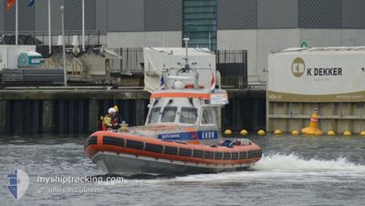
KNRM-EDITH GRONDEL
Search and Rescue vessel
Current Trip
KATWIJK A ZEE
| Time Travelled | --- |
|---|---|
| Remaining Time | --- |
| Distance Travelled | --- |
| Remaining Distance | --- |
| AVG Speed | --- |
| MAX Speed | --- |
| AVG Wind | --- |
| MAX Wind | --- |
| MIN Temp | --- |
| MAX Temp | --- |
| Draught | 0.8 m |
| Position Received | 18 h, 19 m ago |
Current Position
| Longitude | 4.40303° |
|---|---|
| Latitude | 52.21111° |
| Status | Under way using engine |
| Speed | |
| Course | --- |
| Area | North Sea |
| Station | T-AIS |
| Position Received | 18 h, 19 m ago |
Info
Information
The current position of KNRM-EDITH GRONDEL is in North Sea with coordinates 52.21111° / 4.40303° as reported on 2024-04-22 19:01 by AIS to our vessel tracker app. The vessel's current speed is 0 Knots
The vessel KNRM-EDITH GRONDEL (MMSI: 244690768) is a Search and Rescue vessel It's sailing under the flag of [NL] Netherlands.
In this page you can find informations about the vessels current position, last detected port calls, and current voyage information. If the vessels is not in coverage by AIS you will find the latest position.
The current position of KNRM-EDITH GRONDEL is detected by our AIS receivers and we are not responsible for the reliability of the data. The last position was recorded while the vessel was in Coverage by the Ais receivers of our vessel tracking app.
The current draught of KNRM-EDITH GRONDEL as reported by AIS is 0.8 meters
Weather
| Temperature | 6.9°C / 44.42°F |
|---|---|
| Wind Speed | 13 knots |
| Direction | 32° NNE |
| Pressure | 1024.3 hPa |
| Humidity | 50.3 % |
| Cloud Coverage | 80 % |
Featured Company
Last Port Calls
| Port | Arrival | Departure | Time In Port |
|---|---|---|---|
| 2024-04-06 08:06 | 2024-04-06 09:09 | 1 h | |
| 2024-03-09 09:25 | 2024-03-09 10:49 | 1 h | |
| 2024-03-01 14:26 | 2024-03-01 15:39 | 1 h | |
| 2024-02-24 07:38 |
Most Visited Ports (Last year)
| Port | Arrivals | |
|---|---|---|
| 17 | ||
| 12 | ||
| 5 | ||
| 3 | ||
| 1 | ||
| 1 |
Last Trips
| Origin | Departure | Destination | Arrival | Distance | |
|---|---|---|---|---|---|
| 2024-03-09 11:49 | 2024-04-06 10:06 | 107.19 nm | |||
| 2024-03-01 16:39 | 2024-03-09 10:25 | 19.49 nm | |||
| 2024-02-24 08:38 | 2024-03-01 15:26 | 29.74 nm |
Events
| Time | Event | Details | Position / Dest | Info |
|---|---|---|---|---|
| 2024-04-22 19:01 | OUT of Coverage |
52.21111 / 4.40303
North Sea
|
Speed: Course: 511° |
|
| 2024-04-22 18:12 | IN Coverage |
52.21110 / 4.40306
North Sea
|
Speed: Course: 511° |
|
| 2024-04-20 10:20 | OUT of Coverage |
52.21117 / 4.40299
North Sea
|
Speed: Course: 511° |
|
| 2024-04-20 09:49 | STOP Moving | 0.6 nm, North West of KATWIJK |
52.21123 / 4.40151
KATWIJK A ZEE
|
Speed: Course: 285° |
| 2024-04-20 09:46 | START Moving | 0.79 nm, North West of KATWIJK |
52.21368 / 4.39835
KATWIJK A ZEE
|
Speed: 5.4 kn Course: 165.6° |
| 2024-04-20 09:34 | STOP Moving | 0.87 nm, North West of KATWIJK |
52.21552 / 4.39849
KATWIJK A ZEE
|
Speed: 0.1 kn Course: 92° |
| 2024-04-20 08:44 | Status Changed | Under way using engine Moored |
52.21270 / 4.21096
KATWIJK A ZEE
|
Speed: 5.9 kn Course: 7.4° |
| 2024-04-20 07:48 | START Moving | 0.96 nm, North West of KATWIJK |
52.21648 / 4.39663
KATWIJK A ZEE
|
Speed: 12.3 kn Course: 301.6° |
| 2024-04-20 07:47 | STOP Moving | 0.85 nm, North West of KATWIJK |
52.21558 / 4.39943
KATWIJK A ZEE
|
Speed: Course: 296° |
| 2024-04-20 07:44 | START Moving | 0.66 nm, North West of KATWIJK |
52.21167 / 4.40008
KATWIJK A ZEE
|
Speed: 4 kn Course: 126° |