
EDELWEISS
Fishing
Current Trip
| Trip Time | 2 h, 29 mins |
|---|---|
| Trip Distance | 11.70 nm |
| AVG Speed | 9.9 Knots |
| MAX Speed | 11.3 Knots |
| Draught | 2.4 m |
| AVG Wind | 12.1 knots |
| MAX Wind | 13.7 knots |
| MIN Temp | 10.3°C / 50.54°F |
| MAX Temp | 10.8°C / 51.44°F |
| Position Received | 2 h, 16 m ago |
Current Position
| Longitude | 8.86308° |
|---|---|
| Latitude | 54.12786° |
| Status | Under way using engine |
| Speed | |
| Course | 232° |
| Area | North Sea |
| Station | T-AIS |
| Position Received | 2 h, 16 m ago |
Info
Information
The current position of EDELWEISS is in North Sea with coordinates 54.12786° / 8.86308° as reported on 2024-04-18 16:56 by AIS to our vessel tracker app. The vessel's current speed is 0 Knots and is currently inside the port of BUESUM.
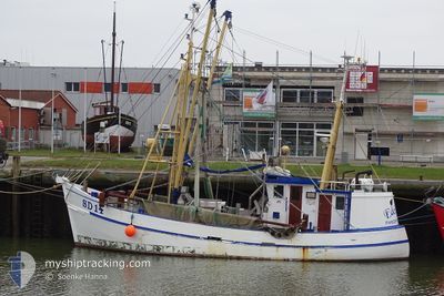
The vessel EDELWEISS (MMSI: 211314600) is a Fishing It's sailing under the flag of [DE] Germany.
In this page you can find informations about the vessels current position, last detected port calls, and current voyage information. If the vessels is not in coverage by AIS you will find the latest position.
The current position of EDELWEISS is detected by our AIS receivers and we are not responsible for the reliability of the data. The last position was recorded while the vessel was in Coverage by the Ais receivers of our vessel tracking app.
The current draught of EDELWEISS as reported by AIS is 2.4 meters
Weather
| Temperature | 7.6°C / 45.68°F |
|---|---|
| Wind Speed | 15 knots |
| Direction | 288° WNW |
| Pressure | 1015.2 hPa |
| Humidity | 65.9 % |
| Cloud Coverage | 92 % |
Featured Company
Events
| Time | Event | Details | Position / Dest | Info |
|---|---|---|---|---|
| 2024-04-18 16:56 | OUT of Coverage |
54.12786 / 8.86308
North Sea
[DE] BUESUM
|
Speed: Course: 0° |
|
| 2024-04-18 16:56 | IN Coverage |
54.12786 / 8.86308
North Sea
[DE] BUESUM
|
Speed: Course: 0° |
|
| 2024-04-11 00:01 | OUT of Coverage |
54.12745 / 8.86208
North Sea
[DE] BUESUM
|
Speed: Course: 0° |
|
| 2024-04-10 22:39 | IN Coverage |
54.12743 / 8.86208
North Sea
[DE] BUESUM
|
Speed: Course: 0° |
|
| 2024-04-09 11:02 | OUT of Coverage |
54.12742 / 8.86212
North Sea
[DE] BUESUM
|
Speed: 0.2 kn Course: 146° |
|
| 2024-04-09 11:02 | STOP Moving |
54.12742 / 8.86212
[DE] BUESUM
|
Speed: 0.2 kn Course: 235° |
|
| 2024-04-09 10:21 | PORT ARRIVAL |
|
54.12537 / 8.86153
[DE] BUESUM
|
Speed: 11 kn Course: 95° |
| 2024-04-09 09:05 | IN Coverage |
54.09433 / 8.54438
North Sea
|
Speed: 9.3 kn Course: 86° |
|
| 2024-04-09 07:52 | PORT DEPARTURE |
|
54.09433 / 8.54438
FISHING GROUND
|
Speed: Course: 231° |