
EAGLE BLANE
Tanker C
Current Trip
| Time Travelled | 5 days |
|---|---|
| Remaining Time | 1 day |
| Distance Travelled | 1326.59 nm |
| Remaining Distance | 560.55 nm |
| AVG Speed | 11 Knots |
| MAX Speed | 14.8 Knots |
| AVG Wind | 20.4 knots |
| MAX Wind | 33 knots |
| MIN Temp | 4°C / 39.2°F |
| MAX Temp | 10.4°C / 50.72°F |
| Draught | 12.4 m |
| Position Received | 2 m ago |
Current Position
| Longitude | 4.07599° |
|---|---|
| Latitude | 60.94422° |
| Status | Under way using engine |
| Speed | 12.2 Knots |
| Course | 181.1° |
| Area | North Sea |
| Station | T-AIS |
| Position Received | 2 m ago |
Info
Information
The current position of EAGLE BLANE is in North Sea with coordinates 60.94422° / 4.07599° as reported on 2024-04-24 01:02 by AIS to our vessel tracker app. The vessel's current speed is 12.2 Knots and is heading at the port of ROTTERDAM. The estimated time of arrival as calculated by MyShipTracking vessel tracking app is 2024-04-26 00:10 LT
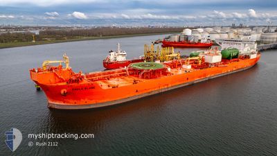
The vessel EAGLE BLANE (IMO: 9833101, MMSI: 257089140) is a Tanker C It's sailing under the flag of [NO] Norway.
In this page you can find informations about the vessels current position, last detected port calls, and current voyage information. If the vessels is not in coverage by AIS you will find the latest position.
The current position of EAGLE BLANE is detected by our AIS receivers and we are not responsible for the reliability of the data. The last position was recorded while the vessel was in Coverage by the Ais receivers of our vessel tracking app.
The current draught of EAGLE BLANE as reported by AIS is 12.4 meters
Weather
| Temperature | 4.9°C / 40.82°F |
|---|---|
| Wind Speed | 26 knots |
| Direction | 5° N |
| Pressure | 1016.1 hPa |
| Humidity | 77.6 % |
| Cloud Coverage | 8 % |
Featured Company
Last Trips
| Origin | Departure | Destination | Arrival | Distance | |
|---|---|---|---|---|---|
| 2024-03-31 17:25 | 2024-04-16 11:33 | 1881.83 nm | |||
| 2024-02-24 10:44 | 2024-03-29 12:38 | 3634.82 nm | |||
| 2024-02-11 05:37 | 2024-02-22 10:19 | 1450.26 nm | |||
| 2024-01-09 14:26 | 2024-02-08 21:12 | 4229.88 nm |
Events
| Time | Event | Details | Position / Dest | Info |
|---|---|---|---|---|
| 2024-04-24 00:48 | Change Sea Area | Norwegian part of the North Sea Norwegian part of the Norwegian Sea |
60.99330 / 4.07831
North Sea
NLRTM
|
Speed: 12.2 kn Course: 182° |
| 2024-04-23 09:54 | Draught Changed | 12.4 9.5 |
63.87400 / 4.97249
NLRTM
|
Speed: 11.8 kn Course: 203.9° |
| 2024-04-23 09:54 | Destination Changed | NLRTM XZAAD |
63.87400 / 4.97249
NLRTM
|
Speed: 11.8 kn Course: 203.9° |
| 2024-04-23 09:54 | ETA Changed | 2024/04/26 04:00 2024/04/21 17:00 |
63.87400 / 4.97249
NLRTM
|
Speed: 11.8 kn Course: 203.9° |
| 2024-04-23 09:23 | Status Changed | Under way using engine Default |
63.96410 / 5.06501
XZAAD
|
Speed: 11 kn Course: 206° |
| 2024-04-23 09:14 | Status Changed | Default Under way using engine |
63.98833 / 5.09167
XZAAD
|
Speed: 11.4 kn Course: 206.8° |
| 2024-04-23 09:10 | Status Changed | Under way using engine Default |
64.00050 / 5.10263
XZAAD
|
Speed: 11 kn Course: 207° |
| 2024-04-23 09:10 | IN Coverage |
64.00050 / 5.10263
Norwegian Sea
|
Speed: 11.4 kn Course: 206.8° |
|
| 2024-04-23 01:30 | START Moving |
65.11762 / 6.87668
XZAAD
|
Speed: 5.4 kn Course: 212° |
|
| 2024-04-22 12:45 | STOP Moving |
65.12193 / 6.88293
XZAAD
|
Speed: 0.3 kn Course: 315° |