
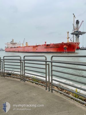
EAGLE BARCELONA
Tanker
Current Trip
| Time Travelled | 9 days |
|---|---|
| Remaining Time | --- |
| Distance Travelled | 2562.90 nm |
| Remaining Distance | --- |
| AVG Speed | 11.5 Knots |
| MAX Speed | 14.1 Knots |
| AVG Wind | 17.6 knots |
| MAX Wind | 35.8 knots |
| MIN Temp | 9°C / 48.2°F |
| MAX Temp | 18.3°C / 64.94°F |
| Draught | 8.8 m |
| Position Received | 22 h, 6 m ago |
Current Position
| Longitude | 13.99028° |
|---|---|
| Latitude | 35.74766° |
| Status | Under way using engine |
| Speed | 12 Knots |
| Course | 129.3° |
| Area | Mediterranean Sea - Eastern Basin |
| Station | T-AIS |
| Position Received | 22 h, 6 m ago |
Info
Information
The current position of EAGLE BARCELONA is in Mediterranean Sea - Eastern Basin with coordinates 35.74766° / 13.99028° as reported on 2024-04-23 08:51 by AIS to our vessel tracker app. The vessel's current speed is 12 Knots and is heading at the port of ES SIDER. The estimated time of arrival as calculated by MyShipTracking vessel tracking app is 2024-04-26 22:00 LT
The vessel EAGLE BARCELONA (IMO: 9795048, MMSI: 563045300) is a Tanker It's sailing under the flag of [SG] Singapore.
In this page you can find informations about the vessels current position, last detected port calls, and current voyage information. If the vessels is not in coverage by AIS you will find the latest position.
The current position of EAGLE BARCELONA is detected by our AIS receivers and we are not responsible for the reliability of the data. The last position was recorded while the vessel was in Coverage by the Ais receivers of our vessel tracking app.
The current draught of EAGLE BARCELONA as reported by AIS is 8.8 meters
Weather
| Temperature | 17°C / 62.6°F |
|---|---|
| Wind Speed | 15 knots |
| Direction | 322° NW |
| Pressure | 1014.5 hPa |
| Humidity | 66.3 % |
| Cloud Coverage | 86 % |
Featured Company
Last Port Calls
| Port | Arrival | Departure | Time In Port |
|---|---|---|---|
| 2024-04-13 14:24 | 2024-04-14 21:02 | 1 d | |
| 2024-03-14 21:16 | 2024-03-18 00:49 | 3 d | |
| 2024-02-20 00:08 | 2024-02-25 17:38 | 5 d | |
| 2024-02-14 18:22 | 2024-02-17 09:25 | 2 d | |
| 2024-02-07 05:34 | 2024-02-08 15:56 | 1 d |
Last Trips
| Origin | Departure | Destination | Arrival | Distance | |
|---|---|---|---|---|---|
| 2024-03-17 19:49 | 2024-04-13 16:24 | 5603.17 nm | |||
| 2024-02-25 18:38 | 2024-03-14 16:16 | 5135.65 nm | |||
| 2024-02-17 10:25 | 2024-02-20 01:08 | 43.85 nm | |||
| 2024-02-08 16:56 | 2024-02-14 19:22 | 551.11 nm | |||
| 2024-01-19 16:54 | 2024-02-07 06:34 | 5235.00 nm |
Events
| Time | Event | Details | Position / Dest | Info |
|---|---|---|---|---|
| 2024-04-23 08:57 | Status Changed | Default Under way using engine |
35.73427 / 14.01042
ES SIDER, LIBYA
|
Speed: 12 kn Course: 129.3° |
| 2024-04-23 08:51 | OUT of Coverage |
35.74766 / 13.99028
Mediterranean Sea - Eastern Basin
ES SIDER, LIBYA
|
Speed: 12 kn Course: 129.3° |
|
| 2024-04-23 08:48 | ETA Changed | 2024/04/26 22:00 2024/04/26 22:01 |
35.75464 / 13.97972
ES SIDER, LIBYA
|
Speed: 11.9 kn Course: 129.9° |
| 2024-04-23 08:38 | Detected in Sea | Maltese part of the Mediterranean Sea - Eastern Basin |
35.77461 / 13.95030
Mediterranean Sea - Eastern Basin
ES SIDER, LIBYA
|
Speed: 11.9 kn Course: 131.5° |
| 2024-04-23 08:37 | Status Changed | Under way using engine Default |
35.77676 / 13.94725
ES SIDER, LIBYA
|
Speed: 12 kn Course: 131° |
| 2024-04-23 08:37 | IN Coverage |
35.77461 / 13.95030
Mediterranean Sea - Eastern Basin
ES SIDER, LIBYA
|
Speed: 11.9 kn Course: 131.5° |
|
| 2024-04-22 21:55 | Status Changed | Default Under way using engine |
37.14415 / 11.75434
ES SIDER, LIBYA
|
Speed: 12.8 kn Course: 114.1° |
| 2024-04-22 21:39 | OUT of Coverage |
37.16885 / 11.68788
Mediterranean Sea - Eastern Basin
ES SIDER, LIBYA
|
Speed: 12.8 kn Course: 114.1° |
|
| 2024-04-22 21:38 | Detected in Sea | Tunisian part of the Mediterranean Sea - Eastern Basin |
37.17050 / 11.68327
Mediterranean Sea - Eastern Basin
ES SIDER, LIBYA
|
Speed: 12.8 kn Course: 114.2° |
| 2024-04-22 21:38 | Status Changed | Under way using engine Default |
37.17050 / 11.68327
ES SIDER, LIBYA
|
Speed: 12.6 kn Course: 112° |