
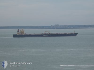
DUBAI GLAMOUR
Crude Oil Tanker
Current Trip
PK KHI
| Time Travelled | 2 days |
|---|---|
| Remaining Time | --- |
| Distance Travelled | 19.04 nm |
| Remaining Distance | --- |
| AVG Speed | 12.2 Knots |
| MAX Speed | 13.2 Knots |
| AVG Wind | 7.1 knots |
| MAX Wind | 8.8 knots |
| MIN Temp | 26.1°C / 78.98°F |
| MAX Temp | 27°C / 80.6°F |
| Draught | 10.9 m |
| Position Received | 8 d ago |
Current Position
| Longitude | 57.09535° |
|---|---|
| Latitude | 25.75465° |
| Status | Under way using engine |
| Speed | 12.1 Knots |
| Course | 149° |
| Area | Gulf of Oman |
| Station | T-AIS |
| Position Received | 8 d ago |
Info
Information
The current position of DUBAI GLAMOUR is in Gulf of Oman with coordinates 25.75465° / 57.09535° as reported on 2024-04-11 00:47 by AIS to our vessel tracker app. The vessel's current speed is 12.1 Knots
The vessel DUBAI GLAMOUR (IMO: 9402483, MMSI: 538003526) is a Crude Oil Tanker that was built in 2009 ( 15 years old ). It's sailing under the flag of [MH] Marshall Is.
In this page you can find informations about the vessels current position, last detected port calls, and current voyage information. If the vessels is not in coverage by AIS you will find the latest position.
The current position of DUBAI GLAMOUR is detected by our AIS receivers and we are not responsible for the reliability of the data. The last position was recorded while the vessel was in Coverage by the Ais receivers of our vessel tracking app.
The current draught of DUBAI GLAMOUR as reported by AIS is 10.9 meters
Weather
| Temperature | 25.8°C / 78.44°F |
|---|---|
| Wind Speed | 7 knots |
| Direction | 246° WSW |
| Pressure | 1010.2 hPa |
| Humidity | 84.5 % |
| Cloud Coverage | 73 % |
Featured Company
Last Port Calls
| Port | Arrival | Departure | Time In Port |
|---|---|---|---|
| 2024-04-14 12:21 | 2024-04-16 19:51 | 2 d | |
| 2024-04-08 02:30 | 2024-04-09 09:29 | 1 d | |
| 2024-02-13 22:46 | 2024-02-16 07:35 | 2 d | |
| 2024-02-06 06:56 | 2024-02-08 00:51 | 1 d |
Most Visited Ports (Last year)
| Port | Arrivals | |
|---|---|---|
| 3 | ||
| 1 | ||
| 1 | ||
| 1 | ||
| 1 | ||
| 1 |
Last Trips
| Origin | Departure | Destination | Arrival | Distance | |
|---|---|---|---|---|---|
| 2024-04-09 12:29 | 2024-04-14 17:21 | 1008.29 nm | |||
| 2024-02-16 15:35 | 2024-04-08 05:30 | 5036.01 nm | |||
| 2024-02-08 08:51 | 2024-02-14 06:46 | 1500.77 nm | |||
| 2024-01-29 13:49 | 2024-02-06 14:56 | 90.79 nm |
Events
| Time | Event | Details | Position / Dest | Info |
|---|---|---|---|---|
| 2024-04-16 21:38 | STOP Moving | 16.85 nm, West of BABA ISLAND |
24.73313 / 66.66836
PK KHI
|
Speed: 0.3 kn Course: 296° |
| 2024-04-16 19:51 | PORT DEPARTURE |
|
24.78128 / 66.98738
PK KHI
|
Speed: 4.1 kn Course: 162° |
| 2024-04-16 19:37 | START Moving |
24.80940 / 66.97383
[PK] KARACHI
|
Speed: 4.1 kn Course: 162° |
|
| 2024-04-14 12:21 | STOP Moving |
24.81277 / 66.97425
[PK] KARACHI
|
Speed: Course: 348° |
|
| 2024-04-14 12:21 | PORT ARRIVAL |
|
24.81277 / 66.97425
[PK] KARACHI
|
Speed: 0.4 kn Course: 348° |
| 2024-04-14 09:59 | START Moving | 6 nm, South West of SALEHAABAD ISLAND |
24.73900 / 66.88692
PK KHI
|
Speed: 3.2 kn Course: 79° |
| 2024-04-13 03:32 | STOP Moving | 6.32 nm, South West of SALEHAABAD ISLAND |
24.73412 / 66.88384
PK KHI
|
Speed: 0.2 kn Course: 22° |
| 2024-04-11 00:50 | Status Changed | Default Under way using engine |
25.74775 / 57.09983
PK KHI
|
Speed: 12.1 kn Course: 149° |
| 2024-04-11 00:47 | OUT of Coverage |
25.75465 / 57.09535
Gulf of Oman
PK KHI
|
Speed: 12.1 kn Course: 149° |
|
| 2024-04-11 00:11 | Change Sea Area | Iranian part of the Gulf of Oman Omani part of the Persian Gulf |
25.86073 / 57.02358
Gulf of Oman
PK KHI
|
Speed: 12 kn Course: 147° |