
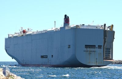
DOVER HIGHWAY
Vehicles Carrier
Current Trip
| Time Travelled | 15 h, 18 mins |
|---|---|
| Remaining Time | 1 day |
| Distance Travelled | 157.44 nm |
| Remaining Distance | 739.09 nm |
| AVG Speed | 14.5 Knots |
| MAX Speed | 16.5 Knots |
| AVG Wind | 6.6 knots |
| MAX Wind | 9.9 knots |
| MIN Temp | 29.3°C / 84.74°F |
| MAX Temp | 30.6°C / 87.08°F |
| Draught | 8.4 m |
| Position Received | 12 h, 1 m ago |
Current Position
| Longitude | 104.39654° |
|---|---|
| Latitude | 1.35071° |
| Status | Under way using engine |
| Speed | 15.2 Knots |
| Course | 49.1° |
| Area | South China Sea |
| Station | T-AIS |
| Position Received | 12 h, 1 m ago |
Info
Information
The current position of DOVER HIGHWAY is in South China Sea with coordinates 1.35071° / 104.39654° as reported on 2024-04-23 13:45 by AIS to our vessel tracker app. The vessel's current speed is 15.2 Knots and is heading at the port of LAEM CHABANG. The estimated time of arrival as calculated by MyShipTracking vessel tracking app is 2024-04-25 14:36 LT
The vessel DOVER HIGHWAY (IMO: 9574107, MMSI: 432824000) is a Vehicles Carrier that was built in 2011 ( 13 years old ). It's sailing under the flag of [JP] Japan.
In this page you can find informations about the vessels current position, last detected port calls, and current voyage information. If the vessels is not in coverage by AIS you will find the latest position.
The current position of DOVER HIGHWAY is detected by our AIS receivers and we are not responsible for the reliability of the data. The last position was recorded while the vessel was in Coverage by the Ais receivers of our vessel tracking app.
The current draught of DOVER HIGHWAY as reported by AIS is 8.4 meters
Weather
| Temperature | 29.6°C / 85.28°F |
|---|---|
| Wind Speed | 6 knots |
| Direction | 127° SE |
| Pressure | 1008.5 hPa |
| Humidity | 74.1 % |
| Cloud Coverage | 93 % |
Featured Company
Last Port Calls
| Port | Arrival | Departure | Time In Port |
|---|---|---|---|
| 2024-04-23 00:18 | 2024-04-23 10:29 | 10 h | |
| 2024-04-11 08:50 | 2024-04-12 12:04 | 1 d | |
| 2024-04-06 00:27 | 2024-04-08 13:39 | 2 d | |
| 2024-03-31 21:26 | 2024-04-02 17:32 | 1 d | |
| 2024-03-27 17:22 | 2024-03-28 08:34 | 15 h | |
| 2024-03-07 16:21 | |||
| 2024-03-03 21:05 | 2024-03-04 06:12 | 9 h | |
| 2024-02-24 21:48 | 2024-02-26 05:06 | 1 d | |
| 2024-02-19 10:08 | 2024-02-19 22:56 | 12 h | |
| 2024-02-14 16:55 | 2024-02-17 07:59 | 2 d |
Most Visited Ports (Last year)
| Port | Arrivals | |
|---|---|---|
| 9 | ||
| 8 | ||
| 7 | ||
| 4 | ||
| 4 | ||
| 3 |
Last Trips
| Origin | Departure | Destination | Arrival | Distance | |
|---|---|---|---|---|---|
| 2024-04-12 21:34 | 2024-04-23 08:18 | 3820.88 nm | |||
| 2024-04-08 23:39 | 2024-04-11 18:20 | 525.55 nm | |||
| 2024-04-03 04:32 | 2024-04-06 11:27 | 731.24 nm | |||
| 2024-03-28 18:34 | 2024-04-01 08:26 | 594.01 nm | |||
| 2024-03-07 23:21 | 2024-03-28 03:22 | 4694.42 nm | |||
| 2024-02-26 13:06 | 2024-03-04 05:05 | 2459.84 nm | |||
| 2024-02-20 09:26 | 2024-02-25 05:48 | 1495.37 nm | |||
| 2024-02-17 18:59 | 2024-02-19 20:38 | 521.34 nm | |||
| 2024-02-07 09:29 | 2024-02-15 03:55 | 948.04 nm | |||
| 2024-01-23 01:36 | 2024-02-05 04:49 | 4974.19 nm |
Events
| Time | Event | Details | Position / Dest | Info |
|---|---|---|---|---|
| 2024-04-23 13:52 | Status Changed | Default Under way using engine |
1.36922 / 104.41803
TH LCH
|
Speed: 15.2 kn Course: 49.1° |
| 2024-04-23 13:45 | OUT of Coverage |
1.35071 / 104.39654
South China Sea
TH LCH
|
Speed: 15.2 kn Course: 49.1° |
|
| 2024-04-23 13:40 | Change Sea Area | Malaysian part of the South China Sea Malaysian part of the Singapore Strait |
1.33509 / 104.37779
South China Sea
TH LCH
|
Speed: 15 kn Course: 50.7° |
| 2024-04-23 13:40 | Status Changed | Under way using engine Default |
1.33509 / 104.37779
TH LCH
|
Speed: 14.9 kn Course: 51° |
| 2024-04-23 13:32 | Status Changed | Default Under way using engine |
1.31599 / 104.35477
TH LCH
|
Speed: 14.3 kn Course: 51.2° |
| 2024-04-23 12:40 | Detected in Sea | Malaysian part of the Singapore Strait |
1.26108 / 104.15039
Singapore Strait
TH LCH
|
Speed: 15 kn Course: 80.7° |
| 2024-04-23 11:23 | Change Sea Area | Indonesian part of the Singapore Strait Singaporean part of the Singapore Strait |
1.18640 / 103.84165
Singapore Strait
TH LCH
|
Speed: 13.4 kn Course: 67° |
| 2024-04-23 10:29 | PORT DEPARTURE |
|
1.28076 / 103.74523
TH LCH
|
Speed: 5.3 kn Course: 191° |
| 2024-04-23 10:26 | START Moving |
1.28400 / 103.74692
[SG] SINGAPORE
|
Speed: 3.2 kn Course: 220° |
|
| 2024-04-23 10:06 | Draught Changed | 8.4 7.9 |
1.28486 / 103.75266
[SG] SINGAPORE
|
Speed: Course: 30° |