
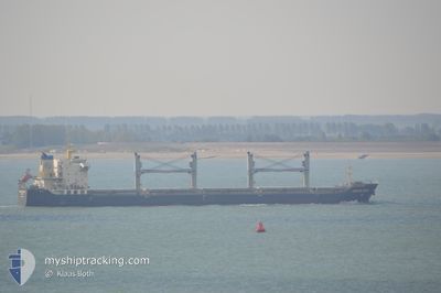
DONG FANG WEI YE
Bulk Carrier
Current Trip
| Time Travelled | 8 days |
|---|---|
| Remaining Time | --- |
| Distance Travelled | 1665.38 nm |
| Remaining Distance | --- |
| AVG Speed | 10.4 Knots |
| MAX Speed | 11.5 Knots |
| AVG Wind | 7.5 knots |
| MAX Wind | 16 knots |
| MIN Temp | 3.9°C / 39.02°F |
| MAX Temp | 28.3°C / 82.94°F |
| Draught | 8.8 m |
| Position Received | 6 d ago |
Current Position
| Longitude | 129.19214° |
|---|---|
| Latitude | 34.83158° |
| Status | Under way using engine |
| Speed | 11 Knots |
| Course | 219.1° |
| Area | Japan Sea |
| Station | T-AIS |
| Position Received | 6 d ago |
Info
Information
The current position of DONG FANG WEI YE is in Japan Sea with coordinates 34.83158° / 129.19214° as reported on 2024-04-12 22:26 by AIS to our vessel tracker app. The vessel's current speed is 11 Knots and is heading at the port of CAM PHA. The estimated time of arrival as calculated by MyShipTracking vessel tracking app is 2024-04-19 12:00 LT
The vessel DONG FANG WEI YE (IMO: 9584798, MMSI: 413229350) is a Bulk Carrier that was built in 2010 ( 14 years old ). It's sailing under the flag of [CN] China.
In this page you can find informations about the vessels current position, last detected port calls, and current voyage information. If the vessels is not in coverage by AIS you will find the latest position.
The current position of DONG FANG WEI YE is detected by our AIS receivers and we are not responsible for the reliability of the data. The last position was recorded while the vessel was in Coverage by the Ais receivers of our vessel tracking app.
The current draught of DONG FANG WEI YE as reported by AIS is 8.8 meters
Weather
| Temperature | 26.8°C / 80.24°F |
|---|---|
| Wind Speed | 11 knots |
| Direction | 232° SW |
| Pressure | 1008.4 hPa |
| Humidity | 89.8 % |
| Cloud Coverage | 43 % |
Featured Company
Last Port Calls
| Port | Arrival | Departure | Time In Port |
|---|---|---|---|
| 2024-04-05 03:52 | 2024-04-10 20:55 | 5 d | |
| 2024-04-03 05:31 | 2024-04-04 02:04 | 20 h | |
| 2024-02-14 00:59 | 2024-02-16 02:53 | 2 d | |
| 2024-02-02 02:38 |
Most Visited Ports (Last year)
| Port | Arrivals | |
|---|---|---|
| 11 | ||
| 3 | ||
| 2 | ||
| 2 | ||
| 2 | ||
| 2 |
Last Trips
| Origin | Departure | Destination | Arrival | Distance | |
|---|---|---|---|---|---|
| 2024-04-04 12:04 | 2024-04-05 13:52 | 3.82 nm | |||
| 2024-02-16 12:53 | 2024-04-03 15:31 | 1560.83 nm | |||
| 2024-02-02 10:38 | 2024-02-14 10:59 | 1210.72 nm |
Events
| Time | Event | Details | Position / Dest | Info |
|---|---|---|---|---|
| 2024-04-17 14:18 | START Moving | 7.23 nm, South of HONG KONG |
22.16940 / 114.17909
VN CPH
|
Speed: 8 kn Course: 90° |
| 2024-04-17 08:31 | STOP Moving | 7.58 nm, South of HONG KONG |
22.16403 / 114.16798
VN CPH
|
Speed: 0.2 kn Course: 256° |
| 2024-04-12 22:41 | Status Changed | Default Under way using engine |
34.79500 / 129.15500
VN CPH
|
Speed: 11 kn Course: 219.1° |
| 2024-04-12 22:26 | OUT of Coverage |
34.83158 / 129.19214
Japan Sea
VN CPH
|
Speed: 11 kn Course: 219.1° |
|
| 2024-04-12 22:20 | Status Changed | Under way using engine Default |
34.84416 / 129.20474
VN CPH
|
Speed: 10.7 kn Course: 220° |
| 2024-04-12 22:09 | IN Coverage |
34.84105 / 129.20169
Japan Sea
VN CPH
|
Speed: 10.9 kn Course: 220° |
|
| 2024-04-12 21:02 | Status Changed | Default Under way using engine |
35.02639 / 129.37605
VN CPH
|
Speed: 10.2 kn Course: 213.4° |
| 2024-04-12 20:53 | OUT of Coverage |
35.04665 / 129.39201
Japan Sea
VN CPH
|
Speed: 10.2 kn Course: 213.4° |
|
| 2024-04-12 20:52 | Status Changed | Under way using engine Default |
35.04946 / 129.39426
VN CPH
|
Speed: 10.2 kn Course: 213° |
| 2024-04-12 20:31 | Status Changed | Default Under way using engine |
35.09892 / 129.43541
VN CPH
|
Speed: 10 kn Course: 212.2° |