
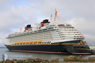
DISNEY FANTASY
Passengers Ship
Current Trip
KYGEC
| Time Travelled | 1 day |
|---|---|
| Remaining Time | --- |
| Distance Travelled | 330.67 nm |
| Remaining Distance | --- |
| AVG Speed | 19.5 Knots |
| MAX Speed | 22.5 Knots |
| AVG Wind | 10.9 knots |
| MAX Wind | 12.9 knots |
| MIN Temp | 26.8°C / 80.24°F |
| MAX Temp | 28.7°C / 83.66°F |
| Draught | 8.6 m |
| Position Received | 16 h, 18 m ago |
Current Position
| Longitude | -84.26865° |
|---|---|
| Latitude | 20.00748° |
| Status | Under way using engine |
| Speed | 20.7 Knots |
| Course | 104.9° |
| Area | Caribbean Sea |
| Station | T-AIS |
| Position Received | 16 h, 18 m ago |
Info
Information
The current position of DISNEY FANTASY is in Caribbean Sea with coordinates 20.00748° / -84.26865° as reported on 2024-04-23 06:00 by AIS to our vessel tracker app. The vessel's current speed is 20.7 Knots
The vessel DISNEY FANTASY (IMO: 9445590, MMSI: 311058700) is a Passengers Ship that was built in 2012 ( 12 years old ). It's sailing under the flag of [BS] Bahamas.
In this page you can find informations about the vessels current position, last detected port calls, and current voyage information. If the vessels is not in coverage by AIS you will find the latest position.
The current position of DISNEY FANTASY is detected by our AIS receivers and we are not responsible for the reliability of the data. The last position was recorded while the vessel was in Coverage by the Ais receivers of our vessel tracking app.
The current draught of DISNEY FANTASY as reported by AIS is 8.6 meters
Weather
| Temperature | 27.2°C / 80.96°F |
|---|---|
| Wind Speed | 12 knots |
| Direction | 58° ENE |
| Pressure | 1014.5 hPa |
| Humidity | 74.1 % |
| Cloud Coverage | 25 % |
Featured Company
Last Port Calls
| Port | Arrival | Departure | Time In Port |
|---|---|---|---|
| 2024-04-22 12:37 | 2024-04-22 21:56 | 9 h | |
| 2024-04-20 09:17 | 2024-04-20 21:17 | 12 h | |
| 2024-04-17 09:56 | 2024-04-17 20:27 | 10 h | |
| 2024-04-16 10:53 | 2024-04-16 22:06 | 11 h | |
| 2024-04-13 09:06 | 2024-04-13 20:55 | 11 h | |
| 2024-04-10 11:24 | 2024-04-10 22:23 | 10 h | |
| 2024-04-08 12:37 | 2024-04-08 21:59 | 9 h | |
| 2024-04-06 09:20 | 2024-04-06 21:10 | 11 h | |
| 2024-04-03 10:50 | 2024-04-03 20:06 | 9 h | |
| 2024-04-02 10:53 | 2024-04-02 21:59 | 11 h |
Last Trips
| Origin | Departure | Destination | Arrival | Distance | |
|---|---|---|---|---|---|
| 2024-04-20 17:17 | 2024-04-22 07:37 | 696.28 nm | |||
| 2024-04-17 16:27 | 2024-04-20 05:17 | 1074.12 nm | |||
| 2024-04-16 18:06 | 2024-04-17 05:56 | 120.88 nm | |||
| 2024-04-13 16:55 | 2024-04-16 06:53 | 1090.55 nm | |||
| 2024-04-10 17:23 | 2024-04-13 05:06 | 879.78 nm | |||
| 2024-04-08 16:59 | 2024-04-10 06:24 | 563.19 nm | |||
| 2024-04-06 17:10 | 2024-04-08 07:37 | 701.95 nm | |||
| 2024-04-03 16:06 | 2024-04-06 05:20 | 1083.96 nm | |||
| 2024-04-02 17:59 | 2024-04-03 06:50 | 131.76 nm | |||
| 2024-03-30 17:01 | 2024-04-02 06:53 | 1082.44 nm |
Events
| Time | Event | Details | Position / Dest | Info |
|---|---|---|---|---|
| 2024-04-23 14:46 | STOP Moving |
19.30255 / -81.38924
KYGEC
|
Speed: 0.1 kn Course: 70° |
|
| 2024-04-23 06:10 | Status Changed | Default Under way using engine |
19.99260 / -84.21093
KYGEC
|
Speed: 20.7 kn Course: 104.9° |
| 2024-04-23 06:00 | Detected in Sea | Cuban part of the Caribbean Sea |
20.00748 / -84.26865
Caribbean Sea
KYGEC
|
Speed: 20.7 kn Course: 104.9° |
| 2024-04-23 06:00 | Status Changed | Under way using engine Default |
20.00748 / -84.26865
KYGEC
|
Speed: 20.8 kn Course: 105° |
| 2024-04-23 06:00 | IN Coverage |
20.00748 / -84.26865
Caribbean Sea
KYGEC
|
Speed: 20.7 kn Course: 104.9° |
|
| 2024-04-23 06:00 | OUT of Coverage |
20.00748 / -84.26865
Caribbean Sea
KYGEC
|
Speed: 20.7 kn Course: 104.9° |
|
| 2024-04-22 23:19 | Status Changed | Default Under way using engine |
20.59135 / -86.57304
KYGEC
|
Speed: 19.9 kn Course: 103° |
| 2024-04-22 23:00 | OUT of Coverage |
20.61530 / -86.68425
Caribbean Sea
KYGEC
|
Speed: 19.9 kn Course: 103° |
|
| 2024-04-22 21:56 | PORT DEPARTURE |
|
20.51697 / -86.95643
KYGEC
|
Speed: 7.5 kn Course: 3° |
| 2024-04-22 21:54 | START Moving |
20.51388 / -86.95682
[MX] COZUMEL
|
Speed: 5.3 kn Course: 12° |