
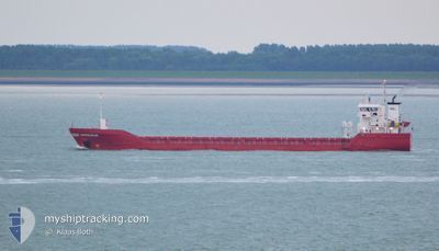
DINTELDIJK
General Cargo
Current Trip
| Time Travelled | 1 day |
|---|---|
| Remaining Time | 23 h, 54 mins |
| Distance Travelled | 399.81 nm |
| Remaining Distance | 251.25 nm |
| AVG Speed | 9.7 Knots |
| MAX Speed | 12.8 Knots |
| AVG Wind | 8.5 knots |
| MAX Wind | 21.6 knots |
| MIN Temp | 3.2°C / 37.76°F |
| MAX Temp | 13.3°C / 55.94°F |
| Draught | 6.2 m |
| Position Received | 3 h, 13 m ago |
Current Position
| Longitude | -4.54024° |
|---|---|
| Latitude | 49.94262° |
| Status | Under way using engine |
| Speed | 10.3 Knots |
| Course | 254.2° |
| Area | English Channel |
| Station | T-AIS |
| Position Received | 3 h, 13 m ago |
Info
Information
The current position of DINTELDIJK is in English Channel with coordinates 49.94262° / -4.54024° as reported on 2024-04-19 18:11 by AIS to our vessel tracker app. The vessel's current speed is 10.3 Knots and is heading at the port of DROGHEDA. The estimated time of arrival as calculated by MyShipTracking vessel tracking app is 2024-04-20 21:18 LT
The vessel DINTELDIJK (IMO: 9346677, MMSI: 245044000) is a General Cargo that was built in 2007 ( 17 years old ). It's sailing under the flag of [NL] Netherlands.
In this page you can find informations about the vessels current position, last detected port calls, and current voyage information. If the vessels is not in coverage by AIS you will find the latest position.
The current position of DINTELDIJK is detected by our AIS receivers and we are not responsible for the reliability of the data. The last position was recorded while the vessel was in Coverage by the Ais receivers of our vessel tracking app.
The current draught of DINTELDIJK as reported by AIS is 6.2 meters
Weather
| Temperature | 11°C / 51.8°F |
|---|---|
| Wind Speed | 11 knots |
| Direction | 18° NNE |
| Pressure | 1025.5 hPa |
| Humidity | 88.7 % |
| Cloud Coverage | 24 % |
Featured Company
Last Port Calls
| Port | Arrival | Departure | Time In Port |
|---|---|---|---|
| 2024-04-15 22:16 | 2024-04-18 03:36 | 2 d | |
| 2024-04-14 01:25 | 2024-04-15 06:56 | 1 d | |
| 2024-04-08 11:03 | 2024-04-10 12:55 | 2 d | |
| 2024-04-01 18:41 | 2024-04-01 22:21 | 3 h | |
| 2024-03-22 10:56 | 2024-03-23 11:34 | 1 d | |
| 2024-03-10 09:42 | 2024-03-20 14:21 | 10 d | |
| 2024-03-01 20:42 | 2024-03-02 00:39 | 3 h | |
| 2024-02-15 02:05 | |||
| 2024-02-07 19:25 | 2024-02-07 19:42 | 17 m | |
| 2024-02-02 19:05 | 2024-02-07 19:22 | 5 d |
Last Trips
| Origin | Departure | Destination | Arrival | Distance | |
|---|---|---|---|---|---|
| 2024-04-15 07:56 | 2024-04-16 00:16 | 168.46 nm | |||
| 2024-04-10 13:55 | 2024-04-14 02:25 | 717.05 nm | |||
| 2024-04-02 00:21 | 2024-04-08 12:03 | 1433.17 nm | |||
| 2024-03-23 14:34 | 2024-04-01 20:41 | 2101.38 nm | |||
| 2024-03-20 16:21 | 2024-03-22 13:56 | 464.53 nm | |||
| 2024-03-02 01:39 | 2024-03-10 11:42 | 1816.30 nm | |||
| 2024-02-15 03:05 | 2024-03-01 21:42 | 2510.54 nm | |||
| 2024-02-07 20:22 | 2024-02-07 20:25 | 0.04 nm | |||
| 2024-02-02 19:41 | 2024-02-02 20:05 | 0.70 nm | |||
| 2024-02-01 20:03 | 2024-02-02 19:00 | 184.71 nm |
Events
| Time | Event | Details | Position / Dest | Info |
|---|---|---|---|---|
| 2024-04-19 18:18 | Status Changed | Default Under way using engine |
49.93742 / -4.57195
DROGHEDA
|
Speed: 10.3 kn Course: 254.2° |
| 2024-04-19 18:11 | OUT of Coverage |
49.94262 / -4.54024
English Channel
DROGHEDA
|
Speed: 10.3 kn Course: 254.2° |
|
| 2024-04-19 18:07 | Status Changed | Under way using engine Default |
49.94537 / -4.52380
DROGHEDA
|
Speed: 10.3 kn Course: 255° |
| 2024-04-19 18:06 | Status Changed | Default Under way using engine |
49.94595 / -4.52020
DROGHEDA
|
Speed: 10.3 kn Course: 254.1° |
| 2024-04-19 17:39 | Status Changed | Under way using engine Default |
49.96534 / -4.40357
DROGHEDA
|
Speed: 10 kn Course: 257° |
| 2024-04-19 17:38 | Status Changed | Default Under way using engine |
49.96583 / -4.40070
DROGHEDA
|
Speed: 10 kn Course: 257.6° |
| 2024-04-19 12:37 | Status Changed | Under way using engine Default |
50.16076 / -3.18400
DROGHEDA
|
Speed: 11 kn Course: 262° |
| 2024-04-19 12:00 | Status Changed | Default Under way using engine |
50.18758 / -3.01910
DROGHEDA
|
Speed: 11 kn Course: 260.8° |
| 2024-04-19 11:41 | Status Changed | Under way using engine Default |
50.19595 / -2.93190
DROGHEDA
|
Speed: 11 kn Course: 261° |
| 2024-04-19 11:33 | Status Changed | Default Under way using engine |
50.19953 / -2.89162
DROGHEDA
|
Speed: 10.9 kn Course: 262.4° |