
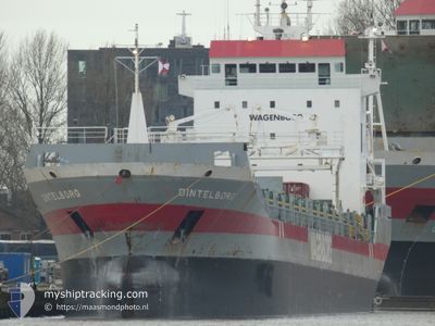
DINTELBORG
General Cargo
Current Trip
| Trip Time | 2 days |
|---|---|
| Trip Distance | 273.41 nm |
| AVG Speed | 10.2 Knots |
| MAX Speed | 13.3 Knots |
| Draught | 5 m |
| AVG Wind | 6.7 knots |
| MAX Wind | 14 knots |
| MIN Temp | 16.5°C / 61.7°F |
| MAX Temp | 25.5°C / 77.9°F |
| Position Received | 13 h, 57 m ago |
Current Position
| Longitude | -9.91066° |
|---|---|
| Latitude | 31.89524° |
| Status | Under way using engine |
| Speed | 12 Knots |
| Course | 208° |
| Area | North Atlantic Ocean |
| Station | T-AIS |
| Position Received | 13 h, 57 m ago |
Info
Information
The current position of DINTELBORG is in North Atlantic Ocean with coordinates 31.89524° / -9.91066° as reported on 2024-04-19 05:20 by AIS to our vessel tracker app. The vessel's current speed is 12 Knots and is currently inside the port of AGADIR.
The vessel DINTELBORG (IMO: 9163685, MMSI: 245279000) is a General Cargo that was built in 1999 ( 25 years old ). It's sailing under the flag of [NL] Netherlands.
In this page you can find informations about the vessels current position, last detected port calls, and current voyage information. If the vessels is not in coverage by AIS you will find the latest position.
The current position of DINTELBORG is detected by our AIS receivers and we are not responsible for the reliability of the data. The last position was recorded while the vessel was in Coverage by the Ais receivers of our vessel tracking app.
The current draught of DINTELBORG as reported by AIS is 5 meters
Weather
| Temperature | 20.2°C / 68.36°F |
|---|---|
| Wind Speed | 12 knots |
| Direction | 310° NW |
| Pressure | 1013.4 hPa |
| Humidity | 61 % |
| Cloud Coverage | 100 % |
Featured Company
Last Port Calls
| Port | Arrival | Departure | Time In Port |
|---|---|---|---|
| 2024-04-19 17:34 | |||
| 2024-04-16 13:05 | 2024-04-17 14:47 | 1 d | |
| 2024-04-15 02:46 | 2024-04-15 12:02 | 9 h | |
| 2024-03-25 17:17 | 2024-03-28 00:57 | 2 d | |
| 2024-03-10 05:44 | 2024-03-18 17:31 | 8 d | |
| 2024-02-14 19:28 | 2024-03-10 05:23 | 24 d | |
| 2024-02-10 19:30 | 2024-02-13 15:15 | 2 d |
Most Visited Ports (Last year)
| Port | Arrivals | |
|---|---|---|
| 4 | ||
| 3 | ||
| 3 | ||
| 2 | ||
| 2 | ||
| 1 |
Last Trips
| Origin | Departure | Destination | Arrival | Distance | |
|---|---|---|---|---|---|
| 2024-04-17 15:47 | 2024-04-19 18:34 | 273.41 nm | |||
| 2024-04-15 13:02 | 2024-04-16 14:05 | 195.23 nm | |||
| 2024-03-28 01:57 | 2024-04-15 03:46 | 2880.45 nm | |||
| 2024-03-18 19:31 | 2024-03-25 18:17 | 869.10 nm | |||
| 2024-03-10 07:23 | 2024-03-10 07:44 | 0.56 nm | |||
| 2024-02-13 17:15 | 2024-02-14 21:28 | 310.22 nm | |||
| 2024-01-30 18:57 | 2024-02-10 21:30 | 2369.75 nm |
Events
| Time | Event | Details | Position / Dest | Info |
|---|---|---|---|---|
| 2024-04-19 17:34 | PORT ARRIVAL |
|
30.42211 / -9.64122
[MA] AGADIR
|
Speed: 4 kn Course: -1° |
| 2024-04-19 17:20 | START Moving | 0.81 nm, South West of AGADIR |
30.40636 / -9.64289
MAAGA
|
Speed: 4.7 kn Course: 40° |
| 2024-04-19 14:41 | STOP Moving | 2.31 nm, West of AGADIR |
30.42167 / -9.67833
MAAGA
|
Speed: Course: -1° |
| 2024-04-19 06:08 | Status Changed | Default Under way using engine |
31.74081 / -9.96256
MAAGA
|
Speed: 12 kn Course: 208° |
| 2024-04-19 05:20 | OUT of Coverage |
31.89524 / -9.91066
North Atlantic Ocean
MAAGA
|
Speed: 12 kn Course: 208° |
|
| 2024-04-19 05:13 | Status Changed | Under way using engine Default |
31.91821 / -9.89709
MAAGA
|
Speed: 12 kn Course: 206° |
| 2024-04-19 04:54 | Status Changed | Default Under way using engine |
31.97308 / -9.86418
MAAGA
|
Speed: 12 kn Course: 210.4° |
| 2024-04-19 04:06 | Status Changed | Under way using engine Default |
32.11282 / -9.77532
MAAGA
|
Speed: 11 kn Course: 211° |
| 2024-04-19 04:06 | IN Coverage |
32.11035 / -9.77709
North Atlantic Ocean
MAAGA
|
Speed: 12.1 kn Course: 212.2° |
|
| 2024-04-19 01:05 | OUT of Coverage |
32.65319 / -9.44127
North Atlantic Ocean
MAAGA
|
Speed: 12.3 kn Course: 215.8° |