
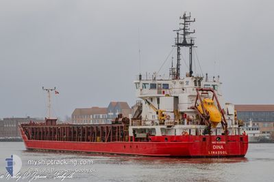
DINA
General Cargo
Current Trip
| Time Travelled | 3 days |
|---|---|
| Remaining Time | 17 h, 23 mins |
| Distance Travelled | 497.13 nm |
| Remaining Distance | 139.83 nm |
| AVG Speed | 7.5 Knots |
| MAX Speed | 11.5 Knots |
| AVG Wind | 17.6 knots |
| MAX Wind | 29.3 knots |
| MIN Temp | 3.9°C / 39.02°F |
| MAX Temp | 7.6°C / 45.68°F |
| Draught | 5.4 m |
| Position Received | Now |
Current Position
| Longitude | --- |
|---|---|
| Latitude | --- |
| Status | Under way using engine |
| Speed | 8.2 Knots |
| Course | 135.7° |
| Area | Kattegat |
| Station | T-AIS |
| Position Received | Now |
Info
Information
The current position of DINA is in Kattegat with coordinates 57.70062° / 11.02488° as reported on 2025-12-07 16:27 by AIS to our vessel tracker app. The vessel's current speed is 8.2 Knots and is heading at the port of COPENHAGEN. The estimated time of arrival as calculated by MyShipTracking vessel tracking app is 2025-12-08 09:51 LT
The vessel DINA (IMO: 9226786, MMSI: 210350000) is a General Cargo that was built in 2002 ( 23 years old ). It's sailing under the flag of [CY] Cyprus.
In this page you can find informations about the vessels current position, last detected port calls, and current voyage information. If the vessels is not in coverage by AIS you will find the latest position.
The current position of DINA is detected by our AIS receivers and we are not responsible for the reliability of the data. The last position was recorded while the vessel was in Coverage by the Ais receivers of our vessel tracking app.
The current draught of DINA as reported by AIS is 5.4 meters
Weather
| Temperature | 6.9°C / 44.42°F |
|---|---|
| Wind Speed | 18 knots |
| Direction | 145° SE |
| Pressure | 1005.8 hPa |
| Humidity | 96.1 % |
| Cloud Coverage | 100 % |
Featured Company
Last Port Calls
| Port | Arrival | Departure | Time In Port |
|---|---|---|---|
| 2025-12-04 05:28 | 2025-12-04 15:49 | 10 h | |
| 2025-11-27 07:39 | 2025-11-27 17:01 | 9 h | |
| 2025-11-17 12:24 | 2025-11-17 23:09 | 10 h | |
| 2025-11-15 06:06 | 2025-11-15 16:48 | 10 h | |
| 2025-11-07 11:34 | 2025-11-07 22:54 | 11 h | |
| 2025-11-06 16:27 | 2025-11-06 19:17 | 2 h | |
| 2025-11-01 10:38 | 2025-11-02 00:24 | 13 h | |
| 2025-10-29 10:24 | 2025-10-29 20:24 | 10 h | |
| 2025-10-27 15:27 | 2025-10-28 17:55 | 1 d | |
| 2025-10-22 10:59 | 2025-10-22 18:31 | 7 h |
Most Visited Ports (Last year)
| Port | Arrivals | |
|---|---|---|
| 22 | ||
| 17 | ||
| 15 | ||
| 6 | ||
| 6 | ||
| 5 |
Last Trips
| Origin | Departure | Destination | Arrival | Distance | |
|---|---|---|---|---|---|
| 2025-11-27 18:01 | 2025-12-04 06:28 | 910.74 nm | |||
| 2025-11-18 00:09 | 2025-11-27 08:39 | 1207.38 nm | |||
| 2025-11-15 17:48 | 2025-11-17 13:24 | 278.10 nm | |||
| 2025-11-07 23:54 | 2025-11-15 07:06 | 1152.65 nm | |||
| 2025-11-06 20:17 | 2025-11-07 12:34 | 133.66 nm | |||
| 2025-11-02 01:24 | 2025-11-06 17:27 | 666.13 nm | |||
| 2025-10-29 21:24 | 2025-11-01 11:38 | 316.51 nm | |||
| 2025-10-28 18:55 | 2025-10-29 11:24 | 160.40 nm | |||
| 2025-10-22 20:31 | 2025-10-27 16:27 | 793.04 nm | |||
| 2025-10-14 19:40 | 2025-10-22 12:59 | 1077.08 nm |
Events
| Time | Event | Details | Position / Dest | Info |
|---|---|---|---|---|
| 2025-12-07 15:40 | Change Sea Area | Danish part of the Kattegat Danish part of the Skaggerak |
57.78033 / 10.87876
Kattegat
COPENHAGEN
|
Speed: 8.2 kn Course: 135° |
| 2025-12-07 15:02 | Status Changed | Under way using engine Default |
57.80185 / 10.72890
COPENHAGEN
|
Speed: 8.1 kn Course: 89° |
| 2025-12-07 15:02 | IN Coverage |
57.80144 / 10.73645
Skaggerak
COPENHAGEN
|
Speed: 8.1 kn Course: 94.5° |
|
| 2025-12-07 14:05 | Status Changed | Default Under way using engine |
57.79997 / 10.49518
COPENHAGEN
|
Speed: 8.2 kn Course: 87.8° |
| 2025-12-07 14:00 | Status Changed | Under way using engine Default |
57.79963 / 10.47261
COPENHAGEN
|
Speed: 8.2 kn Course: 90° |
| 2025-12-07 14:00 | OUT of Coverage |
57.79963 / 10.47261
Skaggerak
COPENHAGEN
|
Speed: 8.2 kn Course: 87.8° |
|
| 2025-12-07 13:29 | Status Changed | Default Under way using engine |
57.79826 / 10.33983
COPENHAGEN
|
Speed: 8.5 kn Course: 85.3° |
| 2025-12-07 13:21 | Status Changed | Under way using engine Default |
57.79732 / 10.30559
COPENHAGEN
|
Speed: 8.6 kn Course: 92° |
| 2025-12-07 13:09 | IN Coverage |
57.79735 / 10.30947
Skaggerak
COPENHAGEN
|
Speed: 8.6 kn Course: 88.7° |
|
| 2025-12-07 09:36 | OUT of Coverage |
57.81109 / 9.30134
Skaggerak
COPENHAGEN
|
Speed: 8.6 kn Course: 95.9° |