
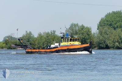
DIKKY
Tug
Current Trip
HIAMBACHT
| Time Travelled | 2 h, 50 mins |
|---|---|
| Remaining Time | --- |
| Distance Travelled | 9.63 nm |
| Remaining Distance | --- |
| AVG Speed | 5.2 Knots |
| MAX Speed | 9.3 Knots |
| AVG Wind | 4.9 knots |
| MAX Wind | 5 knots |
| MIN Temp | -0.4°C / 31.28°F |
| MAX Temp | 0.8°C / 33.44°F |
| Draught | 0.3 m |
| Position Received | Now |
Current Position
| Longitude | --- |
|---|---|
| Latitude | --- |
| Status | Under way using engine |
| Speed | 4.6 Knots |
| Course | 115.4° |
| Area | North Sea |
| Station | T-AIS |
| Position Received | Now |
Info
Information
The current position of DIKKY is in North Sea with coordinates 51.88870° / 5.72333° as reported on 2024-12-13 08:43 by AIS to our vessel tracker app. The vessel's current speed is 4.6 Knots
The vessel DIKKY (MMSI: 244730091) is a Tug It's sailing under the flag of [NL] Netherlands.
In this page you can find informations about the vessels current position, last detected port calls, and current voyage information. If the vessels is not in coverage by AIS you will find the latest position.
The current position of DIKKY is detected by our AIS receivers and we are not responsible for the reliability of the data. The last position was recorded while the vessel was in Coverage by the Ais receivers of our vessel tracking app.
The current draught of DIKKY as reported by AIS is 0.3 meters
Weather
| Temperature | -0.4°C / 31.28°F |
|---|---|
| Wind Speed | 5 knots |
| Direction | 97° E |
| Pressure | 1028.5 hPa |
| Humidity | 93.8 % |
| Cloud Coverage | --- |
Featured Company
Last Port Calls
| Port | Arrival | Departure | Time In Port |
|---|---|---|---|
| 2024-12-12 16:17 | 2024-12-13 06:54 | 14 h | |
| 2024-12-11 15:56 | 2024-12-12 08:23 | 16 h | |
| 2024-12-11 15:29 | 2024-12-11 15:37 | 8 m | |
| 2024-12-11 12:55 | 2024-12-11 13:55 | 59 m | |
| 2024-12-11 09:51 | 2024-12-11 10:00 | 9 m | |
| 2024-12-10 16:06 | 2024-12-11 07:25 | 15 h | |
| 2024-12-09 16:17 | 2024-12-10 08:23 | 16 h | |
| 2024-12-06 15:56 | 2024-12-09 09:24 | 2 d | |
| 2024-12-05 15:54 | 2024-12-06 08:29 | 16 h | |
| 2024-12-04 15:53 | 2024-12-05 08:10 | 16 h |
Last Trips
| Origin | Departure | Destination | Arrival | Distance | |
|---|---|---|---|---|---|
| 2024-12-12 08:23 | 2024-12-12 16:17 | 38.79 nm | |||
| 2024-12-11 15:37 | 2024-12-11 15:56 | 1.02 nm | |||
| 2024-12-11 13:55 | 2024-12-11 15:29 | 5.23 nm | |||
| 2024-12-11 10:00 | 2024-12-11 12:55 | 12.98 nm | |||
| 2024-12-11 07:25 | 2024-12-11 09:51 | 15.13 nm | |||
| 2024-12-10 08:23 | 2024-12-10 16:06 | 44.91 nm | |||
| 2024-12-09 09:24 | 2024-12-09 16:17 | 33.29 nm | |||
| 2024-12-06 08:29 | 2024-12-06 15:56 | 40.48 nm | |||
| 2024-12-05 08:10 | 2024-12-05 15:54 | 43.28 nm | |||
| 2024-12-04 08:51 | 2024-12-04 15:53 | 43.98 nm |
Events
| Time | Event | Details | Position / Dest | Info |
|---|---|---|---|---|
| 2024-12-13 08:38 | START Moving | 1.55 nm, East of DEEST |
51.89195 / 5.71407
HIAMBACHT
|
Speed: 4.4 kn Course: 117.9° |
| 2024-12-13 08:36 | STOP Moving | 1.45 nm, East of DEEST |
51.89278 / 5.71130
HIAMBACHT
|
Speed: 0.1 kn Course: 511° |
| 2024-12-13 08:19 | START Moving | 1.54 nm, East of DEEST |
51.89182 / 5.71359
HIAMBACHT
|
Speed: 3.6 kn Course: 114.5° |
| 2024-12-13 08:17 | STOP Moving | 1.44 nm, East of DEEST |
51.89283 / 5.71114
HIAMBACHT
|
Speed: 0.2 kn Course: 511° |
| 2024-12-13 07:29 | START Moving | 2.05 nm, East of DEEST |
51.88752 / 5.72646
HIAMBACHT
|
Speed: 7.8 kn Course: 283.8° |
| 2024-12-13 06:23 | STOP Moving | 2.16 nm, East of DEEST |
51.88717 / 5.72946
HIAMBACHT
|
Speed: 0.2 kn Course: 511° |
| 2024-12-13 05:54 | PORT DEPARTURE |
|
51.86445 / 5.82628
HIAMBACHT
|
Speed: 4.3 kn Course: 332.5° |
| 2024-12-13 05:47 | START Moving |
51.85692 / 5.82510
[NL] NIJMEGEN
|
Speed: 3.7 kn Course: 28.2° |
|
| 2024-12-13 05:41 | STOP Moving |
51.85511 / 5.82416
[NL] NIJMEGEN
|
Speed: 0.3 kn Course: 511° |
|
| 2024-12-13 05:39 | START Moving |
51.85721 / 5.82561
[NL] NIJMEGEN
|
Speed: 4 kn Course: 201.3° |