
DESERT GLORY
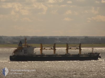
Bulk Carrier
Current Trip
| Time Travelled | --- |
|---|---|
| Remaining Time | 4 days |
| Distance Travelled | --- |
| Remaining Distance | 1131.06 nm |
| AVG Speed | --- |
| MAX Speed | --- |
| AVG Wind | --- |
| MAX Wind | --- |
| MIN Temp | --- |
| MAX Temp | --- |
| Draught | 12.4 m |
| Position Received | 2 h, 50 m ago |
Current Position
| Longitude | -9.19888° |
|---|---|
| Latitude | 36.78117° |
| Status | Under way using engine |
| Speed | 11.5 Knots |
| Course | 318.5° |
| Area | North Atlantic Ocean |
| Station | T-AIS |
| Position Received | 2 h, 50 m ago |
Info
Information
The current position of DESERT GLORY is in North Atlantic Ocean with coordinates 36.78117° / -9.19888° as reported on 2024-04-19 15:25 by AIS to our vessel tracker app. The vessel's current speed is 11.5 Knots and is heading at the port of VLISSINGEN. The estimated time of arrival as calculated by MyShipTracking vessel tracking app is 2024-04-24 00:59 LT
The vessel DESERT GLORY (IMO: 9543691, MMSI: 241139000) is a Bulk Carrier that was built in 2011 ( 13 years old ). It's sailing under the flag of [GR] Greece.
In this page you can find informations about the vessels current position, last detected port calls, and current voyage information. If the vessels is not in coverage by AIS you will find the latest position.
The current position of DESERT GLORY is detected by our AIS receivers and we are not responsible for the reliability of the data. The last position was recorded while the vessel was in Coverage by the Ais receivers of our vessel tracking app.
The current draught of DESERT GLORY as reported by AIS is 12.4 meters
Weather
| Temperature | 17.3°C / 63.14°F |
|---|---|
| Wind Speed | 10 knots |
| Direction | 123° ESE |
| Pressure | 1014.7 hPa |
| Humidity | 86.1 % |
| Cloud Coverage | 100 % |
Featured Company
Last Port Calls
| Port | Arrival | Departure | Time In Port |
|---|---|---|---|
| 2024-04-11 06:09 | 2024-04-11 15:38 | 9 h | |
| 2024-03-23 05:50 | 2024-03-27 16:43 | 4 d | |
| 2024-03-22 15:52 | |||
| 2024-03-02 08:46 | 2024-03-02 18:01 | 9 h |
Most Visited Ports (Last year)
| Port | Arrivals | |
|---|---|---|
| 2 | ||
| 2 | ||
| 2 | ||
| 1 | ||
| 1 | ||
| 1 |
Last Trips
| Origin | Departure | Destination | Arrival | Distance | |
|---|---|---|---|---|---|
| 2024-03-22 18:52 | 2024-03-23 08:50 | 162.33 nm | |||
| 2023-12-30 21:45 | 2024-03-02 10:46 | 7383.71 nm |
Events
| Time | Event | Details | Position / Dest | Info |
|---|---|---|---|---|
| 2024-04-19 15:54 | Status Changed | Default Under way using engine |
36.84832 / -9.27888
NL VLI
|
Speed: 11.5 kn Course: 318.5° |
| 2024-04-19 15:25 | Status Changed | Under way using engine Default |
36.78117 / -9.19888
NL VLI
|
Speed: 11.6 kn Course: 287° |
| 2024-04-19 15:25 | IN Coverage |
36.78117 / -9.19888
North Atlantic Ocean
NL VLI
|
Speed: 11.5 kn Course: 318.5° |
|
| 2024-04-19 15:25 | OUT of Coverage |
36.78117 / -9.19888
North Atlantic Ocean
NL VLI
|
Speed: 11.5 kn Course: 318.5° |
|
| 2024-04-19 14:21 | Status Changed | Default Under way using engine |
36.69960 / -8.97461
NL VLI
|
Speed: 11.2 kn Course: 288.7° |
| 2024-04-19 13:50 | OUT of Coverage |
36.66573 / -8.84177
North Atlantic Ocean
NL VLI
|
Speed: 11.2 kn Course: 288.7° |
|
| 2024-04-19 13:43 | ETA Changed | 2024/04/23 19:00 2024/04/23 18:00 |
36.66033 / -8.82094
NL VLI
|
Speed: 11.2 kn Course: 287.7° |
| 2024-04-19 12:01 | Status Changed | Under way using engine Default |
36.56123 / -8.45419
NL VLI
|
Speed: 11.2 kn Course: 288° |
| 2024-04-19 11:33 | Status Changed | Default Under way using engine |
36.53313 / -8.34865
NL VLI
|
Speed: 11.2 kn Course: 287.7° |
| 2024-04-19 11:00 | Status Changed | Under way using engine Default |
36.50136 / -8.22826
NL VLI
|
Speed: 11.1 kn Course: 288° |